History of Dorchester: King Alfred

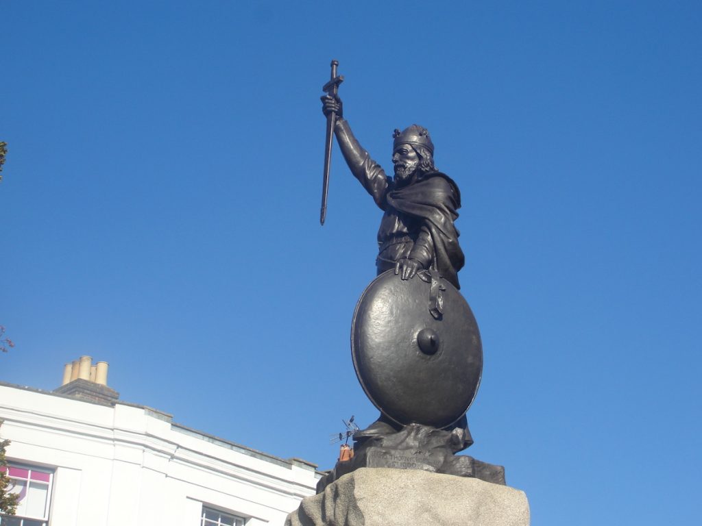
This post looks at King Alfred in the history of Dorchester (Dorset), and is adapted from, and provides additional materials for, my book , King Alfred: A Man on the Move, available from Amazon and book shops.

I have lived near Dorchester for many years. Evidence from charters (legal documents showing transfers of land or rights) indicates that Alfred came to Dorchester while his elder brother Æthelred was king, and therefore presumably there would have been some sort of Saxon base there. Links to transcripts of these charters are here and here. Please note that very few charters have not been challenged as to their authenticity, either in whole or in part.

The line of the west wall of Dorchester. Towards Salisbury Street.
The line of the west wall of Dorchester, looking north towards Salisbury Street.

Where was the royal residence?

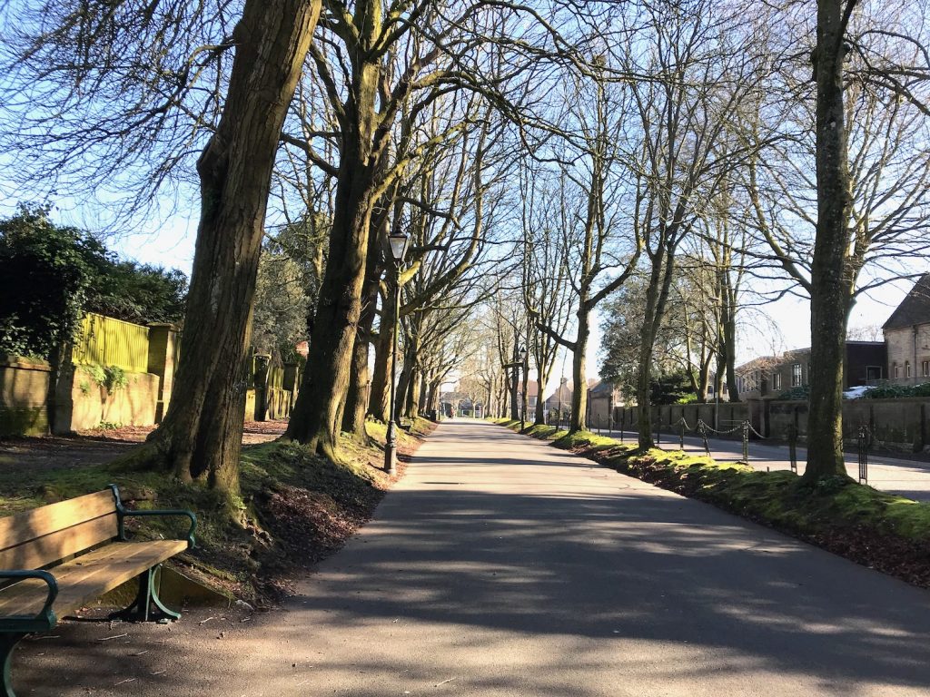
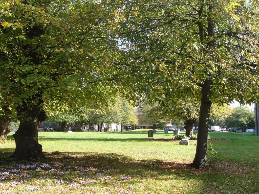
Clues about the Saxon history of Dorchester are scant, and this includes any evidence that might help us establish the location of a Saxon royal residence at the time of King Alfred. My personal speculation, which I have heard others suggest as well, is that the royal site would have included the location on the northern edge of the town where the current prison buildings are sited, where we know that the Norman castle was also located. It seems to make sense that if a site was deemed defendable by the Saxons (which a royal site would need to be) then it would hold a similar appeal for the Normans. It therefore seems plausible that the Normans would have built their castle on the site of the previous Saxon fortification/royal residence. There is a very pleasant footpath that follows the River Frome and which passes below the site of the former castle. From there one can understand how elevated (and therefore defendable) the site would have been.

Dorchester prison. Site of Norman castle. Probable Saxon stronghold or royal location.
Dorchester prison, now being converted to residences, is on the site of the Norman castle, and possibly also the Saxon stronghold/royal location.

Map of Dorchester, Dorset
Map of Dorchester Dorset, presented to Mayor Kingston. From Hutchins. Research suggests this ultimately derives from 1771.

Fordington

It has been suggested that King Alfred spent every Christmas at a royal manor at Fordington, which is now part of Dorchester but was once a separate settlement, not only to the east, but also around the south and to the west (where it was called West Fordington). I have found nothing to support the claim that there was a Christmas residence of the Wessex court in or near Dorchester. The oldest reference I could find referring to this was in Beatrice Adelaide Lees’ 1915 book on King Alfred where she states “…there is nothing to show that he was in North Wiltshire at the time of the inroad, and the Dorset Dorchester, which was a more usual place for the Christmas sojourn of the West-Saxon court…”. However, she does not indicate where she gets this information from. The Viking attack of Chippenham of 878 is being referred to.

It has been suggested that King Alfred spent every Christmas at a royal manor at Fordington, which is now part of Dorchester but was once a separate settlement, not only to the east, but also around the south and to the west (where it was called West Fordington). I have found nothing to support the claim that there was a Christmas residence of the Wessex court in or near Dorchester. The oldest reference I could find referring to this was in Beatrice Adelaide Lees’ 1915 book on King Alfred where she states “…there is nothing to show that he was in North Wiltshire at the time of the inroad, and the Dorset Dorchester, which was a more usual place for the Christmas sojourn of the West-Saxon court…”. However, she does not indicate where she gets this information from. The Viking attack of Chippenham of 878 is being referred to.

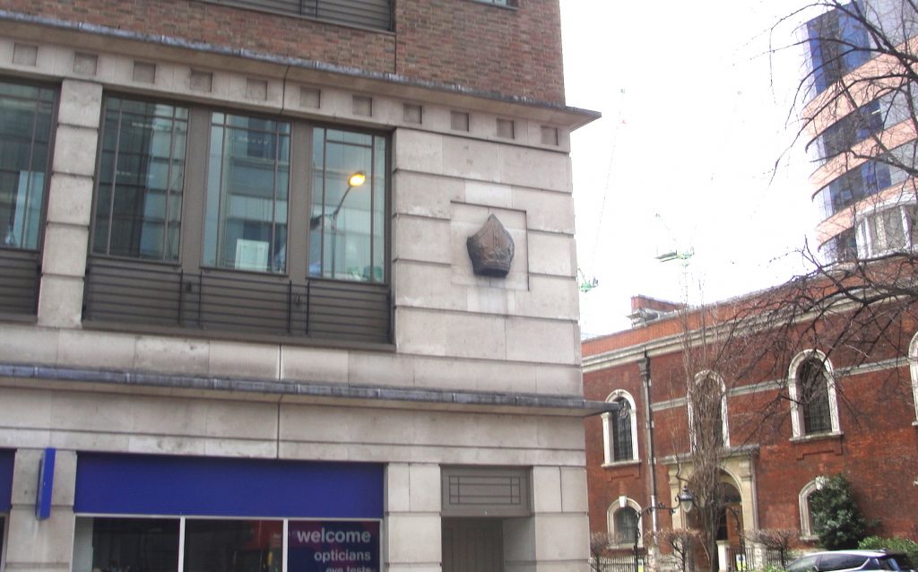
 I have also read that Fordington became a royal manor after the Romans left and that the first church there had been built about 857, and that this was a royal church dedicated to St George. Although the earliest parts of the current St George’s church date to the 11th century, it is located at the site of a Roman cemetery so the location was clearly a significant one stretching back to ancient times, which makes the presence of a church being there in 857 seem more plausible.

Roman gravestone St George's Church, Fordington, Dorchester, Dorset
The Roman gravestone that is to be found inside St George’s Church, Fordington. An explanatory plaque tells us that it was found in 1907 as a foundation stone beneath the Norman porch.

It is thought that burials found at the site of what is now the Trumpet Major pub were Saxon (although earlier than the time of King Alfred) (DNHAS Proceedings 1984)

St George's church, Fordington, Dorchester. Dorset
St George’s church, Fordington, Dorchester (Dorset)

So, we have two potential royal locations that are close to each other, one in the centre of Dorchester at the site of the former prison, and the other at Fordington. Although the evidence from charters suggests that Dorchester really was a royal location, I am not aware of any charters having been issued from Fordington. It is perhaps possible that a royal residence at Fordington would have been close enough to Dorchester to go under that name, or that the residence was at Fordington while the charters were signed at nearby Dorchester. Fordington is so close to Dorchester that I found that I could walk, at a brisk pace, from St George’s church in Fordington to the closest point of Dorchester’s former Roman walls in a matter of three minutes.

St George's Fordington
This image of Fordington is from Richard Grosvenor Bartelot’s History of Fordington (1915). St George’s church is shown. The position from which it was drawn is somewhat difficult to determine, but I think it might have been somewhere near the junction of High Street Fordington and Pound Lane.
St George's Church, Fordington, Dorchester
View of St George’s Church, Fordington from the north west, where the farm was once located. From Richard Grosvenor Bartelot’s History of Fordington (1915).

Dorchester’s walls

It seems to me that the Roman walls (perhaps replaced or repaired in places) would have been present in Alfred’s time and would have probably continued to define and defend the town. This is supported by the fact that even today much of the line of the walls can still be followed. The exception to this is the northern section stretching between Northernhay and Salisbury Street where it is possible that there was no wall at all, with the River Frome providing defence instead. My personal opinion is that there would have been a wall here as well, which has long since been destroyed and built over. A recognition that the town was walled leads to a discussion about the location of gates through which King Alfred might have passed, including when he was pursuing the Vikings from Wareham to Exeter, perhaps passing through Dorchester, in 876. The main east-west road through Dorchester is probably just slightly north of the line of the Roman road and at the West Gate, which would have been near the Top o’ Town roundabout, two Roman roads led to Exeter (via Bridport) and Ilchester. The Exeter road is still the main road to Winterborne Abbas. The road to Ilchester survives in the road to Bradford Peverell, but is no longer evident near the Top o’ Town roundabout, where it is submerged under the car park. It is perhaps possible that the small shift to the current east-west road alignment took place in the Saxon period.

High West Street and High East Street, Dorchester
Looking east down the main east-west route through Dorchester. Evidence suggests that the Roman route was beneath the buildings on the right, although perhaps the current alignment was in place by King Alfred’s time.

It is easy to think of a wall in isolation, but here in Dorchester it was surrounded by (at least in parts) a triple ditch. On the south side the ditches stretched from where South Walks footpath is, right across South Walks Road and well into the land on the other side (from map RCHM. Dorset II. Part 3).

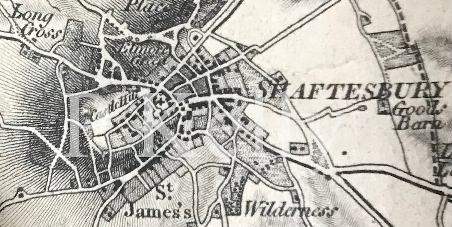
The layout of the main streets seems to have changed somewhat from Roman times to now. The alignment of the main east-west street has already been mentioned, but the Roman road leading from this street to the south gate (and therefore the main north-south road, possibly the cardo maximus) is postulated to run approx 15 degrees divergent to the current main north-south route (map RCHM. Dorset II. Part 3). Taking these Roman orientations to be correct, it is not known when the orientation of the main streets changed to what it is today. Given that changes are recorded in texts for other towns in King Alfred’s reign (eg London and Shaftesbury), it seems possible that the changes at Dorchester also took place in this period.

If there was indeed a north wall, there may well have been a gate in it. However, we only know of a North gate from Civil War records when it was repaired ( source: Hutchins, 3rd ed.).

In 1891 William Miles Barnes, son of William Barnes, made a bold effort to try to demonstrate that the 7th century St Birinus had been the bishop of Dorchester in Dorset, as opposed to Dorchester-on-Thames, Oxfordshire. I am not aware of this hypothesis still being “live” and it seems to me that nobody now thinks other than that Birinus was bishop at Dorchester-on-Thames. His attempt appears in Vol II of Notes & Queries for Somerset and Dorset. There is a remarkable, sometimes unpleasant, to-and-fro between Barnes and a “W.B.W.” (and others) throughout this volume. However, Dorchester never had a bishop, although there was a bishop of Dorset, based at Sherborne, between 909 and 1075 (when the seat was moved to Old Sarum).  The Anglo-Saxon Chronicles tell us that at 639 Birinus baptised a Cuthred in Dorces ceastre. This spelling matches Dorchester-on-Thames better than Dorchester in Dorset, which is rendered as variations on Dornwaraceaster. A Dorchester is also mentioned in ASC A at 636 where Birinus baptises a Cwichelm, although the text (Corpus Christi MS173) is unclear at this entry. Further, it seems unlikely that Dorchester (Dorset) would have been a comfortable place to set up a (unrecorded) bishopric in the early 600s, because this area may still have been contested or even held by the British at this time – the battle at Peonnum did not take place until 658.

To learn more about locations across southern England associated with King Alfred, perhaps try my book, King Alfred: A Man on the Move, available from book shops and Amazon. Click the image below to learn more.

Many thanks to Copper Street Brewery, near Dorchester South station, for stocking copies of my book. It goes well with the names of their beers, which have a King Alfred/Anglo-Saxon theme. I have sampled most of their beers and they are excellent. A shout out also to KeeP 106 (Dorchester) radio, where I talked on air about my book and the history of Dorchester in Saxon times.

Roman wall. Dorchester. Dorset. Albert Road. Top o' Town.
Dorchester’s only remaining stretch of original Roman wall (on Albert Road, near Top O’ Town roundabout)
South Walks Road. Dorchester. Dorset. Line of the Roman walls
South Walks Road, Dorchester (Dorset). An example of how the line of the Roman walls has become embedded in Dorchester’s layout. In Roman times the triple ditch would have extended into the land on the other side of the road.

Shaftesbury, Dorset

King Alfred at Shaftesbury Abbey

The below is adapted from, and provides additional material for, my book, King Alfred: A Man on the Move, available on Amazon

It would be great if you could support this project by purchasing a copy.

Dorset was an important in the time of King Alfred. Important roles were played by Sherborne, Wimborne, Dorchester and Shaftesbury. An important engagement with the Vikings took place at Wareham. Undoubtedly, much went on that never made it into the historical sources that are available to us today. In this post I shall take a look at Shaftesbury. 

King Alfred founded a nunnery at Shaftesbury and it is thought that this was at the same site as where the Normans later constructed their abbey. Although the Norman abbey is now a ruin, it is a delightful and evocative place to visit, as is the rest of the town.

King Alfred in the grounds of Shaftesbury Abbey, Dorset

Asser tells us that Alfred ordered the building of a monastery near Shaftesbury’s  east gate and that his daughter Æthelgifu was appointed abbess. However, this is initially confusing because the Abbey is south-west of the centre, so it seems that it should have been by a west gate. But the modern centre appears not to align well with what was there in Alfred’s time and, when this is taken into account, the abbey was indeed at the eastern aspect of the town. The nunnery This abbey was well endowed; Asser (99-102) tells us that, in combination with the new abbey at Athelney, it received one eighth of King’s Alfred’s taxation income. 

Unfortunately, no early source tells us when the nunnery was built. However, Ranulf Higden’s Polychronicon indicates that it was after Alfred had restored London, and we know from the Anglo-Saxon Chronicles that Alfred took control of London in 886. This suggests that the nunnery may have been built in 886 at the earliest and 893 at the latest (because it had to be present at the time Asser was writing, believed to be 893).

Looking down Gold Hill (perhaps the most famous place in Shaftesbury). The wall to the right, known as Park Wall, once formed the western boundary to the Abbey's grounds. The outline of the abbey's grounds in Alfred's time is not known
Looking down Gold Hill (perhaps the most famous place in Shaftesbury). The wall to the right, known as Park Wall, once formed the western boundary to the Abbey’s grounds. The outline of the abbey’s grounds in Alfred’s time is not known.

However, Higden also tells us that around the time that Alfred restored the settlement of Shaftesbury in 880, Pope Marinus sent Alfred a piece of the “true cross.” Manuscript E of the Anglo-Saxon Chronicles indicates that this was sent in 882. I found out that Marinus was pope between December 882 and May 884, indicating that the item could only have been sent in December 882. This led me to change my mind from believing that the abbey was built between 886 and 893 to a belief that it was in use by 882 or 883 because it seems plausible that the fragment of the true cross had been destined for either the new and important nunnery at Shaftesbury or the new abbey at Athelney, which was built at about the same time. In a generous attempt to make everything fit, one could argue that the nunnery might have come into use before its completion, with this being in the period 886-893, after King Alfred had restored London, although this itself must have taken some time to complete. The current location of this piece of the “true cross” is not known, although there is a reputed fragment of the true cross, which could be different to the one sent to Alfred, in St Michael and St Gudula Cathedral in Brussels, Belgium.

Postulated approximate outline of the Saxon burh
Postulated approximate outline of the Saxon burh. (After Dorset Historic Towns Survey: Shaftesbury, 2011)

Shaftesbury was clearly a very important place. In 980 the nunnery became the resting place of King Edward the Martyr after he had been murdered at Corfe Castle in 978 (he was initially interred at Wareham). His shrine became a focus for pilgrimage, and perhaps this was what King Canute was undertaking when he died at Shaftesbury in 1035. In 944 the site also became the burial place of Ælfgifu, who was the first wife of King Edmund who also became venerated as a saint. Elisabeth, the wife of Robert the Bruce, King of Scotland, was also briefly held here.

Map of Shaftesbury. 1811. Mudge
Map of Shaftesbury, Dorset. Detail from 1811 map by Mudge.

A Saxon pottery kiln dating to approx 660-880 was found at or near the current Tesco car park (during investigations before the area was redeveloped) (DNHAS V129, 2008). These discoveries fit with the earlier 1976 discovery of late Saxon pottery during floor replacement in the crypt of St Peter’s Church (DNHAS V99, 1977) and a later findings of Saxon pottery fragments at Barton Hill (DNHAS V137, 2016), a site close to the location of the earlier-discovered pottery kiln, because all three sites are outside of, and to the east of, the Saxon burgh.

Map of Shaftesbury Dorset
Map of Shaftesbury, Dorset (detail)
. From an undated “History of Shaftesbury”, Nichols and Sons, Red Lion Passage, Fleet Street
Map of Shaftesbury, Dorset
Map of Shaftesbury, Dorset, 1799. From an undated “History of Shaftesbury”, Nichols and Sons, Red Lion Passage, Fleet Street

There is much more about the travels of King Alfred in my book, including maps and references. Tap or click the image below to learn more.

Many thanks to thisisalfred.com for taking an interest in my writing. Hopefully, a recorded chat that we had at the Abbey will be available soon.

Egbert’s Stone. Part 3. The Upper Deverills

Ford at Kingston Deverill, Wiltshire

This post focuses on the Deverills in Wiltshire and is my third post on Egbert’s Stone. The others are here and here. There is a link to a video at the end of this post. This post is adapted from my book, available on Amazon and bookshops.

In my book I argue that the place more likely than any other single location to have been Egbert’s Stone is the collection of villages known today as the Upper Deverills. The Upper Deverills are a short distance south of Warminster (Wiltshire) and consist of three small villages on the River Deverill, now named on maps as part of the River Wylye. These villages are Kingston Deverill, Monkton Deverill and Brixton Deverill. Please note that I have worded this carefully. It is impossible to apply mathematical probabilities to the different options, but hopefully the following will serve as an illustration. If there were to be eleven alternative locations and I ascribed a 20% likelihood of one location being correct and 8% to each of the remaining ten, then it should be seen to be clear that saying that a single location seems more likely than any other single location is a very long way from saying that it was more likely to have been there than anywhere else. 

Looking back to Kingston Deverill, Wiltshire, from the climb up to Cold Kitchen Hill

The ford that lies on the border between Kingston Deverill and Monkton Deverill is thought to be at the junction of two important Roman roads and the area is just a short distance north of the ancient track known as the Harrow Way (also known as the Hard Way). In fact, some of the nearby A303 main road lies on the course of this ancient trackway. Indeed, near Willoughby Hedge service station, the A303 (on the line of the Harrow Way) crosses one of the Roman roads that leads to the aforementioned ford, so this could be a significant location as well, and I expand on this in the book.

A Roman road runs through this hedge. Near Willoughby Hedge service station on the A303
A Roman road runs through this hedge! Near Willoughby Hedge service station on the A303.

Kingston Deverill is also associated with a legend that three large stones were once brought down from Court Hill, adjacent to the village. These once served as stepping stones but were also considered to have been “Egbert’s Stones” (the early sources do not indicate that there was more than one). The name of Court Hill has also been brought into the story in that King Egbert (Alfred’s grand-father) “held court” on the hill. None of this can be proved, but it seems to me that this is the more likely location even without this legend. This is not only because of the proximity of important ancient routes, but also because following the river away from here is a plausible route to options for the location that Alfred went next, which was called Iglea (and the last stop before the Battle of Ethandun. The site also fits with Asser‘s description of Egbert’s Stone being in the eastern part of Selwood.

We need to remind ourselves of the size and shape of Selwood. Towards its southern extremity it extended eastwards across to at least Gillingham Forest (Source: Hutchins, History and Antiquities of Dorset, 1774) and further north, in Wiltshire, it extended east at least as far as Warminster. We know this because the following settlements answered at the forest eyre 1187-90:  Heytesbury, Knoyle and Westbury. The following villages etc were represented at forest inquisitions: Longbridge Deverill, Sutton Veny, Warminster, and Westbury  (source: Victoria County History. Wiltshire Volume IV, 1959)

The ford between Kingston Deverill and Monkton Deverill, Wiltshire. Two Roman roads crossed at or close to here
The ford between Kingston Deverill and Monkton Deverill, Wiltshire. Two Roman roads crossed at or close to here.

I visited the ford and found it to be a lovely spot that also seemed well cared for. Please note that there are signs saying that the ford is not suitable for vehicles to cross. If you visit Kingston Deverill, remember to visit the 15th century St Mary’s church (although there may have been an earlier structure) where I was delighted to find a banner depicting King Alfred, indicating that his connections with this area have not been forgotten.

King Alfred banner in St Mary's church, Kingston Deverill, Wiltshire
King Alfred banner in St Mary’s church, Kingston Deverill, Wiltshire

There is a legend that Alfred prayed at a church at Monkton Deverill before the Battle of Ethandun, and this church later became dedicated to St Alfred the Great. The church is now a private residence, and appears to have been constructed more recently than the time of King Alfred, although there may have been an earlier structure on the site (I am not aware of any evidence of this).

When walking in the hills here I rarely see anyone else and it seems to me that this beautiful rural area is relatively under-visited. I recommend the stiff climb up towards Cold Kitchen Hill (itself an important site in pre-historic and Roman times) for the elevated views over the Upper Deverills that this provides.

Later on, I found an additional contender for Egbert’s Stone just south of the railway line, and on the county boundary, about a third of the way between Westbury and Frome. This appeared on OS maps as Ecbright’s Stone until 1901, after which it disappeared. However, this seems to be far too close to Edington (bearing in mind Alfred would camp an additional night somewhere else before the battle). Today the OS map marks it as a boundary stone, just on the edge of a feature called Round Wood, and perhaps that is all it ever was. Looking at maps, it seems that this site has no public access.

Finally, it is worth noting that both Asser and the Anglo-Saxon Chronicles refer to camps (i.e. plural) at Egbert’s Stone, with Asser reverting to a singular for camp at Æcglea/Iglea. If the Deverills are the correct location, it is perhaps therefore possible that Alfred’s camps were in more than one location there.

I made a video about Egbert’s Stone:

There is much more about the travels of King Alfred in my book, including maps and references. Tap or click on the image below to learn more.

King Alfred and Surrey: Exploring a ‘hotspot.”

This post is adapted from my book, King Alfred: A Man on the Move, available from Amazon. It would be great if you could support this project by purchasing a copy.

I was contacted by somebody who noticed that there was a window depicting King Alfred in a church at Busbridge, not far from Godalming in Surrey. At first I thought that this window was just a random dedication to King Alfred, perhaps associated with the celebration of the 1000th anniversary of his death in 1901 (back then they thought he had died in 901 instead of what it is now know to be, which is 899). However, this for me set off a chain of events that led to me exploring Eashing, Godalming and Guildford. Each place was already significant to me in its own right, but there was no record of Alfred having been at any of them. However, when I looked at these places collectively it seemed to me unlikely that he would never have been at any of these places. Let me explain.

King Alfred stained glass window at St John the Baptist church, Busbridge, near Godalming, Surrey
From the same stained glass window. This shows the now lost church at Tuesley, Surrey, and the well to the left has become Ladywell Convent
From the same stained glass window. This shows the now lost church at Tuesley, Surrey, and the well to the left has become Ladywell Convent.

King Alfred’s will includes estates at Guildford, Godalming and Eashing, and the Burghal Hidage (a list of Alfred’s defended settlements after 878, but drawn up under his son, King Edward the Elder) includes Eashing.  These three locations are close together and are all on the River Wey, which flows into the Thames. Alfred’s connection to the area is remembered in a beautiful stained-glass window in the already mentioned Victorian church of St John the Baptist in Busbridge,  just a couple of miles south of Godalming (there are other stunning windows in this church). He is depicted above an image in the same window of a Saxon church at a place called Tuesley. Tuesley, just to the south-west of Busbridge, is the site of this now lost 7th century Saxon church, and it may be that there was a site of worship here going back to pagan times. It seems that Tuesley derives from the name of the pagan god Tiw , from which we also get “Tuesday”. It has been suggested that the settlement at Tuesley was a predecessor to the settlement at Godalming although, as Tuesley is mentioned in the 1068 Domesday book, the settlement would still have been present in Alfred’s time.  The location of this church is now a shrine to the Virgin Mary and is on land now owned by Ladywell Convent. At the time of writing there is access to this location every day except 21st December. It is a peaceful and beautiful site and I highly recommend spending some time there. We know that Alfred was pious and if he was in this area I think he would have come to this significant church. The shrine is on the other side of the road to the convent, and the access is through a gate down a very short track.

The shrine of the Virgin Mary inside a wall depicting the outline of the old Saxon church at Tuesley, Surrey. I have read that this church had been dedicated to the Virgin Mary
The shrine of the Virgin Mary inside a wall depicting the outline of the old Saxon church at Tuesley, Surrey. I have read that this church had been dedicated to the Virgin Mary.

In Godalming there is good evidence that a church on the current site of the church of St Peter and St Paul would have been present in the 9th century , while King Alfred was alive, and it seems plausible that the church would have been associated with the royal estate there. The royal estate may therefore have been in this part of Godalming, potentially around Church Street, to the south of the church. I was told that an archaeological investigation was carried out before some new buildings were built to the south-west of the church and that hundreds of Anglo-Saxon skeletons had been discovered. However, when I visited Godalming’s museum (with its excellent and helpful staff) I found out that more mid to late-Saxon pottery had been found at the site of what is now Waitrose on Bridge Street, than anywhere else in Surrey and it was now thought that the “Royal Manor” could have been at this location instead, which is quite a distance from the church. However, it seems impossible to tell whether particular estates that Alfred left in his will comprised the whole of that named place or just a part of it. In other words, he might have left the whole of Godalming because he owned all of it. In this situation, looking for a separate “Royal Manor” would be a mistake.

Church of St Peter and St Paul, Godalming, Surrey

We cannot be certain of the location of the royal estate at Guildford but it seems most likely that it would have been located where evidence suggests there was a Saxon presence.  Indeed, following the argument applied to Godalming, he may have owned all of what comprised Guildford at that time.It appears that the Saxon settlement at this time would have been in the area around St Mary’s church. There is evidence that this church may have been preceded by a timber structure. I was very grateful for the assistance given to me in my research by this church and a local historian, and I thank them here. I found it pleasant to wander around this area,which is essentially around Quarry Street. The remains of Guildford’s Norman castle are also in this area. 

St Mary's Church and Quarry Street, Guildford, Surrey
St Mary’s Church and Quarry Street, Guildford, Surrey

The main contender for the the fortified site at Eashing  is immediately to the east of the famous Eashing Bridges, which are marked on Ordnance Survey maps.  There is no public access across the site although a combination of roads and footpaths delineate the perimeter. It may be significant that this site would have been able to defended a crossing over the River Wey at the site of the Eashing Bridges. Today, the location is largely open space, and it is thought that this is because Guildford replaced it as the regional centre.

Paul Kelly. Author of King Alfred: A Man on the Move, at Eashing burgh, Surrey.
The author at the site of the burgh of Eashing, Surrey

The two sides that have a footpath are easy to find. I parked at the little car park on the other side of the historic bridges,walked across and then up the path leading uphill on the west side. From here I could really appreciate how the burgh would have been in an elevated position above the River Wey. But I could only see the (likely) site of the burgh when I got to the path that runs across the north of the site. It was just an open field, but I found that I could use my imagination. I decided not to follow the road for the two remaining sides of the square as it looked dangerous, with no footpath.

I made a short video about these locations:

There is much more about the travels of King Alfred in my book, including maps and references. To learn more about the book, click or tap the image below.

The little church at Aller, Somerset.

St Andrew's church, Aller, Somerset Levels

This post is adapted from my book, King Alfred: A Man on the Move, available on Amazon. It would be great if you could support this project by purchasing a copy.

This is a peaceful spot and I always like coming here. I never cease to be amazed at how this modest location that was so important in the history of England is so under-visited.

St Andrew's church, Aller, Somerset Levels. Where King Alfred baptised Guthrum, the Viking leader, after he was defeated at the Battle of Ethandun
St Andrew’s church, Aller, Somerset Levels. Where King Alfred baptised Guthrum, the Viking leader, after he was defeated at the Battle of Ethandun

King Alfred defeated the Vikings at the crucial Battle of Ethandun (more likely in my opinion to have been at Edington in Wiltshire than any other single location) in 878. The Vikings fled to their fortress, which seems more likely to have been at Chippenham, where they then surrendered.

The Anglo-Saxon Chronicles tell us that three weeks after the Vikings surrendered, the Viking leader Guthrum came, accompanied by thirty of his men, to be baptised into Christianity at a place near Athelney called Aller. Asser tells us that Alfred himself raised Guthrum from the baptismal font and that Guthrum became Alfred’s adopted son.

The older of the two fonts at St Andrew's church, Aller, Somerset Levels
The older of the two fonts at St Andrew’s church, Aller, Somerset Levels

St Andrew’s church at Aller, like Athelney, is on raised ground in the Somerset Levels, suggesting that the church probably would also have been on an island in Alfred’s time. The oldest parts of the current church are 12th century, so the events of 878 must have taken place at a preceding structure. It has been claimed that a font in the church (the more bowl-shaped of the two fonts), recovered from the rectory pond in the nineteenth century, was the one used to baptise Guthrum. The church can be tricky to find. Coming from Langport direction, it is necessary to take a left turn onto the road called Church Path and then turn left where there is a wooden sign for the church. The church also has a small but beautiful King Alfred Window, which is a memorial to the two reigns of King Alfred and Queen Victoria.

The King Alfred stained glass window at St Andrew's church, Aller, Somerset Levels
The King Alfred stained glass window at St Andrew’s church, Aller, Somerset Levels

It can be speculated as to why Aller, about fifty miles distant from Chippenham, was chosen as the location instead of somewhere closer to Chippenham. Perhaps Alfred did not trust Guthrum and this was deemed to be a safer location, or perhaps Aller was a more significant place then than it seems to us today. It might even be that Alfred knew Aller well if he came here to pray when he had his base at nearby Athelney. It seems likely to me that after obtaining the Viking surrender at (most likely) Chippenham, Alfred simply went back to the Somerset Levels where he may still have had a base, and Guthrum had to go there to “seal the deal”. 

 I think there is a major clue in the Anglo Saxon Chronicles where we are told that Guthrum came to Alfred at Aller after a period of three weeks. With this time-frame the distance between Chippenham and Aller becomes less of an issue – there was plenty of time to travel. It was a matter of Guthrum having to go to where Alfred was in order to take advantage of an amazingly beneficial deal on the table. In effect it was: “Confirm your permanent submission by becoming baptised and in return we won’t trouble you if you want to settle permanently in the east. Not only this, but you and your men will also receive large amounts of riches” (which were provided subsequently at Wedmore). There is a big difference between the first scenario of the Vikings having effectively seized East Anglia and the later post-878 scenario of the Vikings settling in East Anglia with the approval and blessing of the King of Wessex. In effect, the Viking presence in East Anglia had now become legitimate. East Anglia must have been unstable since 869 when its king (Edmund) had been murdered by the Vikings. Settling it with a converted Guthrum (now called Athelstan after his baptism) probably had benefits for Alfred. 

Any hopes that Alfred might have had for peace in East Anglia do not seem to have been realised. In 896 Alfred sent ships to the mouth of the Stour in East Anglia (and therefore somewhere near Harwich) and there were two battles with Viking boats. Alfred’s forces won the first engagement, but the Vikings won the second engagement. 

It is by no means certain in my mind that Guthrum was baptised in a church at Aller. In other words, he could have been baptised outside at Aller, because baptism outside in water may have still been taking place, especially for what was a hugely significant moment. If this was the case then there would have been water nearby (Aller is on the Levels). The font in the church that is claimed to be Saxon was re-discovered outside, although it is unknown whether this was used to baptise Guthrum, whether inside or outside of the church.

Aller is the location where Guthrum was baptised, but we must remind ourselves that in The Anglo-Saxon Chronicles we are told that after the Vikings had attacked Chippenham in 878, King Alfred had retreated to morfæstenum, which is a plural. There was more than one stronghold in the marshes, and it is possible that Aller was one of them (and with possibly others on higher ground such as at Burrow Mump).

Aller is only a few miles north-west of Langport, which must have been a significant place in Alfred’s time as it is included in the Burghal Hidage (a list of defended locations), drawn up under his son, King Edward the Elder. Although there is nothing that I could find to specifically connect King Alfred with Langport, it seems likely that he would  have been there at some point.

I made a short video at Aller:

There is much more about the travels of King Alfred in my book, including maps and references. To find out more about the book, click or tap the image below.

King Alfred and London’s walls

This post provides additional material relating to my book: King Alfred, a Man on the Move, available through Amazon and bookshops

This post follows on from a more general one about King Alfred and London. Here we specifically look at the town walls. There is a Youtube video at the end of this post.

The walls of London are Roman in origin but they would have been present, although probably much repaired in places, when King Alfred restored London around 886. It seems that prior to then the main population focus of London had shifted after the Romans left to the area that we now know as Aldwych , with the site of the Roman town, approximating to the area that we now call “The City”,  becoming very much depopulated. It seems that Alfred’s redevelopment of London led to the area of the walled former Roman town becoming a focus of population again.

I decided to see if it was possible to walk what would have been the perimeter of Alfred’s London. Although the wall is sometimes visible (although, even where visible, subject to much repair or later modification), in most places much imagination is required as the line of the wall runs into modern buildings. Nonetheless, it was a fun thing to do and it certainly helped me to appreciate the shape of the old town.

A map from my book. King Alfred: A Man on the Move. A dashed line shows the course of the old town wall of London
A map from my book, King Alfred: A Man on the Move. The dashed line shows the course of the old town wall of London. Contains OS data © Crown copyright and database right (2018).

I started in the Tower Hill area, where there are three  places at which the wall can be seen. Travelling anti-clockwise (as in the rest of this post) the first location is what is known as the Postern Gate. This is revealed in a big hole on the same side of the busy Tower Hill arterial road as the Tower of London. From here, if you turn back north and cross the road you will not be able to miss one of the best remaining sections of wall. It is in a pleasant little park and you can walk right up to it on both sides.

A stretch of the original (repaired) Roman wall of London. The Tower of London is in the distance.Ahead is the site of the Postern Gate, this being the start of the Roman wall.
A stretch of the original (repaired) Roman wall of London. The Tower of London is in the distance. Ahead (through the buses!) is the site of the Postern Gate, this being the start of the Roman wall.

The next bit of wall is very close indeed, but not immediately obvious. I tried following the line north from the previous bit of wall, proceeding past some modern construction to a point where I could indeed see another stretch of the old wall ahead, although the route was blocked by railings. I found, however, that I could get to the other side by walking to nearby Cooper’s Hill and then down the vehicle entrance to the Grange City Hotel. The wall was then straight in front of me in all its glory. There is a small archway in this wall which allows you to pass through to examine the other side as well. A lovely spot. 

A section of the Roman wall of London, located behind the Grange City Hotel, not far from the Tower of London.

The line of the wall then disappears into modern buildings, traversing the railway lines running into Fenchurch Street Station and the enigmatic modern “One America Square.”   My research indicated that once the line of the wall had crossed the appropriately named road called “Crosswall”, the next visible section  would be to the west of Vine Street. Unfortunately, this was not to be the case. The location where the remains were supposed to be visible was in fact a huge building site. I looked across the site through the couple of viewing windows inserted into the fence but I could see no evidence of any old wall. It must have been hidden from view because it seems  that the development once completed will include a display of the preserved Roman wall. The line of the wall then runs through the more recent buildings on the east side of Jury Street, including the Three Tuns pub. 

We then arrived at the site of Aldgate. This was where the Roman road to Colchester left London. There is no remaining remnant of the gate above ground because itwas demolished in 1761. We decided to take a break and got some drinks from the pleasant Kahaila cafe (run by a charity) and sat down in the grounds of St Botolph without Aldgate. We then went on to explore up into Dukes Place and Bevis Marks (names of roads). My research indicated that there was some Roman wall visible in an underpass beneath Dukes Place. I have to admit that I could find no underpass, let alone any wall. So we proceeded north-west up Bevis Marks and Camomile Street, where the line of the old wall would be running under the modern buildings on our right, until we  arrived at Bishopsgate.

Where the Aldgate, one of the gates through the Roman walls of London, would have once stood.

It seems to me that King Alfred would have passed through Bishopsgate at some point. The Roman road called Ermine Street proceeded northwards from this point, and if it was London that Alfred had left from in order to confront the Vikings when they turned up somewhere near Hertford or Ware (Ware is on Ermine Street) in 895, it seems likely that he would have left through Bishopsgate. There are no remains of Bishopsgate above ground because it was demolished in 1760. The site is however markeby a bishop’s mitre above the branch of Boots the Chemists. 

Looking west from Bishopsgate up to Camomile Street, which ta red London bus is turning in to, and Bevis Marks. One of the gates in the Roman walls of London would have been here (a short distance to my left)
Looking west from Bishopsgate up to Camomile Street, which the red London bus is turning in to, and Bevis Marks. One of the gates in the Roman walls of London would have been here (a short distance to my left)
The bishop's mitre, marking the location of the original Bishopsgate, one of the gates in the Roman walls of London.
The bishop’s mitre, marking the location of the original Bishopsgate, one of the gates in the Roman walls of London.

The line of the old wall now follows the north side of Wormwood Street and the appropriately named (if not accurately, because the line of the wall deviates somewhat from it) thoroughfare called London Wall. As you walk down this road called London Wall, you will see that there is a short stretch of old wall around the back of (north of) the church of All-Hallows on the Wall, but apart from this there are no visible clues until one reaches a stretch of wall in what is called St Alphage’s Garden on one side (under reconstruction when we visited) and Salter’s Garden on the other. Once you get to this point, things are a little more complicated as you have arrived at the site of the Roman fort, which was a separate walled-off square area within the overall outline of the old walls. There is no evidence to support this, but it seems plausible that if there was a protected area within the walls then this may have become King Alfred’s residence in London. The case for this is perhaps slightly strengthened by the limited number of alternative sites. The only other one that I have considered is the site of the Roman praetorium that is largely under Cannon Street station. However, in times of Viking threat I feel that Alfred would have preferred to be in a walled area with easy access to an escape route – which favours the fort rather than the praetorium. Of course it cannot be ruled out that Alfred’s residence was an entirely different building, perhaps wooden, of which no traces remain. 

The Roman wall of London at Salter's Garden. The other side of this wall is St Alphage's Garden. This is to the north of the road called London Wall. It is a fairly short walk from the Museum of London.
The Roman wall of London at Salter’s Garden. The other side of this wall is St Alphage’s Garden. This is to the north of the road called London Wall. It is a fairly short walk from the Museum of London.

On proceeding west from St Alphage’s Garden, one comes very quickly indded to the site of the former Cripplegate. It strikes me that if Alfred’s residence was indeed at the site of the Roman fort then he would almost certainly have used Cripplegate, simply because it was in the wall of the Roman fort.

Plaque at Cripplegate, where there would have been a gate in the Roman Walls of London. This photo shows one of the ceramic plaques put up in about 1984. Disappointingly, the spirit behind these seems to have withered, as some of these plaques are no longer present.

I found (becauseof railings) that it was necessary to approach the corner of the very north-west section of wall (and therefore also of the fort) from two different directions. This was worth the effort because there are significant stretches of wall visible. The first stretch is immediately south of the church of St Giles Cripplegate and I got there by walking up to the north end of Wood Street and turning left. Just by looking up Wood Street it isn’t immediately obvious that you can do this. The other stretch is accessible from a muddy track leading off from the down access road to the London Wall Underground Car Park. Incidentally, there is some Roman wall preserved at bay 52 of this car park. 

The Roman (repaired/replaced) wall of London near the church of St Giles Cripplegate. This is near the Barbican.
The Roman wall of London (repaired/replaced) just north of (and facing towards) the down ramp to the London Wall underground car park
The section of the Roman wall of London at Bay 52 in the London Wall underground car park

Within the area of the fort is the location of St Alban’s church (a rumoured site of King Alfred’s palace), which I write about in another post.

We then come to the west side of the fort (this being an outer wall of the fort meaning that it is also the town wall), which runs alongside Noble Street.

The stretch of the Roman wall of London (repaired/replaced) running alongside Noble Street. Also showing the church of St Anne and St Agnes.

From this point there are no remaining above ground sections of the old town wall. The route, however, is known, and much of it can be walked. Let us proceed. From Noble Street the wall would have headed west (to the north of the church of St Anne and St Agnes), cutting through later buildings and emerging onto the road called St Martins-Le-Grand adjacent to the Lord Raglan pub. Indeed, there is a blue plaque at this point marking the site of the Aldersgate. Like the other gates, there are no remains of Aldersgate (it was demolished in 1761). The route of the wall runs into the buildings on the other side of the road, but mercifully appears again in the lovely Postman’s Park, which lies just behind them. 

From here the wall roughly follows the route of the access road/pedestrian walk-through of St Bartholomew’s Hospital, which you will see on the other side of King Edward Street as you emerge from Postman’s Park. Just before this route meets Giltspur Street, the line of the wall turns south and cuts through the buildings to emerge on Newgate Street at, you’ve guessed it, the site of the Newgate. You will probably also guess by now that it has been long demolished and that there are no visible remains above ground. You would be correct. Newgate (along with Ludgate, which is coming up next) would have been a principal gate in the wall for access to and from the west. The west was of course King Alfred’s “heartland”,  so I think it quite likely that he would have used these gates. 

Blue plaque at the site of Newgate, where there would have been a gate in the walls of London.

The wall then runs south through the Central Criminal Court (Old Bailey) to emerge on Ludgate Hill at the site of the Ludgate (which again is long demolished and with no visible remains above ground). It seems that the wall would have emerged through the excruciatingly named Ye Olde London pub and ran into the currency exchange shop on the other side of Ludgate Hill.

From here it isn’t possible to follow a particular line, but I do recommend wending down through Blackfriars via Carter Lane and Church Entry. The wall ended somewhere down here (it did not run along the riverside), so I recommend a drink in the wonderful Black Friar pub! From here you can follow Upper Thames Street and Lower Thames Street all the way back to the Tower of London, although you will not see any Roman wall, and I find this route very traffic-heavy and polluted.

The Black Friar pub, close to Blackfriars train station and the River Thames.

I put together a video about London’s walls. I apologise for the poor sound quality in places. It was a windy day.

To learn more about my book, click or tap the image below:

Winchester. Part one. The Centre.

This post is adapted from my book, King Alfred: A Man on the Move, available on Amazon.

It would be great if you could support this project by purchasing a copy.

Thorneycroft's statue of King Alfred the Great in Winchester, Hampshire
Thorneycroft’s statue of King Alfred the Great in Winchester, Hampshire

Winchester, in Hampshire, is very aware of its associations with King Alfred. But what exactly are these, and what will we uncover if we dig into the detail?

The Anglo-Saxon Chronicles tell us that Winchester had been destroyed by a ship-army in 860, although the attacking forces still lost. Asser (King Alfred’s companion and biographer) tells us that these attackers were Vikings, which perhaps comes as no surprise. However,we do not know where Alfred, who would have been about eleven years old, was at this time.

A section of a map of Winchester, Hampshire, from my book, King Alfred: A Man on the Move.
A section of a map of Winchester, Hampshire, from my book, King Alfred: A Man on the Move. Contains OS data © Crown copyright and database right (2018).

Although I have seen it implied that Winchester was Alfred’s “capital,” there is little evidence to indicate that Alfred’s court had been centered on a particular location in Wessex. However, we know that Alfred was at Winchester in 896 because he ordered the hanging of captured Vikings after they had run ashore on the Sussex coast. It has also been suggested that Alfred became king in Winchester, although I have seen no evidence to support this.

It seems that there must have been a royal estate at Winchester in Alfred’s time. Alfred does not give any land away at Winchester in his will, although this still allows the possibility that there was a royal estate that was just not owned by him personally, or was somehow under the control of the church instead. Winchester is also listed in the Burghal Hidage, being the account of Alfred’s defended settlements drawn up in the reign of his son, King Edward the Elder. Indeed it shared first place (with Wallingford in Oxfordshire) as the largest settlement in that document. It is indeed possible that the Old Minster (long destroyed – see below)  and the royal residence were part of the same complex. It has been claimed that the royal palace was located directly to the west of the Old Minster (and therefore also directly west of the cathedral). I myself once sat on the lawn here (many do) to enjoy my lunch, without having the faintest idea about what might have once been there. As the tourists make a bee-line for the cathedral they may be unwittingly traversing something of competing significance.

The outline of the Old Minster in the lawn adjacent to Winchester Cathedral, Hampshire
North of Winchester Cathedral, and the site of the Old Minster. There isn't anything left to indicate that the New Minster would have once been here.
North of Winchester Cathedral, and the site of the Old Minster. There isn’t anything left to indicate that the New Minster would have once been here.

Winchester had Roman walls and, although there is some evidence that the area within the walls became depopulated in the early Anglo-Saxon period, it seems that this area may have become repopulated by the time of King Alfred. I have seen it stated that the King’s Gate (or Kingsgate), to the south of the cathedral, had been the entrance through the walls to the royal palace. I have not seen anything to corroborate this, although this is possible as this would have been the closest gate to both the Old Minster and the site claimed to be that of the royal palace. The present gate is a later construction but might be nonetheless on the site or the original gate. It is therefore not beyond the bounds of possibility that King Alfred himself may have walked through here. I strongly recommend the nearby Wykeham Arms as a location in which to consolidate your thoughts. If that is not to your taste then perhaps visit the small church of St Swithun-upon-Kingsgate that is built into the walls above the gate.

King's Gate from the north. It is possible that there was a gate here in the walls of Winchester in King Alfred's time, giving access to a royal residence.
King’s Gate from the north. It is possible that there was a gate here in the walls of Winchester in King Alfred’s time, giving access to a royal residence.
King's Gate from the south It is possible that there was a gate here in the walls of Winchester in King Alfred's time, giving access to a royal residence.
King’s Gate from the south It is possible that there was a gate here in the walls of Winchester in King Alfred’s time, giving access to a royal residence.

It is generally accepted that what is now called High Street would have been the main street through Winchester in Alfred’s time. Following High Street to the west one comes to the Westgate, which is an impressive structure that includes some Anglo-Saxon fabric. Unfortunately, it isn’t possible to walk a circuit of walls like it is in some other places. However, this did not stop me trying. The most pleasant stretch is to the south-west of the city, where there are actually walls to be seen. These are post-Roman, but generally lie on the route of the Roman walls. Indeed, at one point the wall has been excavated out to show the Roman wall inside. Much of the rest of the route of the wall is covered by buildings, some pleasant and some, in my opinion, quite ugly. There is even a huge multi-story car park on the route.

Winchester Cathedral, Hampshire
Winchester Cathedral, Hampshire. From Winkles’ Cathedrals, 1836

At the time of writing the location of the remains of King Alfred is not known. The different religious buildings built at different times can cause confusion in trying to work out the relocations of Alfred’s remains. I therefore hope that what follows will help (alongside the above map). Important to our story are three buildings built close to each other in the centre of Winchester. These buildings, in their order of construction, were the Old Minster, the New Minster, and Winchester Cathedral. Today, the only building that remains is Winchester Cathedral. The Old Minster was just north of the current cathedral, and it is the outline of this building that you can see marked out today on the cathedral lawn. The New Minster was built in the reign of Alfred’s son, King Edward the Elder, to the north of the Old Minster, and he had his father’s remains interred there. However, the New Minster was not consecrated until 901, and Alfred, who had died in 899, was therefore initially interred in the Old Minster while the New Minster was being built. It had been King Alfred’s intention to have the New Minster built in his reign but by the time he died he had only managed to obtain the land. This is why the job of building the New Minster fell to his son. Alfred’s remains were joined in the New Minster by those of his wife Ealhswith when she died in 902. The Old Minster continued to exist alongside the New Minster until the cathedral was consecrated in 1093. The Old Minster was then demolished.

I have provided a short video here:

In 1109 Henry I ordered that the New Minster be moved to land that he had provided at Hyde, which was just outside Winchester at this time. It is possible that the New Minster had suffered from a fire prior to 1109, which might have made the move opportune. Or perhaps Henry I did not want the Saxon New Minster crampimg the style of the gleaming new Norman Winchester Cathedral. The re-located New Minster would then become known as Hyde Abbey. The blog post for Hyde Abbey and the mystery surrounding King Alfred’s remains (Winchester, Part 2) is here.

The Wykeham Arms pub in Winchester, just outside the course of the Roman walls of Winchester
A perfect place to consolidate one’s thoughts.The Wykeham Arms pub in Winchester, just outside the course of the Roman walls of Winchester

Winchester did not suddenly have greatness thrust upon it at the time of King Alfred. According to version F of the Anglo-Saxon Chronicles, a minster at Winchester was established in 648. In around 660 it became the episcopal seat of the diocese of Wessex, replacing Dorchester-on-Thames. Bede tells us that the remains of the missionary Birinus were transferred here as well while Hedde was bishop, giving us a date range of 649 (around when Birinus died) and 703 (when Hedde died). I argue elsewhere that Sherborne may for a period during King Alfred’s life have been as important, if not more so, than Winchester. However, before and afterwards this would have not been the case, and even during that period Winchester would have remained very important. That it was the seat of the important Swithun is an indication of this.

Winchester Cathedral, Hampshire
Winchester Cathedral, Hampshire. From Winkles’ Cathedrals, 1836.

It can be reasonably asked – Why was it that Winchester became so important and not somewhere else? There are no doubt geographical reasons, but I also boldly suggest that it may have been the first settlement of any large (for those times) size made by the Saxons who came to this part of Britain.

There is much more about the travels of King Alfred in my book, including maps and references. Tap or click on the image below to learn more about the book.

Delving Deep

My apologies to many of you. This post will be somewhat heavier than the others. However, this is our history, right? And it is important to understand what stands behind what we think we know. So I shall take a brief look at a few of the key early documents that I have used to research King Alfred, a “man on the move.” There are of course many other later sources and I shall be compiling these into a reference list for my book. (Update: my book, King Alfred: A Man on the Move is now published and available on Amazon. It would be great if you could support this project by purchasing a copy.)

The most important source is the set of documents known as the Anglo-Saxon Chronicles, with the oldest versions written solely in Old English. The Anglo-Saxon Chronicles are a set of several documents that differ in detail. Where I refer to the Anglo-Saxon Chronicle it is in the main manuscript A, sometimes known as the Winchester manuscript, that I am referring to. Although there are nine known versions (labelled by the letters A to I) we do not know how many there once were. All of the versions available to us today have been derived or copied from earlier documents. Nonetheless, it is thought that there was a single original document that has not survived. The parts of this original Anglo-Saxon Chronicle that deal with Alfred are thought to have been written more or less at the same time that Alfred was king. Version A is the oldest and probably the closest to the original text and there is evidence that it was commenced in the last years of the ninth century, also while the king, who died in 899, was alive. Modern English translations are available and I encourage those with an interest to obtain a copy. Where I have obtained dates for events from the Anglo-Saxon Chronicles, these are the adjusted dates that take into account the fact that in the past the New Year did not always commence onJanuary 1st. This may be important as readers may find, paticularly in older texts,that a different date (usually one year later) may be provided.

My well-thumbed copy of Michael Swanton’s work on the Anglo-Saxon Chronicles. This book is highly recommended to anybody who wants to delve into Anglo-Saxon history.

I also refer to a chronicle written by a person called Æthelweard, which is thought to have been written in the  970s-980s. This is thought to bea translation from Old English into Latin of a lost Anglo-Saxon Chronicle that differed from the others in some aspects. However, it stands separate from the versions A to I of the Anglo-Saxon Chronicles mentioned above. Interestingly, Æthelweard was a descendant of Alfred’s elder brother Æthelred. Indeed, he was writing it for Mathilde, who was an abbess of Essen Abbey in today’s Germany who happened to be a direct descendent of King Alfred via  his son King Edward the Elder. Æthelweard’s chronicle is written in particularly difficult Latin. I was particularly grateful to have the support of the translation by John Allen Giles, published in 1906.

I also refer to Geffrei Gaimar’s Estoire des Engleis (history of the English), written in Lincolnshire in Early French in the 1130s. It is clear that for the period relevant to King Alfred a version of the Anglo-Saxon Chronicles was being used. It is possible that this version may have been lost and also that it may have differed from other versions. However, it seems impossible to know whether the information only available from Gaimar, such as Alfred’s fleeing to Whistley after the battle at Reading or the inclusion of Dorset forces in the run up to the Battle of Ethandune,  derives from a lost Anglo-Saxon Chronicle or from a less reputable source.

This is a beautiful book. However, it may not be that easy to get hold of (at a sensible price!)

I also repeatedly refer to the writings of Asser, which has become known to us as The Life of King Alfred. Asser was a Welsh monk who spent much time with King Alfred and his writings are sometimes viewed as a biography of the King. Asser records that he was writing Alfred’s biography in 893, as in chapter 91 of his work he tells us that he was writing in Alfred’s forty-fifth year. It therefore seems that he was writing at about the same time that the original Anglo-Saxon Chronicle  started to be written.

A superb piece of work by Simon Keynes and Michael Lapidge. As you can see I have read it until it has fallen apart. Highly recommended. Several key documents (including the Life of King Alfred) dealt with in one book

However, there has been controversy over whether this work was written by Asser or by some other person at a laterdate pretending to be Asser. The arguments for the work having not been written by Asser were strongly put forward by Alfred Smyth, who instead suggested that a monk called Brythferth, who was attached to Ramsey Abbey (Cambridgeshire) penned or collated the document around the year 1000.  Indeed, I personally find that if one strips away from The Life of King Alfred what could have been obtained from other documents (including the Anglo-Saxon Chronicles) one is left wondering how a biographer could write so little about King Alfred that was new or different. Unfortunately, the only known ancient copy of The Life of King Alfred was burnt in a fire in 1731. However, an Archbishop of Canterbury called Matthew Parker, who had owned this copy, had published a printed (as opposed to hand-written) version in 1574. A problem is that Matthew Parker, apparently with a team of people working for him, added to and “improved” the text. Although modern eyes have spotted obvious additions, the more clever additions or changes may remain undetectable. We shall visit problem elsewhere when we look at the matter of King Alfred’s burning of the cakes.

An older book than the one by Keynes and Lapidge. However, a pleasure to read and full of detail. Has Asser in Latin for those who want that.

However, even if the Life of King Alfred had not been written by Asser, it does not necessarily mean that the contents are erroneous. For example, while other sources provide no indication of Alfred’s birth place, The Life of King Alfred tells us that Alfred was born at Wantage. It must still be the case that, even if the work was written around the year 1000 by someone other than Asser, the location of Wantage could have been correct and based on evidence available at that time. It is clear to me through my research that the predominant view is that the work of Asser was indeed written by Asser. However, I continue to entertain the possibility that The Life of King Alfred may not have been written by Asser, whilst accepting the possibility that the contents of this document may be largely factually correct. That the document is always correct is unlikely as there are known errors. For example, the author locates York on the north bank of the Humber, which it clearly is not. Fortunately, however, a large part of the historical events recorded by Asser are corroborated by the Anglo-Saxon Chronicles.

Tap or click on the image below to find out more about my book. 

What about King Alfred burning Cakes?

Although I could find no evidence for King Alfred burning cakes it seems appropriate for me to say a few more words about this famous and persistent legend. This post is adapted from, and provides additional material for, my book, King Alfred: A Man on the Move.

The earliest source

When talking to people it is often the first thing that comes up. It first appears in the anonymous Vita S Neoti (Life of St Neot), which seems to have been put together in the late tenth century, where it states that the burning of the cakes took place at Athelney (King Alfred’s refuge in the Somerset Levels prior to his successful reconquest of his kingdom that took place after his victory over the Vikings at the Battle of Ethandun in 878).

Athelney, Somerset
Athelney, Somerset, where King Alfred is said to have burnt the cakes

The tale’s journey

The story of King Alfred burning cakes found its way from the Vita S Neoti  into a twelfth century compilation of documents that became known as the Annals of St Neots. Then in the sixteenth century it got lifted from the Annals of St Neots and inserted by the theologian Matthew Parker into his copy of Asser’s Life of King Alfred.  Because the writings of Asser have been viewed as a serious historical source, this must have given the story a real boost and is probably why it is so famous today. We cannot ultimately prove that it was inserted by Matthew Parker (as opposed to somebody before him doing it) because the Life of King Alfred that he would have been working from was destroyed in a fire in 1731 and there are no known surviving ancient copies. The result, nonetheless, was that for a significant period of time the story of the cakes was treated as an integral part of the writings of Asser, when this in fact was not the case.

The tale

In brief, the earliest version of the story tells us that Alfred turned up on his own at a pig farmer’s (subulcus, swineherd, was changed in the Annals to uaccarius, cowherd, for reasons unknown) cottage on Athelney where he was taken in and stayed for some days whilst he awaited God’s mercy, and keeping in mind the patience that had been demonstrated by the biblical Job. One day, while the pig-farmer was taking his pigs to a field, the farmer’s wife started baking loaves of bread (not cakes), but then became occupied with other domestic duties. The loaves started to burn and the wife pointed out to Alfred that although he was quite happy to eat them, he hadn’t been so keen to turn them over when he could see that they were burning. It appears that Alfred was shaken but not stirred, and he proceeded to then turn the loaves over.

The tale about King Alfred burning cakes was recast many times subsequently and I suspect a whole book could be written tracing these variations.

There is a legend that the story of Alfred burning of the cakes took place in a field south of the rectory at Brixton Deverill in Wiltshire. However, the Vita S Neoti clearly indicates that this supposed baking mishap took place at Athelney.

Finally, it is interesting to note that this is not the only incident of burning bread in the legends. In the Viking Saga of Ragnar Lothbrok (Ragnars Saga Loðbrókar) Ragnar’s men are distracted in the farmhouse of a poor couple by the beauty of Ragnar’s second future wife (Kráka/Aslaug) and they burn the bread they were baking there. This was written in the 13th century and may be a coincidence.

A delightful tale is told in “We Wander in the West” by SPB Mais (1950). The author writes that when he was at Athelney a small boy offered to show him where the cakes had been burnt. He was taken to the farm buildings and a corner of the scullery was pointed out as the exact place. However, the boy’s mother intervened, saying that since such a long time had passed it might have been somewhere else in the house!

Tap or click the image below to learn more about my book.

Saxon Kent and King Alfred: Part 2

This post is adapted from my book, King Alfred: A Man on the Move, available from Amazon. It would be great if you could support this project by purchasing a copy.

In 892 a Viking force of 250 ships sailed from Boulogne to the south coast of Kent and in the same year another Viking force of 80 ships came to the north coast of Kent at a place called Middletune. The Anglo-Saxon Chronicles tell us that Alfred camped with his army between the two Viking armies. In trying to locate Alfred we therefore must try to find the locations that he set up camp between. It seems that the Viking camp in north Kent must have been in the general area of Milton Regis and Sittingbourne, but I could not resist trying to pin it down more specifically.

It is also possible that Alfred himself may have been at this site. The leader of the Vikings that landed on the north coast of Kent was called Hæsten and Alfred must have had some sort of contact with him as it emerges in the Anglo-Saxon Chronicles that a son of Hæsten had become a godson (as had Guthrum in 878) of Alfred. Clearly the history is incomplete, but it is possible that negotiations took place between Alfred and Hæsten at his site at Milton, or at Alfred’s site (another unknown location examined in a future post), or perhaps somewhere else.

Middletune is thought to be Milton Regis, which lies to the north of Sittingbourne, and is now part of that town. Milton was apparently a significant Saxon site. It is said that Queen Seaxburgh of Kent became a nun at the abbey she founded at MIlton, becoming St Seaxburgh, and that her son became king there in 680.

Castle Rough

The earliest reference that I found for this being the site for the Vikings that came to north Kent is in Edward Hasted’s 1797 writings on the history of Kent.  The location is just east of Kelmsley, to the west of Milton creek, and close to the evocatively named Saxon Shore Way. It has been suggested that Castle Rough would have been a man-made island. Evidence from limited examination by Sittingbourne and Swale Archaeological Research Group indicated that the lowest parts of the mound contained 13th-14th century pottery, and therefore must have been built after the time of King Alfred. Although this does not rule out this site, because a more extensive examination may have produced more evidence, it does cast doubt upon this being the site of the Viking camp. The location is also moated, which may indicate a date later than the time of King Alfred. Oliver Rackham found that to his knowledge there were no mentions of moats in Anglo-Saxon charters, in place names, or in Domesday. It is therefore possible that moats were a later development. Oliver Rackham also suggested that moats may have become status symbols, which may have been the case here as a moat of this relatively small size would have been largely ineffective against a determined army. It seems that Castle Rough may have been a medieval moated manor, although we cannot rule out that it was something else previously. It was not easy to observe Castle Rough. I pulled over near a gate when driving north along Swale Way, just after crossing over Milton Creek and the Sittingbourne and Kemsley Light Railway. I crossed the road on foot and from this elevated position I fancied that I could pick out Castle Rough. However, I needed my Ordnance Survey map to guide my eye to the approximate location. Update: I have had access to an 1801 Ordnance Survey drawing that shows the feature as distinctly squared as though it was present at that time. There is no indication on this map that it is ancient.

Looking across from the road to the site of Castle Rough, Milton Regis, near Sittingbourne in north Kent, where the Vikings may have set up a camp in 892.

I came across a rumour that the camp was under a canteen at the Kemsley paper mill (close to Castle Rough), but I have been unable to find anything to support this.

The former Kemsley paper mill, near Milton Regis, Sittingbourne, north Kent. On the site of the Viking camp?

Bayford Castle and Bayford Court

The former location of a place called Bayford Castle, on the other side of Milton Creek to Castle Rough,  may have been the site of the Viking fortification. However, Hasted, in his 1797 writings on the history of Kent  tells us that it was Alfred who built some fortifications against the Vikings on the other side of Milton Creek from Castle Rough at “Baford-castle.” It should be noted that Hasted appears to be an early originator (if not the originator) of the legend that Castle Rough had been the Viking fortification.

The location of Bayford Castle appears on older Ordnance Survey maps with an indication that it was erected in 893. By the time of the 1960 map references to the location had disappeared. There is nothing for the casual visitor to see there now as the location appears to be approximately where there are now industrial units to the east of a karting track. Although evidence is lacking in terms of it being either a Viking or Saxon site, it is at least in a suitable location being near to  Milton Creek.

To confuse matters, maps dating to 1590 show that the location of Bayford Castle used to be called Castle Ruffe. I haven’t seen anything to explain why the name of Castle Ruffe disappears from the east side of Milton Creek and then a Castle-ruff (later becoming “Castle Rough”)  appears on the other side of the Milton Creek in the 1797 writings of Edward Hasted.

There has been confusion with Bayford Court, which is south of where Bayford Castle appears to have been. This site is located near the centre of Sittingbourne in an industrial area north of Eurolink Way just off Crown Quay Lane. The remains of the Bayford Court moat  are marked on the Ordnance Survey map and it was possible to pull over and have a look.  However, as described under Castle Rough, moats may have been a later development, and nor is the moat here sufficiently wide to stop a determined army. I therefore feel that although Bayford Court may be an interesting old location, the evidence does not stack up sufficiently for it to be seriously considered as a site for the Viking fortification.

The moat at Bayford Court, Sittingbourne, north Kent.

The moat at Bayford Court, Sittingbourne, north Kent.

It seems that although we know that the Viking fortification was at Milton , we cannot locate it precisely. It could, of course, have been located somewhere other than the three locations described above.

There is much more about the travels of King Alfred in my book, including maps and references. Tap or click the image below to learn more about the book.