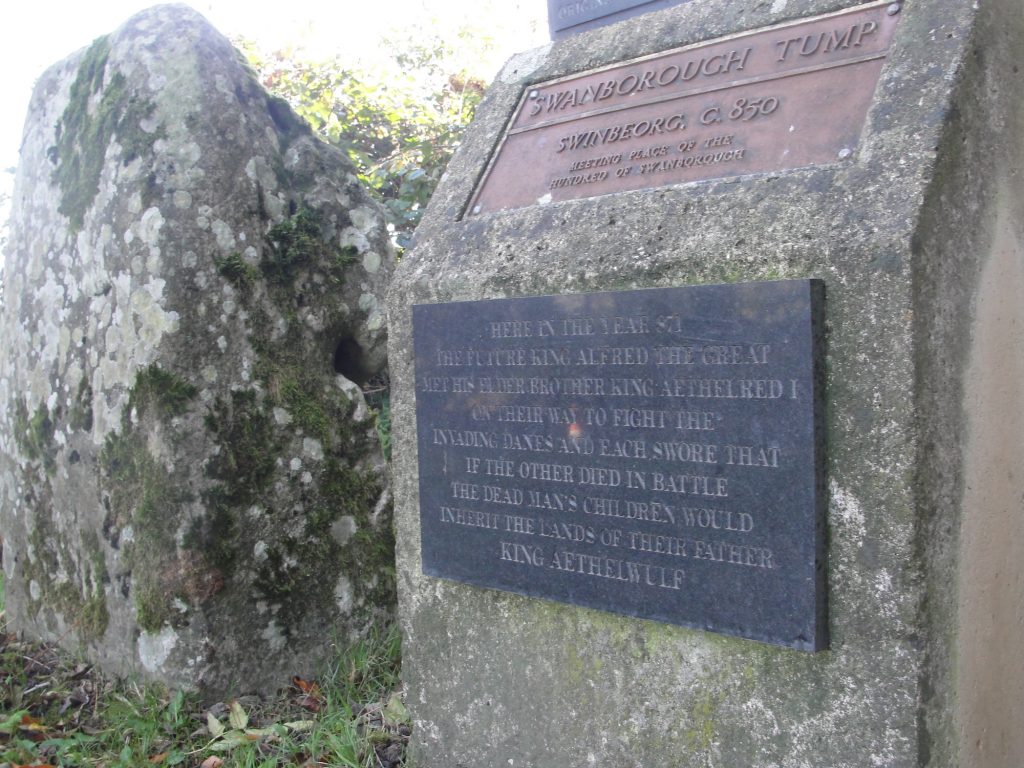
Swinbeorg is an unidentified location that is mentioned in Alfred’s will where he describes an assembly having taken place at which inheritance matters were discussed. Although this might seem quite mundane there are limited places where we might be able to pin the location of Alfred down quite precisely. If we could find this location it would in fact therefore be quite exciting! The context of the entry in his will indicates that this meeting would have taken place when King Alfred’s brother Æthelred was still alive but after the Viking emergency commenced (i.e. between 870 and the summer of 871). It has been speculated that this would have been at the presumed Anglo-Saxon meeting place called Swanborough Tump near Manningford Abbots in the former Swanborough Hundred in Wiltshire.
The monument in the countryside near Pewsey, Wiltshire, commemorating the meeting between King Alfred the Great (not yet king) and his brother at Swanborough Tump (Swinbeorg)
Although this seems tempting, the vowel change is problematic as even in 987 the place-name began with “Swan” and not “Swin.” However, I am not aware of any other proposed location so it seems that this site could indeed be Swinbeorg. A plaque at the location indeed decares this to be the case! It is worth noting, though, that there was a Suaneberge Hundred in Sussex, and this location cannot be ruled out.
The site is easy to visit, being at the roadside on a quiet Wiltshire country lane. It is west of Pewsey and is marked on Ordnance Survey maps.
Detail from the monument near Pewsey, Wiltshire, commemorating the meeting between King Alfred the Great (not yet king) and his brother at Swanborough Tump (Swinbeorg)
There is much more about the travels of King Alfred in my book, including maps and references. Tap or click the image below to learn more about the book.
The writings of a man called Æthelweard tell us that that Alfred besieged London in 886, and another early writer called Henry of Huntingdon suggested that an opportunity had arisen because the Viking presence had been weakened as a result of some having left to join Viking forces on the continent. Although The Anglo-Saxon Chronicles and Asser record Alfred in London at this time, neither source mentions that Alfred had taken London by force. The Chronicles also tell us that in the same year Alfred entrusted London to his son-in-law and ruler of Mercia, Æthelred. London had been a Mercian city and there may have been some resentment after it had been taken over by Wessex, with this being defused by Alfred handing it over to Mercian Æthelred in order to control on behalf of both of them. We know from the Anglo-Saxon Chronicles that London had been under Viking occupation in 871 when they had moved there from Reading. However, the Chronicles also tell us that these Vikings left for Northumbria in 872, and it was perhaps this that subsequently allowed Alfred to start to extend his power to London. Indeed, there is evidence from coins suggesting that London may have been under Alfred’s protection as early as the late 870s.
Where was London?
But what was this London that Alfred was gaining control over? It has been suggested that after Roman control ended the population left the fortified area at the current site of the City of London and went to a place called Lundenwic, approximately 1 mile to the west, perhaps because this provided easier access to a ford at Westminster. The wic element of Lundenwic persists in the modern name Aldwych. It appears that people later moved back to re-use the earlier Roman fortifications (as also appears to have happened at Winchester), and it seems plausible that this move had been triggered by Viking attacks. So, when Alfred took control of London it could well have comprised what is now the City of London and the area around Aldwych, with the two settlements connected by what we now call Fleet Street. There is also evidence of a high status Saxon site at Whitehall, although this seems to have fallen out of use about the same time as Aldwych.
The Queenhithe mosaic on the north bank of the River Thames, London. There would have been a dock here in King Alfred the Great’s time.
It is thought that Alfred restored London after 868 and it has been suggested that the site of the restored Alfredian burgh extended along the north bank of the Thames from near Queenhithe in the west to near Billingsgate in the east, and extending inland by about 300m. It is interesting to note that this area only occupied a small part of the Roman walled area, but in Alfred’s time much space might have been taken up by crops and livestock. Much of this stretch along the river can be walked and for me the most interesting location is Queenhithe, where there are some information boards and one can look out over what would have been a dock in Alfred’s time. It is a great place to stop and think about the Saxon history of London. Queenhithe is named after Matilda, the wife of King Henry I, but the location had previously been called Æthelred’s Hithe, named after king Alfred’s son-in-law.
Queenhithe, on the north bank of the River Thames in London, with the Millennium Bridge and Tate Modern in the distance. There would have been a dock here in King Alfred the Great’s time.
It may be that the administrative centre of London at Alfred’s time was somewhere near Aldermanbury. If this is the case then it seems likely that Alfred would have been there at some point. However, this is based on the presence of the Old English burh in the place name, and it is not known whether this was acquired after the time of King Alfred.
The ward of Aldermanbury, London.
Aldermanbury is immediately to the north-west of the current Guildhall, with Wood Street running north-south through the middle of it. It is possible, based on the 13th century Matthew Paris quoting an 11th century source, that there had been a Saxon royal palace at Aldermanbury near the site of the former church of St Alban on Wood Street. This does not allow us to confirm that it was there when Alfred was alive, but there must have been at least one royal residence and there are few other potential locations within the circuit of London’s walls (another being the site of the former Roman praetorium, the remains of which are largely under Cannon Street station). This church was a victim of the 1940 Blitz and all that remained, with the exception of the tower, was demolished in the 1950s. The tower, now a private residence, still stands in splendid isolation in the middle of Wood Street. if it was still standing, the church would extend eastwards into where the police station is located.
Also perhaps of significance is that this was in a particularly important part of Roman London, being within the outline of the Roman fort, and also very close to the Roman amphitheatre. You may not wish to miss the remains of the amphitheatre, which are located beneath the Guildhall Art Gallery. It is also possible that the walls of the Roman fort were still intact, and this square area at the north-east aspect of the walled city might itself have served as a base (more details on this, with a map, in this post). There is some evidence that there may have been royal palaces at Brentford and Chelsea in the 8th century, but whether these were still in service at the time of King Alfred is not known.
St Alban’s bell tower, Wood Street, London. Inside the outline of the Roman fort. Was there a Saxon royal residence here?
A predecessor to St Paul’s would have been present at or near the site of today’s cathedral, as this had been founded in 604. All Hallows by the Tower shows evidence of Saxon work, so it is possible that a church was also standing there in Alfred’s time.
The north bank of the River Thames, looking east towards London Bridge
Southwark is mentioned in the Burghal Hidage, issued in the reign of Edward the Elder (Alfred’s son) after Alfred’s death, so it seems likely that there was a burgh in place here on the south side of the Thames before Alfred died. Indeed, it is possible that a London Bridge, as a replacement or a repair of the earlier Roman structure, may have been built, perhaps during Alfred’s lifetime, in order to connect the two burghs on either side of the river and to act as a defence against Vikings trying to proceed upstream.
King Alfred may have also been at Chelsea in 892, 898 or 898 (it depends on which reading of a particular charter one is looking at. The one in Corpus Christi, Cambridge has 892. The one from Lambeth Palace has the other dates. The transcription, in Latin, of the Lambeth Palace document is here). I have some concerns about how what seems to be Chelsea is spelt in these documents, which makes me shy away from saying for sure that he was there. It seems to me, however, that it was more likely than not.
It have seen it suggested that Lothbury (a street in the city of London) may have had its name derived from the 7th century King Hlothere of Kent, and that this may indicate that there was some sort of royal function taking place there. However, this does not seem to fit well with evidence that most of the population of London at that time would have been at Lundenwic.
St Paul’s Cathedral, London. From Winkles’ Cathedrals 1836Thames Embankment, London. From Illustrated London News 1856. Looking east. The dome is that of St Paul’s. To the left, back from the river, are the Strand and Aldwych areas.St Paul’s Cathedral, London. From Winkle’s Cathedrals, 1836
I hope that you enjoyed reading about these important events in the history of London. There is much more about the travels of King Alfred in my book, including maps and references. Tap or click the image below to learn more about the book.
The Anglo-Saxon Chronicles refer to Egbert’s Stone (Ecgbryhtes stane) as the place where the armies from Somerset, Wiltshire and part of Hampshire came together to fight alongside Alfred after he had left Athelney in the seventh week after Easter in 878, en route for the important and decisive battle at Ethandun where the Vikings were defeated.
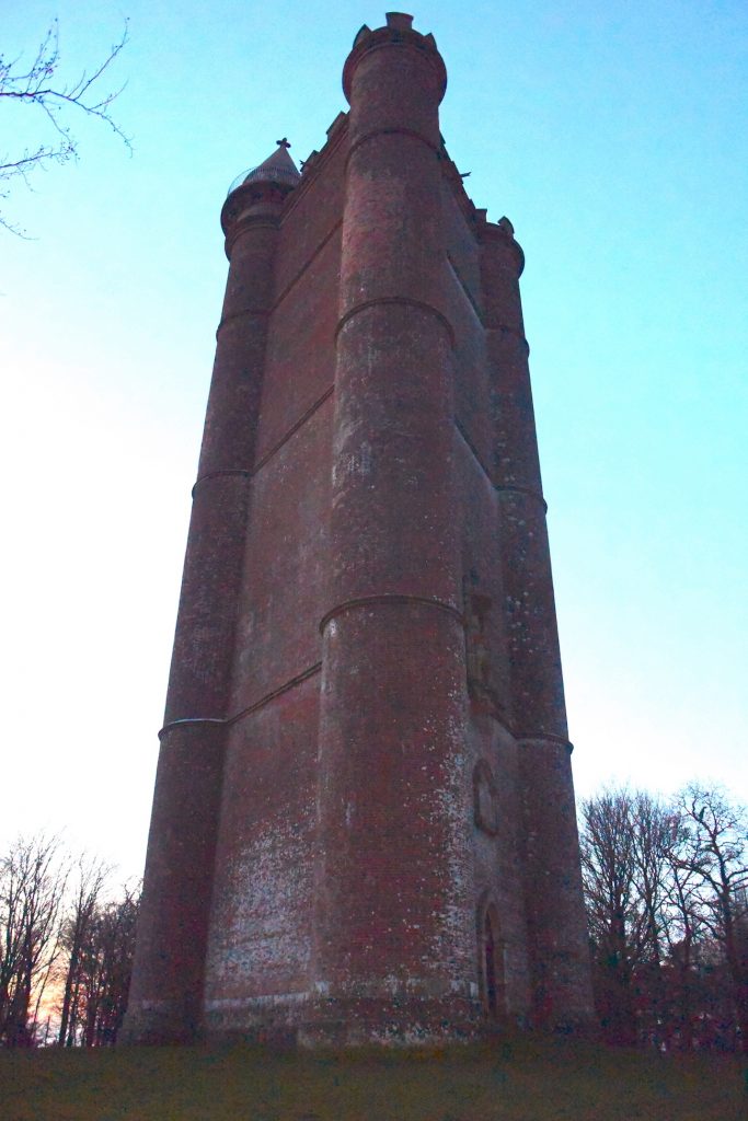
King Alfred’s Tower is frequently suggested as being at or near the site of Egbert’s Stone, and I read some material dating from 1901 that there had been a local tradition that a beacon had been lit here as a signal for the gathering of Alfred’s forces.
King Alfred Tower, Somerset.
This building is a folly, built from 1762 onwards, and is in a lovely location surrounded by woodland on Kingsettle Hill in Somerset. The first thing that struck me about this monument is it’s size. It is huge. Indeed, an american military aeroplane crashed into it in 1944. The second thing that struck me was it’s unusual three-sided shape. I understand the views from the top are excellent but it was closed when I visited. But is this the site of Egbert’s stone? The road that goes past the tower is again the ancient Hard Way (also known as the Harrow Way), with the ancient name surviving at the nearby Hardway Farm. This is the same Hard Way / Harrow Way that crops up in relation to Willoughby Hedge (in a future post) and the Battle of Basing.
The statue of King Alfred the Great, high up on King Alfred’s Tower, Somerset.
From the evidence available, it is, however, difficult to define the location of King Alfred’s Tower as east of, or in the eastern part of, Selwood, which is required to fit the description given by Asser and the Anglo-Saxon Chronicles.
We need to remind ourselves of the size and shape of Selwood. Towards its southern extremity it extended eastwards across to at least Gillingham Forest (Source: Hutchins, History and Antiquities of Dorset, 1774) and further north, in Wiltshire, it extended east at least as far as Warminster. We know this because the following settlements answered at the forest eyre 1187-90: Heytesbury, Knoyle and Westbury. The following villages etc were represented at forest inquisitions: Longbridge Deverill, Sutton Veny, Warminster, and Westbury (source: Victoria County History. Wiltshire Volume IV, 1959)
The location is adjacent to an important ancient route (the Hard Way), but this does not seem enough to determine this to be the spot, or even a candidate, for being the correct location of Egbert’s Stone.
The term “Kingsettle” is also interesting, because there are some woods and a farmhouse approximately 14 miles away, just a short distance north of Shaftesbury, that also have this name. It may be that the name was shared with the location of the tower, or the other way around.
King Alfred’s Tower, Somerset. An unusual three-sided folly
Kilmington Common
Kilmington Common was put forward by a Dr Williams-Freeman in the 1950s . Kilmington Common is the name of the village and it lies about a mile east of Alfred’s Tower. The west-east road and track, named Tower Road and Long Lane respectively, lie on the route of the ancient track called the Hard Way, which is the same Hard Way that goes past King Alfred’s Tower. I parked near where Tower Road meets the village and walked a short distance down the track called Long Lane, partly to appreciate that this was a potential site for Egbert’s Stone and partly for the simple enjoyment of walking on the ancient Hard Way. I looked over to where “the common” is marked on the OS map, but there was little to see apart from crops. Although the case for this location is supported by evidence that tracks ran in other directions near here, it seems difficult to define this location as east of or in the eastern part of Selwood. I therefore consider this to be a less likely location for Egbert’s Stone.
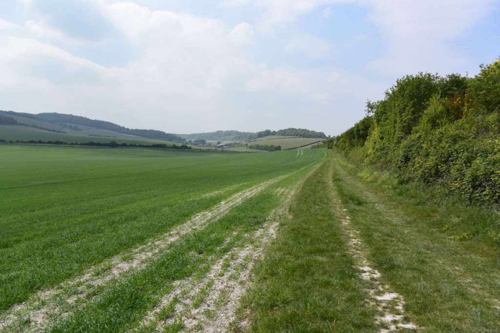
On the Hard Way (also known as the Harrow Way) ancient trackway near Kilmington Common, in Wiltshire. Did King Alfred the Great pass down here after he left Athelney en route to the Battle of Ethandun?
Part three is now available and includes the Deverills in Wiltshire. If you missed part one, it is here.
You can view my video on Egbert’s Stone below:
There is much more about the travels of King Alfred in my book, including maps and references. To learn more about the book, click or tap the image below.
The River Medway at Maidstone, Kent. Looking south from Maidstone Bridge, with the Archbishop’s Palace and All Saints’ Church in the distance to the left
In 892 a Viking force of 250 ships sailed from Boulogne to the south coast of Kent and in the same year another Viking force of 80 ships came to the north coast of Kent.
The Anglo-Saxon Chronicle tells us that the Vikings were at Milton (Milton Regis) to the north and at Appledore to the south, and that Alfred camped with his army between the two raiding armies. Anyone who travels around Kent will soon appreciate the difficulty of simultaneously monitoring these two areas from a single location, because they are quite far apart, so he must have had additional outposts, and perhaps this is what some of the alternative locations (later posts will address these) put forward as Alfred’s base actually were. Indeed, this would fit with the Anglo-Saxon Chronicle telling us that burga (fortresses) were being held.
Milton has now become part of Sittingbourne and was accessible from the Swale via the Milton Creek. Appledore is a lovely village that would have been accessible to the Vikings by following the route of the River Limen (now the Rother) as it would have existed at that time.
Although other possibilities exist, Maidstone has been put forward as a serious contender for the location of Alfred’s base during this Kent emergency.
A crossing of the Medway at Maidstone was developed in saxon times and it has been proposed that the town may have been part of a saxon royal estate with significant ecclesiastical connections.
Maidstone is on the Medway, but it is also at the crossing of a Roman route from Rochester to Hastings (Margary 13) with a possibly ancient track from Ashford to London, now represented by the A20 either side of Maidstone. It has been suggested that in Saxon times Maidstone grew up around this crossing.
Identifying this crossing may help us establish an approximate location of Alfred’s position, if he was based at Maidstone. It appears to be where Week Street, King Street, Gabriel’s Hill and High Street meet. When I visited this location, it was clear that it was near the top of a hill. Such sites are generally strategic.
Looking west down the High Street from the probable site of the origin of Maidstone (at the ancient crossing) in Kent As above, but now looking east towards King Street in Maidstone, Kent.
However, King Alfred lived in the later Saxon period, and by then Maidstone may have developed beyond the vicinity of the junction described above, making it more difficult to define precisely where Alfred might have been.
The location of the former church of St Mary the Virgin may be an important clue . By the 11th century this church was a minster with 17 dependent churches. Some sort of settlement around this site in Alfred’s time would appear to be likely as it would have taken time for a church to build up this level of significance. This church, which was by the Medway, no longer exists, but it is suggested that the site is at the approximate location of, or even beneath, All Saints’ Church, which replaced it in the 1390s.
All Saints’ church, Maidstone, Medway, Kent
The oldest parts of the nearby Archbishop’s Palace date to the 14th century, but the location was likely to have been the site of a manor that we know existed because in 1086 it was being held by the Archbishop of Canterbury. It is therefore possible that there had been a manor here at the time of King Alfred.
The Archbishop’s Palace, Maidstone, Medway, Kent
On visiting this area my attention was drawn to an information board that referred to a track called Knightrider Street going down to the Medway where it could once be forded. I feel that the possibility of being able to easily cross the Medway at this point adds weight to this part of Maidstone, potentially the manor referred to above, being the location for King Alfred’s camp.
Looking down Knightrider Street to the location where there used to be a ford across the River Medway in Maidstone, Kent
I found myself being impressed by the collection of historic buildings, including All Saint’s Church and the Archbishop’s Palace, and it was pleasant to partake in a small circular riverside walk in this area, made possible by the Millenium and Maidstone Bridges. It is worth noting that the latter was designed by Joseph Bazalgette, of Thames Embankment and London sewers fame.
Maidstone is also close to what appears to have been the original Pilgrim’s Way, which was on the route of an ancient trackway. In addition, Maidstone may have offereda direct route to the vicinity of both Milton Regis. In the other direction, there may have been access to the area around Appledore via a route about which we now have no knowledge.
However, Maidstone is much closer to Milton than it is to Appledore, and it is quite a way off a line running between these two places. We therefore possibly run into trouble with the Anglo-Saxon Chronicle having told us that Alfred set up camp between the two raiding armies.
Overall, I feel that Maidstone must have been involved. It seems to have been an important site and it was not far from a Viking base at Milton Regis.
There is much more about the travels of King Alfred in my book, including maps and references. Tap or click the image below to learn more about the book.
Rochester is a lovely and historic city, worth visiting in its own right. However, this city was clearly a target for the Vikings. Rochester had already been sacked by the Vikings in 842, before Alfred was born. However, it was attacked by the Vikings again in 884, but this time King Alfred saw them off.
You may wish to open a map application to help you get the most out of the below. Otherwise just relax and read on.
Where was the Viking camp at Rochester?
The records indicate that on arrival in 884 the Vikings built a fortress around themselves, and we know that this must have been outside of Rochester’s walls because it is recorded in the Anglo-Saxon Chronicles that the inhabitants defended the settlement. Asser tells us that the Viking fortification was at the entrance to the town but, unfortunately for modern-day investigators, there were four entrances, and so the precise location of the Viking fortification has remained unknown. King Alfred later arrived with his forces in 885, and locating the site of the Viking fortification could shed light on where and how Alfred might have engaged with the Vikings and saw that they left. Fortunately, the outline of Rochester’s Roman walls is known. It has been suggested that there would be no Saxon-built stone walls, so the configuration of the walls in 885 should have remained perhaps unchanged since Roman times.
Rochester Bridge over the River Medway (looking north), Kent.
At which gate was the Viking camp?
There had been four gates in the Roman walls. A northern “Bridge Gate” that opened on to the position of the Roman bridge across the River Medway. A north gate, which is more east than north, an east gate that is more south than east, and a south gate that is more west than south. The confusion is explained when one realises that the name seems to indicate the direction in which one could travel after passing through a particular gate, rather than the orientation of the gate itself.
The East Gate
There is evidence that the East Gate was about where the City Wall Wine Bar on High Street is located. On visiting I noticed that the outline of the gate was helpfully marked out with bricks in the pavement and the road, with a metal plaque in the pavement confirming the location.
The outline on the ground of the East Gate in the walls of Rochester, Kent. Easily missed. Had there been a Viking fortification just past the lamp post?
The North Gate
The North Gate appears to be preserved in the current road name of Northgate. It has been suggested that this gate might have just lead to marshy ground. However, there has also been speculation that it may have led to a harbour. Evidence suggests that the Noth Gate would have been approximately where today Northgate meets Corporation Street, being approximately equidistant from Watling Street (which ran along a line close to that of the current High Street) on one side as the cathedral is on the other. This location seems to be consistent with an existing piece of wall that one can see at the back of The Common car park, accessible via Gas House Road and then Acorn Wharf Road. However, the line of bricks in the road at Northgate, outside the Corn Exchange, suggests that at least some person may have thought that the gate may have been not quite as far down Northgate as the junction with Corporation Street. However, I could find no plaque to explain the reason for the bricks embedded into the road at this point.
Rochester, Kent. A line in the road called Northgate which seems to be there to indicate the line of the wall, but might it (and the North Gate) have been a little bit further down somewhere near the junction with Corporation Street towards the right on the photo?
The Bridge/West Gate
The Romans built a bridge at Rochester and a bridge is recorded as present in 960, so a bridge may well have been maintained in the intervening period, including at the time of the Viking attack in 885. This bridge across the Medway is thought to have remained in approximately the same location as today. The location of the gate by the bridge (which I have seen referred to as both Bridge Gate and West Gate) has not been proved although it must have existed in order to allow access to and from the bridge. The gate would most likely have been more or less in line with the bridge. However, the modern bridge is much wider than it has been in the past. Fortunately, the entrance to the old bridge is marked by black lions, which perhaps allows us to speculate that the Bridge Gate would have been at the point where a line drawn from the bridge would have met the town wall.
Rochester, Kent. The north end of High Street, looking north towards the bridge over the River Medway. If it still existed today, the Bridge Gate would surely be in this picture.
The South Gate
It is thought that the South Gate would have been just before where Boley Hill meets St Margaret’s Street, and there is a helpful plaque on a wall that identifies the location. One can wonder whether, if the Viking fortification had been outside this gate, the location would have been where Boley Hill House and Lodge now stand, near the junction of Boley Hill with St Margaret’s Avenue.
The plaque on the wall where the South Gate in the Roman walls of Rochester, Kent, is thought to have been.The site of the South Gate in the Roman walls of Rochester, Kent (plaque on the wall to the right). Looking to the east along Boley Hill
I did not find it possible to exclude any of the entrances as a possible site for the Viking fortification, although I favour the Bridge Gate because the Vikings had a tendency to use waterways and, by blocking the Bridge Gate, they could fend off any support for Alfred from that direction. I was also told by a helpful volunteer at the cathedral that the Bridge Gate currently appears to be the narrow favourite! It seems unlikely that an attacking force would cross the bridge, because such structures restrict the flow of men, making them more vulnerable. If there really had been docks beyond the North Gate it is possible that they could have disembarked there. Alternatively, the Vikings could have disembarked at Chatham and then came up Watling Street to the East Gate of Rochester.
This should provide plenty to think about regarding this important period in the history of Rochester. When you get a chance, pay Rochester a visit, have a look for the sites of the gates of the Roman walls, and see what you think! Rochester Cathedral and Rochester Castle are well worth a visit. You can also see the outline of the Saxon church outlined in the ground partly inside and partly outside of the cathedral.
Rochester Cathedral, Kent, from Winkles’ Cathedrals, 1836.Rochester Cathedral, Kent. The Crypt. From Winkles’ Cathedrals, 1836
There is much more about the travels of King Alfred in my book, including maps and references. Tap or click the image below to learn more about the book.
After Alfred left Athelney, he went via Egbert’s Stone and Iglea to Ethandun where he fought against the Vikings and won. The evidence suggests that after the Vikings had raided Chippenham Wessex had pretty much fallen into their hands. The events leading up to the Battle at Ethandun can therefore be viewed as a reconquest by Alfred for his Kingdom. If Alfred had lost at Ethandun, his loss of Wessex might have become permanent. The stakes were high. However, King Alfred did win this battle, leading to his successful recovery of Wessex.
Paul Kelly, the author of King Alfred: A Man on the Move – climbing Picquet Hill, just south of Edington, Wiltshire
In my opinion, the most likely location that can be pointed out for this battle is the area around the village of Edington in Wiltshire. The following is based on this hypothesis. Please bear in mind that other areas have been suggested (see below). Bratton Camp is also possible because it is close to Edington. We have no proof of where the battle took place but, for the reasons I provide below, places like Edington in Somerset are, in my opinion, far less likely. We need to remind ourselves that it is not an “Edington” that we are seeking but a place called Ethandun, and Edington in Wiltshire fits this.
The route that Alfred would have taken to get from Athelney is contested, largely because the locations of his en-route encampments, at Egbert’s Stone and Iglea, are disputed. If you are interested in the potential routes then you may wish to visit my three posts on Egbert’s Stone (1, 2, 3) and the one on Iglea (here).
Edington
The Anglo-Saxon Chronicles tell us that this battle took place at Eþandun (þ is pronounced “th”), which I refer to as Ethandun. It seems generally accepted that Ethandun is today’s Edington in Wiltshire. Although the identification of Ethandun is most helpful, it still does not allow us to determine the precise location of the battle in that area. My favoured location is the village itself (it seems that there was a royal estate here, and I can’t imagine that the Vikings wouldn’t have taken this) but because there is no proof I explored other options.
Edington Priory church, Wiltshire. It is plausible that the Battle of Ethandun was fought in the vicinity. King Alfred the Great defeated Guthrum and the Vikings in this battle.
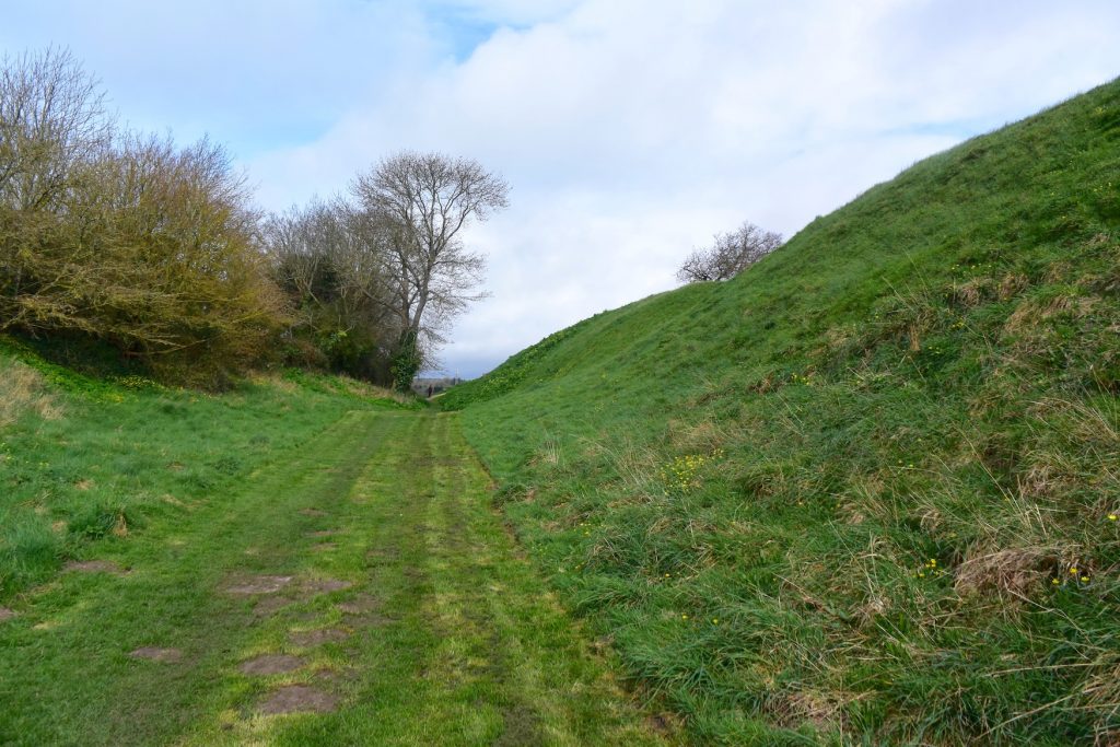
Bratton
It has been suggested that Bratton Camp, which is on Bratton Down, had been the Viking base for the Battle of Ethandun. Standing at this Iron-Age hillfort one can appreciate how, coming from the direction of Chippenham to the north (where this particular Viking army appears to have had its base), once the climb up to Bratton Camp had been achieved, they would have had easy access to Salisbury Plain, in order to confront King Alfred and his armies, if indeed they had come that way.
The iron age ramparts at Bratton Camp, Wiltshire. This has sometimes been put forward as the site of the Battle of Ethandun, or perhaps the site of the Viking camp.
East of Westbury, and just a short distance south-west of Edington, Bratton Camp is marked on maps and is easy to find. There is i a figure of a white horse marked out on the hillside, sadly today made out of concrete. I agree with another writer that it seems unusual that two important battles (the other being Ashdown) had been fought in areas with prominent white horses. However, there is no evidence that a white horse would have been present at Bratton Down at or around Alfred’s time. Furthermore, the location of the Battle of Ashdown seems to me to have not been in the vicinity of the white horse at Uffington in Oxfordshire. I decided to avoid the unreliable practice of divining battle sites via horse-led inquiry.
The White Horse above Westbury, Wiltshire.
The parish of Edington extends a fair way south onto Salisbury plain, approximately level with, and just to the west of the deserted village of Imber. On some days the Ministry of Defence allows public access to Imber and some other parts of Salisbury Plain where access is restricted. I went on one of the special services run by Imberbus, where vintage buses go from Warminster train station to permitted locations, including Imber and New Zealand Camp Farm. This was a delightful way of getting around. However, there is much of Salisbury Plain where there is never public access, including south of the village of Edington, and it is perhaps possible that the site of the battle may be beneath an area where access is restricted owing to unexploded ordnance. The best I could do was to explore the roads and paths to the north of the perimeter of the training area. I include the following suggestion because it seemed most interesting and informative in terms of views, and is also within the Edington parish boundary. Just as you approach Edington coming from Bratton there is a lay-by on the right, with a footpath leading north. This fairly steep path takes you up Picquet Hill and over the top of Luccombe Bottom. As you ascend you will pass ancient tumuli and pillow mounds, and the view will open up in a way that allows one to start to understand the landscape of the potential battle site.
Looking north to Picquet Hill (on the right), Wiltshire. Edington is down over the other side.
After their defeat at the battle of Ethandun it is recorded that the Vikings were pursued as far as their fortification. This is generally thought to be Chippenham, but at least one writer has suggested that it could have been Bratton Camp. I can see the temptation to consider Bratton camp as the Viking base, but the evidence for a base at Chippenham is stronger. Of course, Bratton Camp could have been an additional forward base for the battle, but so could have many other places been used as such and it seems possible on Bratton Down to be seduced by the heady combination of a hill-fort, a horse, and wide-ranging views. There is also the matter of maintaining provisions for troops and animals at an elevated position away from water.
A stone and plaque at Bratton Camp, Wiltshire, reminding us that the Battle of Ethandun had taken place in the vicinity.
It has been claimed that that the battle took place at Edington in Somerset. I examine this in my book and find that this is not likely.
Both Asser and the Anglo-Saxon Chronicles describe Alfred as going to Egbert’s Stone after leaving Athelney and, critically, describe this as being east of, or at least in the eastern part of, the great wood of Selwood. This would have taken him to a position about 30 miles east of Athelney. It seems to make little sense that Alfred would make this journey and then travel approximately thirty miles west again to engage the Vikings at Edington in Somerset. Additional evidence against the Somerset Edington comes from the Domesday survey’s recording of the place as Eduuintone, whereas the Wiltshire location is recorded as Edendone, which is closer to Ethandun. Domesday (1086) also tells us that the Wiltshire Edington was under Romsey Abbey and there is a charter dating to 968 showing that King Edgar, Alfred’s grandson, transferred the church and additional land at Edyndon to Romsey Abbey. That this Edyndon is Edington (Wilts) we know from the fact that the document is in Lansdowne MS 422, the contents of which come from the church at Edington. We also know that Alfred left Eþandun to his wife in his will, confirming that the place that went by that name was in royal hands, which fits with King Edgar being able to give the church land away at Edyndon in 968. In 957 King Eadwig had issued a grant from the villa que diciturEðandun. Finally, we have the chronicle of Æthelweard, who mentions Chippenham and Ethandun in practically the same breath.
We have some evidence that Ethandun was a royal estate prior to King Alfred’s reign from a charter (S290) dating to the reign of his father, King Æthelwulf. Please note that for this charter the Electronic Sawyer website (generally superb) has mistakenly placed Halstock in Devon instead of Dorset. Although the location of the place of issue (Æscantun) is no longer known to us, it was then confirmed at Ethandun by the King and a range of bishops, ministers etc. King Alfred is listed as a witness, which would not be possible as he was not yet born. It is thought that the witness list was later transcribed from a later document. For those who wish to go into this matter further the book “Charters of Sherborne” edited by O’Donovan is excellent.
You can view my short video on the Battle of Ethandun below:
There is much more about the travels of King Alfred in my book, including maps and references. To learn more about the book, click or tap the image below:
This post is adapted from my book, King Alfred: A Man on the Move, available from Amazon. It would be great if you could support this project by purchasing a copy.
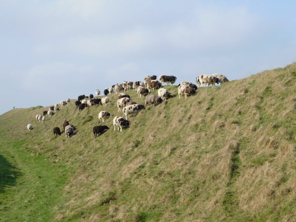
Athelney is where King Alfred developed a fortification at Easter 878, at a time when Wessex had fallen to the Vikings, and it was from here that Alfred set out on the successful reconquest of his kingdom. You will rarely find anyone else here at this important location.
The route up to the King Alfred the Great monument at Athelney, Somerset Levels. Just me and the sheep.
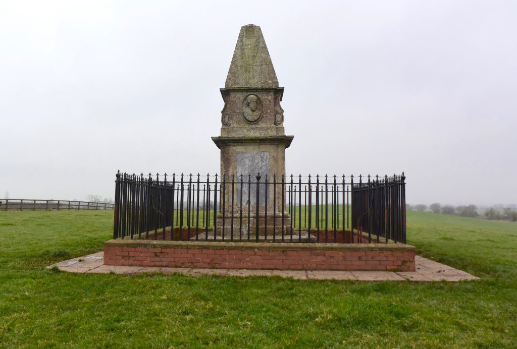
When you are at the site it is apparent that Athelney has two small summits, which was enough to make this location an island in the watery Somerset levels. It is suspected that Alfred’s 878 fortification was on the western summit, while the abbey, founded later by Alfred in around 882, was on the eastern summit, where a monument to King Alfred now stands. This abbey was later replaced by a medieval monastery, although there is nothing visible above ground today. Paragraphs 94-97 of Asser (King Alfred’s “biographer”) describe an attempted murder of the abbot, John the Old Saxon, by two monks, while Alfred was king. This abbey was well endowed; Asser (99-102) tells us that, in combination with Shaftesbury Abbey, it received one eighth of King’s Alfred’s taxation income.
The King Alfred the Great monument at Athelney, Somerset Levels.
I got to this location by taking Cut Road from East Lyng and parking near Athelney Farm. The site is on private land but there is a signpost indicating a route to the monument. Athelney Hill can also be observed from the lay-by on the nearby A361. It’s elevation above the surrounding area is immediately obvious, and one can see the elevation of Burrow Mump not too far away to the north east, which suggests to me the possibility that this other site may have been used for advance defence and signalling back to Athelney. There is other high ground in the area, such as Windmill Hill to the south west, Oath Hill to the south east, and, slightly further and east of Aller village, the high ridge of Aller Hill. Any high ground could have had strategic importance for protecting Athelney. Asser records that Alfred struck out at Vikings from Athelney, which indicates that Vikings had been in the vicinity.
The bust of King Alfred the Great on the monument at Athelney, Somerset Levels
There is evidence that Athelney had previously been an iron age fortification and therefore Alfred was bringing this defended site back into use. Evidence of metalworking at the western summit suggests that weaponry may have been manufactured here to be used in Alfred’s reconquest of Wessex.
There is also a record of a hermit called Æthelwine living at Athelney in the 7th century. Perhaps importantly, this Æthelwine is said to have been the son of Cynegils, king of the West Saxons, and the brother of the next king, Cenwealh. Athelney may therefore have been a royal site known to Alfred, and this may parhaps help explain why he chose this particular location. Alfred’s construction of an abbey here may therefore have been an enlargement of an already significant religious site.
Athelney, called æþelingaegge in the Old English of the Anglo-Saxon Chronicle, is derived from Old English Æðelinga eg with the first word indicating a royal connection (and eg meaning an isle). The impression gained from both the Anglo-Saxon Chronicle and Asser is that this site was already called this when Alfred arrived, rather than it having been given this name retrospectively because Alfred had been there. This is consistent with the hermit Æthelwine being very closely related to the kings of the West Saxons. It is recorded in the Anglo-Saxon Chronicles at 658 that King Cenwealh, the brother of the hermit Æthelwine, fought against the Britons (Walas) at Penselwood (peonnum), in Somerset, and that he drove them as far as the Parret. With Athelney not far from the Parret, it might have been about this time that Athelney developed it’s West Saxon royal associations.
If Alfred had been at Chippenham when the Vikings attacked at Twelfth Night in January 878dc, the most obvious escape route would perhaps have been to get to Bath and then go down the Fosse Way. However, he could have taken a Bath to Badbury Rings route and diverted into Selwood Forest. From there he could have made his way across to Athelney by Easter. This route would satisfy Asser’s description of Alfred being in woods as well as defensive positions in swamps or moors. Alternatively, he could have headed straight for the marshes of the levels, only to build the fortress later at Easter. There is also the possibility that he initially went further west into Devon. Ultimately, we do not know where Alfred was between January 878 and Easter 878.
The Anglo-Saxon Chronicle tells us that Alfred left for Egbert’s Stone in the seventh week after Easter. Alfred was therefore at the fortress at Athelney for about seven weeks, although of course he could have been at Athelney prior to the fortress being built.
Even with the Somerset Levels drained it doesn’t take much for the water around Athelney hill to appear again.
The legend of Alfred burning the cakes when he was put in charge of them by a peasant woman has become associated with his time at Athelney. However, there is no evidence that this baking mishap ever occurred. The earliest known version of the story of the cakes is in the anonymous Vita S Neoti (Life of St Neot), which appears to have been put together in the late tenth century.
Athelney was connected to nearby East Lyng by a causeway. East Lyng, the causeway, and Burrow Mump will be the subject of a different blog post.
Time Team visited the site on two occasions and the videos (first and second) are well worth watching. On the second visit they found human remains at the part of the site where the abbey was located. At least one of these was over the site of an earlier wall indicating that the remains post-dated that part of the abbey structure. The remains of a child was also found. I am not aware of any carbon-dating or isotope analysis having been carried out. However, it seems likely that the remains are associated with the abbey rather than earlier remains from a hillfort or from a conflict at the location prior to the construction of the abbey.
There is much more about the travels of King Alfred in my book, including maps and references. To learn more about the book, click or tap the image below.
This post is adapted from my book,King Alfred: A Man on the Move, available from Amazon. It would be great if you could support this project by purchasing a copy.
Alfred had seen to it that the Vikings would leave Exeter and the whole of Wessex in 877. However, they would return to Wessex and take Chippenham early in 878. This set off a chain of events that would eventually lead to the important Wessex victory over the Vikings at the Battle of Ethandun.
The arrival of the Vikings at Chippenham was an important turning point because the Anglo-Saxon Chronicles tell us that the Vikings then over-ran Wessex, and It was at this point that Alfred went into hiding. It is worth pausing to reflect on what the Chronicle tells us, which is that the Vikings did not just over-run the area around Chippenham, but probably at least most of Wessex, and all of Wessex if we take it literally. There were clearly parts of Wessex that were beyond their control, such as the area in north Devon where the Battle of Cynuit took place, and Athelney, where Alfred found a safe haven for a while. But the implication is still that, for a short while in 878dc, Wessex had been lost to the Vikings. As Wessex was the last kingdom in what we now call England still independent of Viking rule, this also means that for a short while in 878, between Twelfth Night and some time after Easter, the Vikings had control over the whole of England. With King Alfred on the run they must have seen a permanent victory as a plausible outcome.
It is important to appreciate that Alfred decided to stay and did not flee to, for example, Rome. When Mercia had collapsed under the Vikings in 874, the ruler, King Burghred, fled to Rome. Circumstances would not have been precisely the same, they never are, but I believe things would have turned out very differently had Alfred fled. But he did not. From a position that must have seemed irrecoverable to many he fought and won back his kingdom and, eventually, during the reign of his grandson, Athelstan, all of England would be recovered from Viking rule.
It has been suggested that King Alfred had spent Twelfth Night, in January of 878 at Chippenham. However, I can find no evidence that this was the case. However, it is undoubtedly possible as Chippenham was a royal estate, and it would have provided a reason for the Vikings to arrive there at this particular time. Chippenham seems to have been important as Asser recorded that this had been the location of Alfred’s sister’s marriage to Burghred, King of Mercia in 853. However, Alfred may not have been present at his sister’s wedding as Asser also records that in the same year the young Alfred had gone to Rome, with no indication as to when he returned, although it must have been before 855, as Asser says that Alfred went with his father a second time to Rome in that year (but with the Anglo-Saxon Chronicle only mentioning his father going).
The Market Place, Chippenham, Wiltshire.
Chippenham enters the story again, still in 878, immediately after Alfred won the Battle of Ethandun, for it is recorded in the Anglo-Saxon Chronicle that when Alfred put the Vikings to flight, he pursued them as far as an unnamed fortification (geweorc). It has been suggested that this location was perhaps Chippenham. This seems plausible in relation to the most likely sites for the battle. The Anglo-Saxon Chronicle also tells us that the Vikings moved from Chippenham to Cirencester after Guthrum’s baptism. Chippenham seems to have served as a Viking base. It is unlikely that the unnamed fortification was Bratton Camp, on the north-west edge of Salisbury Plain, as provisions for troops and animals would have been difficult to provide on this elevated landscape over an extended period.
The Anglo-Saxon Chronicle tells us that after the Battle of Ethandun Alfred put this fortification under siege for fourteen days, after which the Vikings surrendered. Asser provides further detail and identifies the location of Alfred’s besieging camp as being in front of the gates of the Viking fortification.
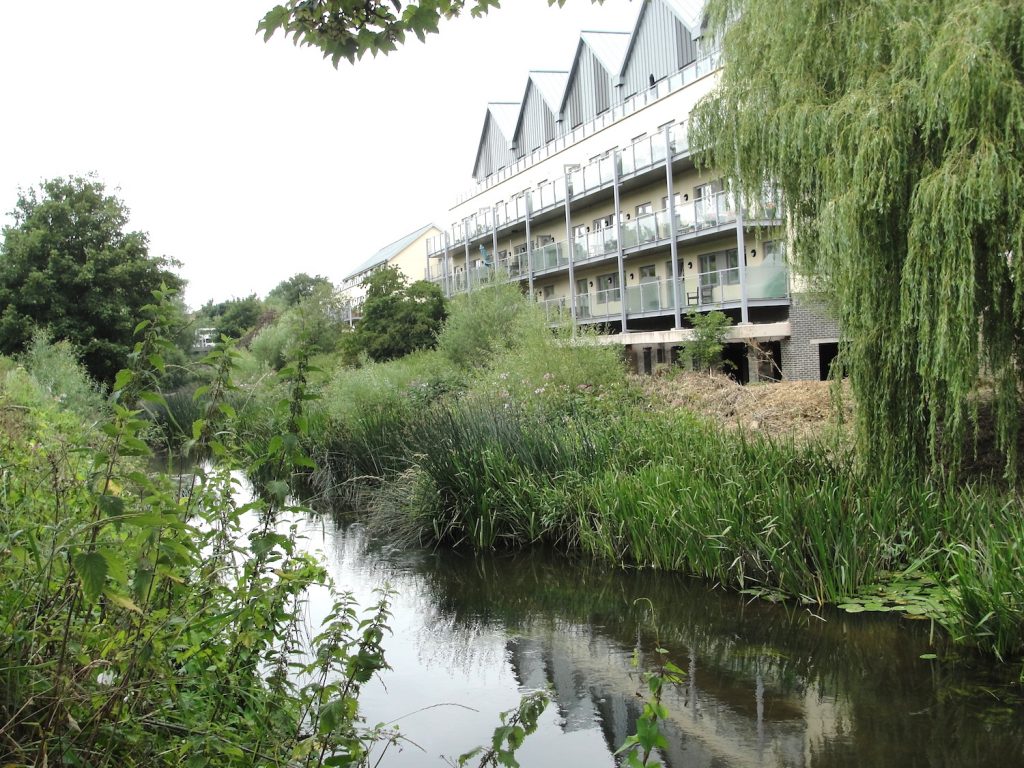
Asser indicates that the location that the Vikings took at Chippenham prior to the Battle of Ethandun as being on the eastern bank of the Avon. It seems likely that any fortification at Chippenham that the Vikings retreated to after Ethandun would be at this same location. Examination of a map shows that there is a bend in the Avon that would allow the Vikings to defend a peninsula, similar to their tactic at Reading. This is where the old town is located. I parked in the Sadler’s Mead car park and walked down to the River Avon, being the same river that flows through Bath and emerges at Avonmouth near Bristol. I walked along the path that heads west and then south along the outer bank, allowing me to appreciate what may have constituted Asser’s east bank of the Avon.
Chippenham, Wiltshire. Looking across the River Avon from the west bank.
It is important to note that the river today is not the same as it appears on old maps, and It would have been even more different in the time of Alfred. But even going back to the Ordnance Survey map of 1886, one can see an Isle of Rea, which no longer exists as such, just south of the town bridge (High Street). My impression is that this island is where much of the deeply unaesthetic Borough Parade shopping centre now stands. This area can therefore be excluded from being Asser’s east of the Avon. Just south of here the river once divided again into a main stream and a Hardenhuish Brook, forming yet another island called The Ham. However, it seems like it is the brook rather than the main stream that has disappeared so that when we look across the river at this point today we are looking at the east bank of the Avon as opposed to the eastern edge of a former island. So I proceeded to walk all the way down the western bank looking across at the eastern bank. Nowadays, perhaps unsurprisingly, this area has been developed, except at the point where one reaches some playing fields.
Chippenham, Wiltshire. Looking across to the east bank of the River Avon (the bridge is Gladstone Road)
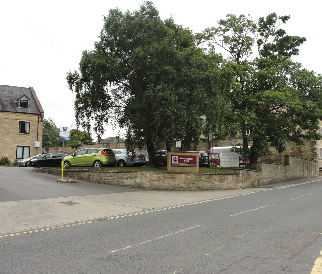
So does this help locate the Viking fortress? It could have been anywhere along this stretch of the east bank as it runs through Chippenham, whilst allowing for the disappearance of the Isle of Rea. However, another option arises. Because the Avon bends sharply, there is a second eastern bank a little further east. A Monkton House is located here, and this is on the location of an older manor house. However, I feel that this is a less likely location because of the pattern of the Vikings usage of water to defend themselves on three sides, which the latter site could not provide. But there is also a third option. Neither Asser nor the Chronicle states whether the Vikings set up their own fortress or took over what was already there instead. Asser records that Chippenham was a royal estate and I believe it would therefore have had some defences, particularly bearing in mind its northerly location compared to the rest of Wessex. It seems to me inconceivable that the Vikings would drive the Saxons out of Chippenham and not use the Saxon site as a base. Establishing the location of the royal estate may therefore also be helpful, as this could be the same location as the Viking fortress. St Andrew’s church is near the Market Place (the main focus of the Saxon town) and St Andrew’s has been described as probably the site of the Saxon church. Ordnance Survey maps from 1900 to 1967 indicate a “site of King Arthur’s Palace” between the Market Place and Gladstone Road. Although it is named after King Arthur, who we cannot prove existed, one wonders how this royal connotation came about. The area indicated is to the rear of the current Museum and Heritage Centre and also appears to be at the northern end of a restricted parking area accessed off Timber Street. The access is opposite to where I found a very good Caribbean restaurant where I enjoyed the best jerk chicken I have ever tasted.
Chippenham, Wiltshire. The Angel Hotel, Gladstone Road. On the site of the Royal estate and the Viking camp?
Anybody who walks down St Mary’s Street will sense it’s age and indeed it is considered to be part of the Saxon settlement, with the area to the north of St Andrew’s chuch considered to be a possibility for the location of the royal estate. Therefore we have two potential sites for a royal palace, one to the west of The Causeway and one to the east. Both of these of course meet Asser’s description of being east of the Avon. However, the latter site would probably be better described as being west of the Avon as it is closer to the other side of the peninsula. It is also possible that the royal site ranged across both of these locations and perhaps we should not always consider them as separate.
Chippenham, Wiltshire. Looking south down St Mary’s Street, with the possibility of the former location of the royal site at the time of King Alfred the Great being to the right.
For me, therefore, the most likely location for both the Royal Estate and the Viking fortification extends between Borough Parade shopping centre car park in the north, Timber Street in the south, and St Mary’s Street to the east. This would be east of the Avon, yet far enough up the peninsula to make that a defensive feature.
There is much more about the travels of King Alfred in my book, including maps and references. To learn more about the book, click or tap the image below:
The history of Wareham is fascinating and the town and nearby Poole harbour are lovelyplaces to visit. However, not everybody will be aware of the dramatic events that took place here in the 9th century.
Wareham Quay, the Purbecks, Dorset, viewed from the south bank of the River Frome. The Vikings may have disembarked here.
Wareham had been occupied by the Vikings in 875, but Alfred made piece with them in 876 when the Vikings swore on the halgan beage (holy ring) that they would leave Wessex. However, they left under the cover of darkness and went instead to Exeter, in Devonshire but also part of Wessex. The Anglo-Saxon Chronicles tell us that the Vikings had given hostages to Alfred as part of the deal, and that these men had been the worthiest in the Viking army. We cannot be sure if this ring was presented in the negotiations by Alfred or by the Vikings, or who it was “holy” to, if not to both parties. It is possible that either the Vikings or Alfred had access to a holy ring as they travelled from place to place. If it was a Viking ring, then Alfred clearly must have had the upper hand to make them swear on it, which would fit with the fact that Alfred was also given important hostages, which could be killed if the Vikings reneged on the deal. The Vikings must have seen Exeter as a great prize if it meant sacrificing their worthiest men. One can imagine how the Vikings might have viewed the subsequent loss of 120 ships near Swanage in a storm as they fled to Exeter as divine retribution for breaking an oath sworn on a holy ring.
On balance it seems to me that this ring was presented by Alfred. The Anglo-Saxon Chronicles refer to it as “holy” and it seems unlikely to me that something un-Christian would be referred to in this way.
Wareham, the Purbecks, Dorset. A view of Lady St Mary’s church from the south bank of the River Frome. Was this the heart of early to middle Saxon Wareham?
But, what was at Wareham when the Vikings attacked? Asser describes Wareham as a castellum (fortification) and the location of a convent for nuns. We know that Alfred embarked on a programme of defending settlements after 878 and it is thought that the origins of the walls that we see today were built then, although we know that they were modified over subsequent centuries. The fortification referred to by Asser is therefore probably not the same as the walls we see today. Castellum could also relate to an ancient or Roman construction, for which there is no remaining evidence, or even Saxon pre-878 defences developed because of a specific risk of Viking attack.
Wareham, the Purbecks, Dorset. The north stretch of the Saxon wall, with the River Piddle disappearing off to the west.Wareham, the Purbecks, Dorset. The west section of the town’s Saxon wall
However, things become even more complicated when we look at Æthelweard’s chronicle. He describes the Vikings moving down from Cambridge to near (iuxta) Wareham and occupying a location alongside (coniecit statum communem cum) a Western Army. There appears to be a significant difference between Æthelweard and Asser as the latter states that the Viking army enterred (intravit) the castellum of Wareham. However these two sources may just be providing two snapshots of a sequence. Taking it all together it appears that the Vikings camped outside of the settlement of Wareham and then took it over, perhaps after besieging it.
But where did the Vikings camp and how did they get there? We know that there must have been a combined land and sea force because that is what left Wareham when they fled to Exeter. We also know that the seaborne force must have been considerable because the Vikings lost 120 ships in a storm near Swanage when fleeing. The ships must have come in to Poole harbour, and perhaps they would have taken some ships up the Frome in order to get closer to Wareham. Presumably, with that many ships, they would have defended their rear by perhaps occupying Brownsea Island and the harbour entrance. This would have been a most serious situation. Try to imagine today over 120 Viking ships in Poole harbour. In fact there would have been more than this as 120, the only figure that we have, is the number that sunk in the storm of Swanage. It is unlikely that all Viking boats had sunk. And on top of this was the land-basedViking army. It is difficult to see that the native settlement at Wareham would have had a chance. The Vikings broke their oath when they fled to Exeter, but Alfred’s intervention had saved Wareham, and we must remember that when the Vikings got to Exeter they had to deal with Alfred again, and this time they did leave Wessex.
How the Viking land-based forces got to Wareham must be very speculative. There may have been a Roman road from Wareham to Woodbury Hill, near Bere Regis. This may have been in use in Alfred’s time because there is still today a straight road that heads in that direction. However, this seems to be in the wrong place (being north-west instead of north-east) if they had come from Cambridge. There is nothing to indicate where Alfred had travelled from.
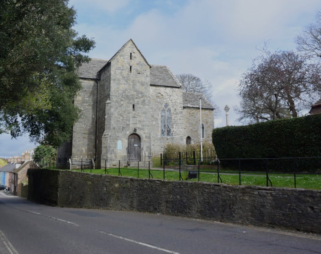
The nearby church of Lady St Mary, although subject to much rebuilding, has an important history going back to at least the 8th century. Inside the church are several pieces of masonry that are dated to Anglo-Saxon times.
Wareham, the Purbecks, Dorset. Lady St Mary’s church. There would have been a church here at the time of King Alfred the Great.
Another important location in the history of Wareham is the very old St Martin’s church, . This church is generally locked outside of the main tourist season, but there is usually an indication of where to get the key in normal trading hours (it is kept in a shop). It is thought that the current building dates to about 1030. The church also contains important 12th century wall paintings.
Wareham, the Purbecks, Dorset. St Martin’s church
One version of the Anglo-Saxon Chronicle (E) tells us that King Edward the Martyr was initially buried at Wareham after he had been murdered at nearby Corfe in 978. Although he was later transferred to Shaftesbury, his initial burial would probably have been at or near the site of St Mary’s church. The “A” manuscript of the Anglo-Saxon Chronicles tells us that King Beorhtric of Wessex had died in 802 and the entry for 786 tells us that his body lies at Wareham (confusingly telling us where his remains are before telling us that he died). The Anglo-Saxon Chronicles for this period are thought to have been composed in the very late 9th century, so it seems that he was not translated in the intervening period to Shaftesbury, Wimborne or Sherborne. The implication is that Wareham may have been a much more important place than it seems to us now. Perhaps Viking raiding had something to do with its loss of status, although it should be born in mind that by the time of the Domesday survey Wareham had two moneyers.
This was not the last that Wareham would see of the Vikings. They attacked Dorset again via the Frome, which then runs past Wareham, in 998 and 1015.
A sword was found in 1927 while widening a bridge. This sword is thought to be Saxon, but some have indicated that it might be Viking. There are inscribed stones in Lady St Mary’s church that are believed to derive from the 7th to 9th centuries (RCHM Dorset, Vol2 Part 2). Unfortunately, what remained of the Saxon church was demolished in 1842. It is thought to have been of a similar size to the current church (RCHM Dorset, Vol2 Part 2). It must have been an impressive Saxon church, sadly no longer.
You can view my short video on Wareham here:
There is much more about the travels of King Alfred in my book, including maps and references. Click or tap on the image below to learn more about the book.
This post is adapted from my book, King Alfred: A Man on the Move, available from Amazon. It would be great if you could support this project by purchasing a copy.
This battle against the Vikings took place in 871AD just four days after the battle at Reading, and while Alfred’s elder brother Æthelred was still king. This battle was an important victory for King Æthelred and Alfred, sandwiched between the two losses at Reading and Basing.
Potential locations for this battle can be divided into two areas. Firstly, the more western sites around White Horse Hill in Oxfordshire, and secondly, about twenty miles to the east, sites on the Downs near Moulsford and Streatley, mainly in Oxfordshire but close to the modern boundary with Berkshire to the south.
This post looks at the second set of sites (click here for part 1). Over the past couple of centuries people have come up with various ideas and because there is no hard evidence it is difficult for anybody to be wrong. However, I think it is still possible to speculate on which sites are perhaps more probable.
A major consideration is the identification of the location of Ashdown itself. In the Old English of the Anglo-Saxon Chronicle the location of the battle is called æscesdun. This Chronicle also tells us that in 1006, after the time of King Alfred, the Vikings proceeded from Cholsey, now in Oxfordshire, along Æscesdun, to a location known today as Scutchamer Knob, which is about 10 miles west of Cholsey. The general area between these sites may therefore be the æscesdun of 871. In fact, one can wonder whether all of the downs that straddle the current Oxfordshire-Berkshire border were once known as Æscesdun.
A further consideration is the accessibility of the location for both the Vikings, who appear to have still been based at Reading, and for Alfred and King Æthelred who, four days earlier and after the battle at Reading, had been fleeing east across the river Loddon in the direction of Windsor. Perhaps importantly, the Thames would have allowed easy access by water from Reading to various locations, and an important ancient track called the Ridgeway would have facilitated east-west movements through this area. We also have preserved in the name Moulsford a possible fording point for crossing the Thames.
All this leads me to think that the battle possibly took place west of the Thames on the Berkshire/Oxfordshire downs. If you consult an Ordnance Survey map you will see the area that I am suggesting, which extends from Lowbury Hill in the west to Moulsford Bottom in the east. I feel that it is important to point out that other writers have come to similar conclusions.
Lowbury Hill, Oxfordshire (from the north). Did the Battle of Ashdown take place here?
I find the most tempting location in this area to be Lowbury Hill. Asser records that the Vikings held the higher position, and if you go up Lowbury Hill you will see that it is a site you would want to use. There is good visibility in all directions and it is close to the Ridgeway. One can envisage the Vikings being on this hill and the Saxons coming west along the Ridgeway, having perhaps forded the Thames at Moulsford, and encountering the Vikings who were at the top of the hill. A line drawn between Cholsey and Cuckhamsley Knob lies just north of here (and also Kingstanding Hill), so it seems to be in the general area of Ashdown. There are footpaths and bridleways that cross the downs, the main one of course being the Ridgeway, which will take you close to the hill.
There are two other locations in this area that have been put forward, and both seem plausible. One is Kingstanding Hill. On the Ordnance Survey map you will see a track heading south west near the hill that eventually becomes called The Fair Mile. It was possible to park at the litter-strewn beginning of this track. Views from the track as it ascends are limited by hedgerows, but there are one or two good views north and south.
On Kingstanding Hill, a candidate for the site of the Battle of Ashdown, looking north over Starveall Farm and Moulsford Bottom, across to Moulsford Downs.
The other location is Moulsford Bottom. I found the best way of viewing this to be by following the footpath that runs from near Moulsford Pavilion.
On a footpath heading west from Moulsford, Oxfordshire. Moulsford Bottom is on the left and Kingstanding Hill is ahead.
While at Moulsford you may wish to appreciate a particularly lovely stretch of the nearby Thames Path. This is the section south of Moulsford, accessed by going down Ferry Lane. I sat down there on a warm late spring afternoon and watched three hobbys feeding over the water whilst red kites were circling overhead. A lovely spot.
Wherever the battle took place, it is important to remember that the Anglo-Saxon Chronicle indicates that it was almost two simultaneous battles at the same location, because the Vikings had split into two forces. King Æthelred took on the forces of the Viking kings and Alfred took on the forces of the Viking earls.
The beautiful Lardons Chase. Great views to be had across the Thames Valley, Streatley and Goring.
It is interesting to note that an Æscesdun is also mentioned in the Anglo-Saxon Chronicles at 661, although we are not provided with a location.
There is much more about the travels of King Alfred in my book, including maps and references. Click or tap the image below to learn more about the book.