This post is aimed at answering one of the most common questions that I am asked. I live in a county (Dorset) for which the regional National Health Service is designated “Wessex”, and a local radio station is called Wessex FM. People tend to know that they are in Wessex (probably) but are uncertain of the area it should be thought to cover. I wish that the answer that I am called upon to provide was more straight-forward.
As this blog is based on King Alfred, I shall describe what Wessex was in that time period. As King Alfred is often associated with Wessex, this will hopefully answer the question for most people. Alfred was King of Wessex from 871 to 899. The following is adapted from my book, King Alfred: A Man on the Move, which is available from Amazon. It would be great if you could support this project by purchasing the book.
In King Alfred’s time, Wessex included the counties that we now call Devon, Dorset, Somerset, Wiltshire, Berkshire (and some of adjacent Oxfordshire), Hampshire, the Isle of Wight, East and West Sussex, Kent and Surrey. Also included was Essex until it was ceded to Guthrum the Viking in a treaty drawn up around the year 886. It is worth pointing out that there were additional areas where King Alfred seems to have had the upper hand in power-sharing arrangements. By the end of his reign, this included London, which had earlier been under Mercian control. It also seems from Asser’s writings that at some time before 893 South Wales came under King Alfred’s control. Nor must we forget Mercia itself. After about 879, western and southern Mercia (eastern Mercia remained under Viking control) was ruled by Æthelred, who was the son-in-law of King Alfred, and it seems that it was Alfred who had the upper hand.
The extent of Wessex control in Cornwall is still unclear. The Annales Cambriæ tell us that King Dungarth of Cornwall drowned in 875, but after that there is no mention of who was ruling in Cornwall until 926 where a version of the Anglo-Saxon Chronicles mentions a King Huwal of West Wales, which would have then meant Cornwall. It therefore seems to me that from a monarchical point of view Cornwall remained independent during Alfred’s time. However, we know that the diocese of Sherborne (in Dorset and therefore in Wessex) extended across the whole of Cornwall.
I did say earlier that it was not straight forward. But perhaps this post will lead to a better understanding. Tap or click the image to learn more about the book.
This post is adapted from my book, King Alfred: A Man on the Move, available from Amazon. It would be great if you could support this project by purchasing a copy.
This battle against the Vikings took place in 871AD just four days after the battle at Reading, and while Alfred’s elder brother Æthelred was still king. This battle was an important victory for King Æthelred and Alfred, sandwiched between the two losses at Reading and Basing.
Potential locations for this battle can be divided into two areas. Firstly, the more western sites around White Horse Hill in Oxfordshire, and secondly, about twenty miles to the east, sites on the Downs near Moulsford and Streatley, mainly in Oxfordshire but close to the modern boundary with Berkshire to the south.
This post looks at the second set of sites (click here for part 1). Over the past couple of centuries people have come up with various ideas and because there is no hard evidence it is difficult for anybody to be wrong. However, I think it is still possible to speculate on which sites are perhaps more probable.
A major consideration is the identification of the location of Ashdown itself. In the Old English of the Anglo-Saxon Chronicle the location of the battle is called æscesdun. This Chronicle also tells us that in 1006, after the time of King Alfred, the Vikings proceeded from Cholsey, now in Oxfordshire, along Æscesdun, to a location known today as Scutchamer Knob, which is about 10 miles west of Cholsey. The general area between these sites may therefore be the æscesdun of 871. In fact, one can wonder whether all of the downs that straddle the current Oxfordshire-Berkshire border were once known as Æscesdun.
A further consideration is the accessibility of the location for both the Vikings, who appear to have still been based at Reading, and for Alfred and King Æthelred who, four days earlier and after the battle at Reading, had been fleeing east across the river Loddon in the direction of Windsor. Perhaps importantly, the Thames would have allowed easy access by water from Reading to various locations, and an important ancient track called the Ridgeway would have facilitated east-west movements through this area. We also have preserved in the name Moulsford a possible fording point for crossing the Thames.
All this leads me to think that the battle possibly took place west of the Thames on the Berkshire/Oxfordshire downs. If you consult an Ordnance Survey map you will see the area that I am suggesting, which extends from Lowbury Hill in the west to Moulsford Bottom in the east. I feel that it is important to point out that other writers have come to similar conclusions.
Lowbury Hill, Oxfordshire (from the north). Did the Battle of Ashdown take place here?
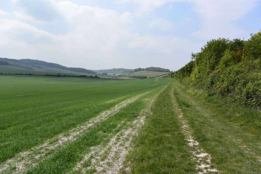
I find the most tempting location in this area to be Lowbury Hill. Asser records that the Vikings held the higher position, and if you go up Lowbury Hill you will see that it is a site you would want to use. There is good visibility in all directions and it is close to the Ridgeway. One can envisage the Vikings being on this hill and the Saxons coming west along the Ridgeway, having perhaps forded the Thames at Moulsford, and encountering the Vikings who were at the top of the hill. A line drawn between Cholsey and Cuckhamsley Knob lies just north of here (and also Kingstanding Hill), so it seems to be in the general area of Ashdown. There are footpaths and bridleways that cross the downs, the main one of course being the Ridgeway, which will take you close to the hill.
There are two other locations in this area that have been put forward, and both seem plausible. One is Kingstanding Hill. On the Ordnance Survey map you will see a track heading south west near the hill that eventually becomes called The Fair Mile. It was possible to park at the litter-strewn beginning of this track. Views from the track as it ascends are limited by hedgerows, but there are one or two good views north and south.
On Kingstanding Hill, a candidate for the site of the Battle of Ashdown, looking north over Starveall Farm and Moulsford Bottom, across to Moulsford Downs.
The other location is Moulsford Bottom. I found the best way of viewing this to be by following the footpath that runs from near Moulsford Pavilion.
On a footpath heading west from Moulsford, Oxfordshire. Moulsford Bottom is on the left and Kingstanding Hill is ahead.
While at Moulsford you may wish to appreciate a particularly lovely stretch of the nearby Thames Path. This is the section south of Moulsford, accessed by going down Ferry Lane. I sat down there on a warm late spring afternoon and watched three hobbys feeding over the water whilst red kites were circling overhead. A lovely spot.
Wherever the battle took place, it is important to remember that the Anglo-Saxon Chronicle indicates that it was almost two simultaneous battles at the same location, because the Vikings had split into two forces. King Æthelred took on the forces of the Viking kings and Alfred took on the forces of the Viking earls.
The beautiful Lardons Chase. Great views to be had across the Thames Valley, Streatley and Goring.
It is interesting to note that an Æscesdun is also mentioned in the Anglo-Saxon Chronicles at 661, although we are not provided with a location.
There is much more about the travels of King Alfred in my book, including maps and references. Click or tap the image below to learn more about the book.
This post is adapted from my book, King Alfred: A Man on the Move, available from Amazon. It would be great if you could support this project by purchasing a copy.
Reading has changed enormously over the centuries, and some of you will be surprised to learn that an important battle was fought here, right in what is now the centre.
The Vikings set up a base at Reading in 870. A local ealdorman named Æthelwulf (not to be confused with Alfred’s father, who had the same name, but who was dead by now) engaged a contingent of these Vikings at a place called Englefield, of which more in another post. Suffice to say that Æthelwulf won! However, this had not eradicated the root problem, which was the Viking camp at Reading. Troops led by King Æthelred and Alfred, his younger brother and future king, therefore turned up at Reading in 871. However, the Vikings won. King Alfred, although truly great, did not win everything.
This leaves us with a couple of things to puzzle over. Because Asser (King Alfred’s “biographer”) states that the Wessex troops went to the gate of the Viking fortress, finding the location of this would not only specify the location of the fortress, but also perhaps the location of the battle, which must have then been nearby.
It is important to appreciate that part of Reading lies on a peninsula between the River Thames and the River Kennet. Asser is helpful again in that he tells us that the Vikings were between the Thames and the Kennet, and that they built a rampart between the rivers to the south of the royal estate that was there. Wait a minute. That’s three things now: A Viking camp, a battle site and now a royal estate as well!
Reading, Berkshire. Standing right at the confluence of the Thames and the River Kennet (looking west up the Thames)Reading, Berkshire. The end of the peninsula straight ahead. The Thames on the right, and the River Kennet coming off on the left.
We know that there used to be a ditch running across part of the peninsula, called the Plummery Ditch. This could be a red herring, or it could have been a ditch associated with ramparts that are now lost. There is no ditch to see now as it has been lost to development. Looking at old maps it seems that it ran north from the Kennet approximately where Oscar Wilde Road is, and then headed west to the south side of the railway line beneath what is now a retail park.
Reading, Berkshire. A retail park, beneath which may be the Plummery Ditch
I believe that the royal estate and the Viking camp were at the same location. Effectively, the Vikings took over the royal estate. This may even have been what had attracted the Vikings in the first place. Asser also clearly states that it was on the south bank of the Thames. My opinion is therefore that the Viking camp (and the royal estate) was north of the current railway line at King’s meadow or perhaps even beneath the Tesco supermarket development.
The Forbury Gardens in the centre of Reading, Berkshire, allowed me to take a welcome break from my explorations
I think that the battle would have taken place to the west of the Viking camp, because the Vikings would have been holding and controlling the peninsula to the west towards the confluence between the Thames and the Kennet.
I considered a location called Katesgrove for the Viking camp , but rejected this because it did not seem to be sufficiently between the two rivers.
It seems that the Viking camp at Reading persisted some time after the battle at Reading. It seems probable that Reading was the base when the later battles at Ashdown and Basing took place (both still in 871). The Anglo-Saxon Chronicle tells us that the Vikings eventually left Reading after Wessex made peace with them (which usually seemed to mean paying them off) some time after the Battle of Wilton. Alfred had become king by the time of the battle of Wilton, so the peace, whatever this constituted, was made under his rule. At least he put a stop to the carnage…for a while.
The best way of exploring all this is on foot. You can walk around the peninsula to the confluence of the two rivers and head back along the river that you did not approach by! Look out for deer and the odd egyptian goose. I think you’ll have fun wandering around thinking about where the Vikings were and where the battle was. You’ll certainly see Reading in an entirely different light.
Note: there is a Battle Place and a Battle Hospital building (there was a Battle Farm here before all this). However, this location does not fit with the 871 battle and may be named after the engagement that took place in 1688.
There is much more about the travels of King Alfred in my book, including maps and references. To learn more about the book, tap or click on the image below.