What about King Alfred burning Cakes?

Although I could find no evidence for King Alfred burning cakes it seems appropriate for me to say a few more words about this famous and persistent legend. This post is adapted from, and provides additional material for, my book, King Alfred: A Man on the Move.

The earliest source

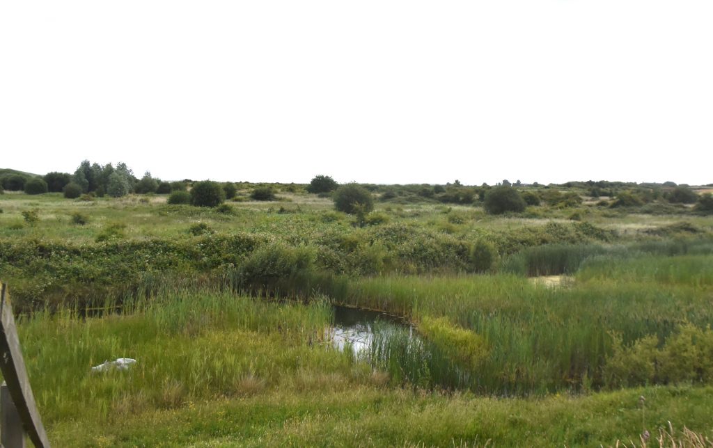
When talking to people it is often the first thing that comes up. It first appears in the anonymous Vita S Neoti (Life of St Neot), which seems to have been put together in the late tenth century, where it states that the burning of the cakes took place at Athelney (King Alfred’s refuge in the Somerset Levels prior to his successful reconquest of his kingdom that took place after his victory over the Vikings at the Battle of Ethandun in 878).

Athelney, Somerset
Athelney, Somerset, where King Alfred is said to have burnt the cakes

The tale’s journey

The story of King Alfred burning cakes found its way from the Vita S Neoti  into a twelfth century compilation of documents that became known as the Annals of St Neots. Then in the sixteenth century it got lifted from the Annals of St Neots and inserted by the theologian Matthew Parker into his copy of Asser’s Life of King Alfred.  Because the writings of Asser have been viewed as a serious historical source, this must have given the story a real boost and is probably why it is so famous today. We cannot ultimately prove that it was inserted by Matthew Parker (as opposed to somebody before him doing it) because the Life of King Alfred that he would have been working from was destroyed in a fire in 1731 and there are no known surviving ancient copies. The result, nonetheless, was that for a significant period of time the story of the cakes was treated as an integral part of the writings of Asser, when this in fact was not the case.

The tale

In brief, the earliest version of the story tells us that Alfred turned up on his own at a pig farmer’s (subulcus, swineherd, was changed in the Annals to uaccarius, cowherd, for reasons unknown) cottage on Athelney where he was taken in and stayed for some days whilst he awaited God’s mercy, and keeping in mind the patience that had been demonstrated by the biblical Job. One day, while the pig-farmer was taking his pigs to a field, the farmer’s wife started baking loaves of bread (not cakes), but then became occupied with other domestic duties. The loaves started to burn and the wife pointed out to Alfred that although he was quite happy to eat them, he hadn’t been so keen to turn them over when he could see that they were burning. It appears that Alfred was shaken but not stirred, and he proceeded to then turn the loaves over.

The tale about King Alfred burning cakes was recast many times subsequently and I suspect a whole book could be written tracing these variations.

There is a legend that the story of Alfred burning of the cakes took place in a field south of the rectory at Brixton Deverill in Wiltshire. However, the Vita S Neoti clearly indicates that this supposed baking mishap took place at Athelney.

Finally, it is interesting to note that this is not the only incident of burning bread in the legends. In the Viking Saga of Ragnar Lothbrok (Ragnars Saga Loðbrókar) Ragnar’s men are distracted in the farmhouse of a poor couple by the beauty of Ragnar’s second future wife (Kráka/Aslaug) and they burn the bread they were baking there. This was written in the 13th century and may be a coincidence.

A delightful tale is told in “We Wander in the West” by SPB Mais (1950). The author writes that when he was at Athelney a small boy offered to show him where the cakes had been burnt. He was taken to the farm buildings and a corner of the scullery was pointed out as the exact place. However, the boy’s mother intervened, saying that since such a long time had passed it might have been somewhere else in the house!

Tap or click the image below to learn more about my book.

Saxon Kent and King Alfred: Part 2

This post is adapted from my book, King Alfred: A Man on the Move, available from Amazon. It would be great if you could support this project by purchasing a copy.

In 892 a Viking force of 250 ships sailed from Boulogne to the south coast of Kent and in the same year another Viking force of 80 ships came to the north coast of Kent at a place called Middletune. The Anglo-Saxon Chronicles tell us that Alfred camped with his army between the two Viking armies. In trying to locate Alfred we therefore must try to find the locations that he set up camp between. It seems that the Viking camp in north Kent must have been in the general area of Milton Regis and Sittingbourne, but I could not resist trying to pin it down more specifically.

It is also possible that Alfred himself may have been at this site. The leader of the Vikings that landed on the north coast of Kent was called Hæsten and Alfred must have had some sort of contact with him as it emerges in the Anglo-Saxon Chronicles that a son of Hæsten had become a godson (as had Guthrum in 878) of Alfred. Clearly the history is incomplete, but it is possible that negotiations took place between Alfred and Hæsten at his site at Milton, or at Alfred’s site (another unknown location examined in a future post), or perhaps somewhere else.

Middletune is thought to be Milton Regis, which lies to the north of Sittingbourne, and is now part of that town. Milton was apparently a significant Saxon site. It is said that Queen Seaxburgh of Kent became a nun at the abbey she founded at MIlton, becoming St Seaxburgh, and that her son became king there in 680.

Castle Rough

The earliest reference that I found for this being the site for the Vikings that came to north Kent is in Edward Hasted’s 1797 writings on the history of Kent.  The location is just east of Kelmsley, to the west of Milton creek, and close to the evocatively named Saxon Shore Way. It has been suggested that Castle Rough would have been a man-made island. Evidence from limited examination by Sittingbourne and Swale Archaeological Research Group indicated that the lowest parts of the mound contained 13th-14th century pottery, and therefore must have been built after the time of King Alfred. Although this does not rule out this site, because a more extensive examination may have produced more evidence, it does cast doubt upon this being the site of the Viking camp. The location is also moated, which may indicate a date later than the time of King Alfred. Oliver Rackham found that to his knowledge there were no mentions of moats in Anglo-Saxon charters, in place names, or in Domesday. It is therefore possible that moats were a later development. Oliver Rackham also suggested that moats may have become status symbols, which may have been the case here as a moat of this relatively small size would have been largely ineffective against a determined army. It seems that Castle Rough may have been a medieval moated manor, although we cannot rule out that it was something else previously. It was not easy to observe Castle Rough. I pulled over near a gate when driving north along Swale Way, just after crossing over Milton Creek and the Sittingbourne and Kemsley Light Railway. I crossed the road on foot and from this elevated position I fancied that I could pick out Castle Rough. However, I needed my Ordnance Survey map to guide my eye to the approximate location. Update: I have had access to an 1801 Ordnance Survey drawing that shows the feature as distinctly squared as though it was present at that time. There is no indication on this map that it is ancient.

Looking across from the road to the site of Castle Rough, Milton Regis, near Sittingbourne in north Kent, where the Vikings may have set up a camp in 892.

I came across a rumour that the camp was under a canteen at the Kemsley paper mill (close to Castle Rough), but I have been unable to find anything to support this.

The former Kemsley paper mill, near Milton Regis, Sittingbourne, north Kent. On the site of the Viking camp?

Bayford Castle and Bayford Court

The former location of a place called Bayford Castle, on the other side of Milton Creek to Castle Rough,  may have been the site of the Viking fortification. However, Hasted, in his 1797 writings on the history of Kent  tells us that it was Alfred who built some fortifications against the Vikings on the other side of Milton Creek from Castle Rough at “Baford-castle.” It should be noted that Hasted appears to be an early originator (if not the originator) of the legend that Castle Rough had been the Viking fortification.

The location of Bayford Castle appears on older Ordnance Survey maps with an indication that it was erected in 893. By the time of the 1960 map references to the location had disappeared. There is nothing for the casual visitor to see there now as the location appears to be approximately where there are now industrial units to the east of a karting track. Although evidence is lacking in terms of it being either a Viking or Saxon site, it is at least in a suitable location being near to  Milton Creek.

To confuse matters, maps dating to 1590 show that the location of Bayford Castle used to be called Castle Ruffe. I haven’t seen anything to explain why the name of Castle Ruffe disappears from the east side of Milton Creek and then a Castle-ruff (later becoming “Castle Rough”)  appears on the other side of the Milton Creek in the 1797 writings of Edward Hasted.

There has been confusion with Bayford Court, which is south of where Bayford Castle appears to have been. This site is located near the centre of Sittingbourne in an industrial area north of Eurolink Way just off Crown Quay Lane. The remains of the Bayford Court moat  are marked on the Ordnance Survey map and it was possible to pull over and have a look.  However, as described under Castle Rough, moats may have been a later development, and nor is the moat here sufficiently wide to stop a determined army. I therefore feel that although Bayford Court may be an interesting old location, the evidence does not stack up sufficiently for it to be seriously considered as a site for the Viking fortification.

The moat at Bayford Court, Sittingbourne, north Kent.

The moat at Bayford Court, Sittingbourne, north Kent.

It seems that although we know that the Viking fortification was at Milton , we cannot locate it precisely. It could, of course, have been located somewhere other than the three locations described above.

There is much more about the travels of King Alfred in my book, including maps and references. Tap or click the image below to learn more about the book. 

Swinbeorg. Is it or isn’t it?

This post is adapted from my book, King Alfred: A Man on the Move, available from Amazon.

Swinbeorg is an unidentified location that is mentioned in Alfred’s will where he describes an assembly having taken place at which inheritance matters were discussed.  Although this might seem quite mundane there are limited places where we might be able to pin the location of Alfred down quite precisely. If we could find this location it would in fact therefore be quite exciting! The context of the entry in his will indicates that this meeting would have taken place when King Alfred’s brother Æthelred was still alive but after the Viking emergency commenced (i.e. between 870 and the summer of 871). It has been speculated that this would have been at the presumed Anglo-Saxon meeting place called Swanborough Tump near Manningford Abbots in the former Swanborough Hundred in Wiltshire.

The monument in the countryside near Pewsey, Wiltshire, commemorating the meeting between King Alfred the Great (not yet king) and his brother at Swanborough Tump (Swinbeorg)

Although this seems tempting, the vowel change is problematic as even in 987 the place-name began with “Swan” and not “Swin.” However, I am not aware of any other proposed location so it seems that this site could indeed be Swinbeorg. A plaque at the location indeed decares this to be the case! It is worth noting, though, that there was a Suaneberge Hundred in Sussex, and this location cannot be ruled out. 

The site is easy to visit, being at the roadside on a quiet Wiltshire country lane. It is west of Pewsey and is marked on Ordnance Survey maps.

Detail from the monument near Pewsey, Wiltshire, commemorating the meeting between King Alfred the Great (not yet king) and his brother at Swanborough Tump (Swinbeorg)

There is much more about the travels of King Alfred in my book, including maps and references. Tap or click the image below to learn more about the book.

Saxon Kent and King Alfred. Part 1: Maidstone

This post is adapted from my book, King Alfred: A Man on the Move, available from Amazon.

The River Medway at Maidstone, Kent. Looking south from Maidstone Bridge, with the Archbishop's Palace and All Saints' Church in the distance to the left
The River Medway at Maidstone, Kent. Looking south from Maidstone Bridge, with the Archbishop’s Palace and All Saints’ Church in the distance to the left

In 892  a Viking force of 250 ships sailed from Boulogne to the south coast of Kent and in the same year another Viking force of 80 ships came to the north coast of Kent.

The Anglo-Saxon Chronicle tells us that the Vikings were at Milton (Milton Regis) to the north and at Appledore to the south, and that Alfred camped with his army between the two raiding armies. Anyone who travels around Kent will soon appreciate the difficulty of simultaneously monitoring these two areas from a single location, because they are quite far apart, so he must have had additional outposts, and perhaps this is what some of the alternative locations (later posts will address these) put forward as Alfred’s base actually were. Indeed, this would fit with the Anglo-Saxon Chronicle telling us that burga (fortresses) were being held.

Milton has now become part of Sittingbourne and was accessible from the Swale via the Milton Creek. Appledore is a lovely village that would have been accessible to the Vikings by following the route of the River Limen (now the Rother) as it would have existed at that time.

Although other possibilities exist, Maidstone has been put forward as a serious contender for the location of Alfred’s base during this Kent emergency.

A crossing of the Medway at Maidstone was developed in saxon times  and it has been proposed that the town may have been part of a saxon royal estate with significant ecclesiastical connections.

Maidstone is on the Medway, but it is also  at the crossing of a Roman route from Rochester to Hastings (Margary 13) with a possibly ancient track from Ashford to London, now represented by the A20 either side of Maidstone. It has been suggested that in Saxon times Maidstone grew up around this crossing.

Identifying this crossing may help us establish an approximate location of Alfred’s position, if he was based at Maidstone. It  appears to be where Week Street, King Street, Gabriel’s Hill and High Street meet. When I visited this location, it was clear that it was near the top of a hill. Such sites are generally strategic.

Looking west down the High Street from the probable site of the origin of Maidstone (at the ancient crossing) in Kent

As above, but now looking east towards King Street in Maidstone, Kent.

However, King Alfred lived in the later Saxon period, and by then Maidstone may have developed beyond the vicinity of the junction described above, making it more difficult to define precisely where Alfred might have been.

The location of the former church of St Mary the Virgin may be an important clue . By the 11th century this church was a minster with 17 dependent churches. Some sort of settlement around this site in Alfred’s time would appear to be likely as it would have taken time for a church to build up this level of significance. This church, which was by the Medway, no longer exists, but it is suggested  that the site is at the approximate location of, or even beneath, All Saints’ Church, which replaced it in the 1390s.

All Saints' church, Maidstone, Medway, Kent
All Saints’ church, Maidstone, Medway, Kent

The oldest parts of the nearby Archbishop’s Palace date to the 14th century, but the location was likely to have been the site of a manor that we know existed because in 1086 it was being held by the Archbishop of Canterbury. It is therefore possible that there had been a manor here at the time of King Alfred.

The Archbishop's Palace, Maidstone, Medway, Kent
The Archbishop’s Palace, Maidstone, Medway, Kent

On visiting this area my attention was drawn to an information board  that referred to a track  called Knightrider Street going down to the Medway where it could once be forded. I feel that the possibility of being able to easily cross the Medway at this point adds weight to this part of Maidstone, potentially the manor referred to above, being the location for King Alfred’s camp.

Looking down Knightrider Street to the location where there used to be a ford across the River Medway in Maidstone, Kent

I found myself being impressed by the collection of historic buildings, including All Saint’s Church and the Archbishop’s Palace, and it was pleasant to partake in a small circular riverside walk in this area, made possible by the Millenium and Maidstone Bridges. It is worth noting that the latter was designed by Joseph Bazalgette, of Thames Embankment and London sewers fame.

Maidstone is also close to what appears to have been the original Pilgrim’s Way, which was on the route of an ancient trackway. In addition, Maidstone may have offereda direct route to the vicinity of both Milton Regis.  In the other direction, there may have been access to the area around Appledore via a route about which we now have no knowledge.

However, Maidstone is much closer to Milton than it is to Appledore, and it is quite a way off a line running between these two places. We therefore possibly run into trouble with the Anglo-Saxon Chronicle having told us that Alfred set up camp between the two raiding armies.

Overall, I feel that Maidstone must have been involved. It seems to have been an important site and it was not far from a Viking base at Milton Regis.

There is much more about the travels of King Alfred in my book, including maps and references. Tap or click the image below to learn more about the book. 

History of Rochester: King Alfred and the Vikings

Rochester, Kent. Plaque showing where the East Gate in the Roman walls once was.

This post on the history of Rochester is adapted from my book, King Alfred: A Man on the Move, available from Amazon. It would be great if you could support this project by purchasing a copy.

Rochester is a lovely and historic city, worth visiting in its own right. However, this city was clearly a  target for the Vikings. Rochester had already been sacked by the Vikings in 842, before Alfred was born. However, it was attacked by the Vikings again in 884, but this time King Alfred saw them off.

You may wish to open a map application to help you get the most out of the below. Otherwise just relax and read on.

Where was the Viking camp at Rochester?

The records indicate that on arrival in 884 the Vikings built a fortress around themselves, and we know that this must have been outside of Rochester’s walls because it is recorded in the Anglo-Saxon Chronicles that the inhabitants defended the settlement. Asser tells us that the Viking fortification was at the entrance to the town but, unfortunately for modern-day investigators, there were four entrances, and so the precise location of the Viking fortification has remained unknown. King Alfred later arrived with his forces in 885, and locating the site of the Viking fortification could shed light on where and how Alfred might have engaged with the Vikings and saw that they left. Fortunately, the outline of Rochester’s Roman walls is known. It has been suggested that there would be no Saxon-built stone walls, so the configuration of the walls in 885 should have remained perhaps unchanged since Roman times.

Rochester Bridge. River Medway, Kent.
Rochester Bridge over the River Medway (looking north), Kent.

At which gate was the Viking camp?

There had been four gates in the Roman walls. A northern “Bridge Gate” that opened on to the position of the Roman bridge across the River Medway. A north gate, which is more east than north, an east gate that is more south than east, and a south gate that is more west than south. The confusion is explained when one realises that the name seems to indicate the direction in which one could travel  after passing through a particular gate, rather than the orientation of the gate itself.

The East Gate

There is evidence that the East Gate was about where the City Wall Wine Bar on High Street is located. On visiting I noticed that the outline of the gate was helpfully marked out with bricks in the pavement and the road, with a metal plaque in the pavement confirming the location.

East Gate. Roman walls. Rochester, Kent.
The outline on the ground of the East Gate in the walls of Rochester, Kent. Easily missed. Had there been a Viking fortification just past the lamp post?

The North Gate

The North Gate appears to be preserved in the current road name of Northgate. It has been suggested that this gate might have just lead to marshy ground. However, there has also been speculation that it may have led to a harbour. Evidence suggests that the Noth Gate would have been approximately where today Northgate meets Corporation Street, being approximately equidistant from Watling Street (which ran along a line close to that of the current High Street) on one side as the cathedral is on the other. This location seems to be consistent with an existing piece of wall that one can see at the back of The Common car park, accessible via Gas House Road and then Acorn Wharf Road. However, the line of bricks in the road at Northgate, outside the Corn Exchange, suggests that at least some person may have thought that the gate may have been not quite as far down Northgate as the junction with Corporation Street. However, I could find no plaque to explain the reason for the bricks embedded into the road at this point.

Rochester, Kent. North Gate. Roman Walls. Alternative location.
Rochester, Kent. A line in the road called Northgate which seems to be there to indicate the line of the wall, but might it (and the North Gate) have been a little bit further down somewhere near the junction with Corporation Street towards the right on the photo?

The Bridge/West Gate

The Romans built a bridge at Rochester and a bridge is recorded as present in 960, so a bridge may well have been maintained in the intervening period, including at the time of the Viking attack in 885. This bridge across the Medway is thought to have remained in approximately the same location as today. The location of the gate by the bridge (which I have seen referred to as both Bridge Gate and West Gate) has not been proved although it must have existed in order to allow access to and from the bridge. The gate would most likely have been more or less in line with the bridge. However, the modern bridge is much wider than it has been in the past. Fortunately, the entrance to the old bridge is marked by  black lions, which perhaps allows us to speculate that the Bridge Gate would have been at the point where a line drawn from the bridge would have met the town wall.

Rochester, Kent. Bridge Gate. West Gate. Probable location.
Rochester, Kent. The north end of High Street, looking north towards the bridge over the River Medway. If it still existed today, the Bridge Gate would surely be in this picture.

The South Gate

It is thought that the South Gate would have been just before where Boley Hill meets St Margaret’s Street, and there is a helpful plaque on a wall that identifies the location. One can wonder whether, if the Viking fortification had been outside this gate, the location would have been where Boley Hill House and Lodge now stand, near the junction of Boley Hill with St Margaret’s Avenue.

Plaque. South Gate. Roman walls. Rochester, Kent.
The plaque on the wall where the South Gate in the Roman walls of Rochester, Kent, is thought to have been.
South Gate. Roman walls. Rochester, Kent.
The site of the South Gate in the Roman walls of Rochester, Kent (plaque on the wall to the right). Looking to the east along Boley Hill

I did not find it possible to exclude any of the entrances as a possible site for the Viking fortification, although I favour the Bridge Gate because the Vikings had a tendency to use waterways and, by blocking the Bridge Gate, they could fend off any support for Alfred from that direction. I was also told by a helpful volunteer at the cathedral that the Bridge Gate currently appears to be the narrow favourite! It seems unlikely that an attacking force would cross the bridge, because such structures restrict the flow of men, making them more vulnerable. If there really had been docks beyond the North Gate it is possible that they could have disembarked there. Alternatively, the Vikings could have disembarked at Chatham and then came up Watling Street to the East Gate of Rochester.

This should provide plenty to think about regarding this important period in the history of Rochester. When you get a chance, pay Rochester a visit, have a look for the sites of the gates of the Roman walls, and see what you think! Rochester Cathedral and Rochester Castle are well worth a visit. You can also see the outline of the Saxon church outlined in the ground partly inside and partly outside of the cathedral.

Rochester Cathedral, Kent
Rochester Cathedral, Kent, from Winkles’ Cathedrals, 1836.
Rochester Cathedral, Kent. The Crypt. From Winkles’ Cathedrals, 1836

There is much more about the travels of King Alfred in my book, including maps and references. Tap or click the image below to learn more about the book. 

About the Book

July 2019 update: the book, King Alfred: A Man on the Move, is now published and available from Amazon.

It all started one spring day in Winchester. I tagged along with my partner who had to go there to work for a day. I was at a loose end and had been to Winchester many times. I had seen the cathedral, the round table and so on. So, what should I do? I remembered reading that there had been an abbey at Hyde, just north of the centre, and that it was connected with King Alfred. So I worked out where it was and paid a visit to the location. In contrast to the cathedral, and the city centre generally, there was nobody else there but me. Yet this was  the site where perhaps the greatest king in the history of England had been buried. Surely this could not be correct. Where was everybody? A few weeks later I visited Athelney, the site where Alfred hid out before striking out to defeat the Vikings. There was nobody there either. Then I went to the little church at Aller, where the path of English history was sealed when Alfred baptised the Viking leader Guthrum, leading to a period of peace. You’ve got it – Nobody there either. The strong interest in history that I had always had became re-awakened as I found the experience of finding these places deeply involving and I felt that just being in these locations gave me a direct engagement with 9th century history. I am certain that people are interested in the Anglo-Saxons, and King Alfred in particular; everybody I speak to is genuinely interested.

It seemed to me that the problem was partly down to information on relevant sites not being readily available. Additionally, accurate locations for some historical events have not been established (e.g. the Battle of Ashdown) so it is easy to sink in a sea of alternative ideas or theories. A further problem that I came across was what today we might call mis-information (or even fake news?) Perhaps often well-intentioned, but over the past few centuries it appears that many places have wanted a slice of King Alfred, even if it means being over-optimistic with regard to the evidence.

I have tried to cut through all of this to produce something that facilitates better engagement with arguably our most important king by visiting locations that are associated with him. Where the location cannot be established, I put forward alternatives and invite the reader to engage in balancing the evidence.

So, join me on a romp from Wantage, Reading, Basing, London, the Somerset Levels and the Berkshire Downs, Kent, Wiltshire, Dorset, Exeter and other places besides. I truly hope that you benefit a connection and engagement with perhaps our greatest King, just like I have.

To view the book on Amazon, click or tap the image below.