This matter turned out to be more complicated than I had anticipated. It will therefore be broken down into a few posts. This one is more-or-less introductory, to be followed by posts on Hertford and Ware.
The Anglo-Saxon Chronicles tell us that in 895 some Vikings left Mersea Island in Essex and built a fortress by the River Lea at a point about 20 miles north of London. They were then attacked by garrisons loyal to Alfred, which were in turn beaten back by the Vikings, with some loss of life. We are then told that later that year, at harvest-time, King Alfred himself arrived and camped in the vicinity of the Viking fortification in order to prevent the Vikings from stopping the locals from reaping their corn. The Anglo-Saxon Chronicles also tell us that after this, but still in the same year, Alfred rode up the River Lea to see where the river could be obstructed in order to block the Viking ships in. The Anglo-Saxon Chronicles record that the river was indeed obstructed and that Alfred started to build a fortification on either side of the river. The Vikings abandoned their ships because they realised that they were being trapped, and fled overland all the way to Bridgnorth (or possibly nearby Quatford) on the River Severn in what is now Shropshire. We do not know whether the ships were being physically hemmed in or whether they were being immobilised because of some sort of drainage of the river.
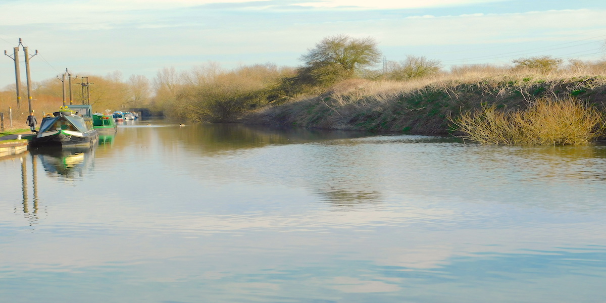
The author walking a stretch of the original River Lea, just north of Waltham Abbey (although I think it must have been wider)
It is worth noting that the Annals of St Bertin inform us that in 862 Charles the Bald, King of West Francia, had hemmed the Vikings in on the River Marne by re-building a destroyed bridge and placing troops on both banks. Trapping the Vikings upstream was a tactic that had been used before.
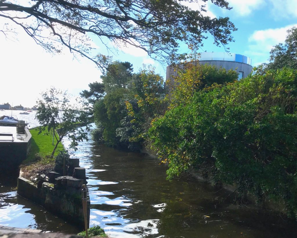
The River Lee Navigation (the river is variably called “River Lea” or “River Lee”, whereas the man-made navigation is always called “Lee”), which runs the whole stretch of our area of interest from Hertford, in Hertfordshire, to London, was cut in 1770. However, before 1770 there were at least four streams, and there may have been as many as seven, so it seems difficult to establish with certainty the course of the River Lea in Alfred’s time. Back then, if the total volume of water was anything like it is today, feeding through different streams and large lakes, the river must have been much wider than the remnants of what today are said to be original course of the Lea.
The Lakes near Fishers Green, north of Waltham Abbey
So, we have four things that it would be nice to locate. The Viking fortification, Alfred’s camp, the point where the river had been obstructed, and Alfred’s pair of incomplete fortifications on the River Lea. Because we cannot be certain about the distance represented by a mile (with Saxon, Roman and modern miles being slightly different) , or how accurate measurement was at the time, I feel that it would be sensible to consider the distance for the Viking fortress of twenty miles north of London as approximate. Twenty miles takes us to somewhere just south of Hertford, and perhaps the stretch of the river near Hoddesdon and Broxbourne. Only slightly upstream on the River Lea are the towns of Hertford and Ware, and I think these deserve serious consideration because they are approximately twenty miles from London. I shall look at these places more closely in later posts.
King Alfred was buried at Winchester, in Hampshire, but the location of his remains are unknown. His remains were moved at least twice and the different religious buildings built at different times can cause confusion in trying to work out where these remains went. I refer you to my first post on Winchester for the first two locations of Alfred’s remains, the Old Minster and the New Minster.
In 1109 Henry I ordered that the New Minster be moved to land that he had provided at Hyde, which was then just outside Winchester. It is possible that the New Minster had suffered from a fire prior to 1109, which might have made the move opportune, or perhaps Henry I did not want the Saxon New Minster cramping the style of the gleaming Norman Winchester Cathedral. The re-located New Minster would then become known as Hyde Abbey. In my opinion, the location of this abbey must be one of the most important of the lesser-known sites in British history, and it deserves to be much more famous.
The three stone slabs at Hyde Abbey Gardens, Winchester,marking the location near the high altar where King Alfred, King Edward the Elder (his son) and Ealhswith (his wife) would have been once buried. Their (or some of) their remains may still be present in the vicinity.
Documents indicate that Alfred was transferred to Hyde Abbey in 1110 and that he was interred in front of the altar. Today, Hyde is just north of the city centre and can be easily visited by walking north up Hyde Street, and then turning right into King Alfred Place. This leads to the location of the altar of Hyde Abbey where three stone slabs show where Alfred, his wife and his son were once buried.
Hyde Abbey fifteenth century gateway, Winchester. A reminder of what once stood elsewhere in this part of Winchester.
Hyde Abbey was destroyed in 1539 in Henry VIII’s dissolution of the monasteries. Furthermore, the Annals of Winchester tell us that Hyde Abbey was burnt in 1141, which fits with another record that tells us that the abbey laid “in ruins” after having been set alight in a battle between King Stephen and Matilda in 1141. It seems possible to me that Alfred’s and other important remains could have been relocated in 1141, or prior to the 1539 dissolution. However, the discovery of part of a pelvis (see below) shows that bones from the Anglo-Saxon period remained.
There is a detailed story (for those interested, this is in my book) about how eventually some bones, thought to include those of King Alfred, ended up being interred in the grounds of St Bartholomew’s church, which is located within the footprint of the precinct of Hyde Abbey. However, when these bones were radio-carbon dated, they were found to be more recent than the Anglo-Saxon period. This was the subject of a TV documentary, which you may have seen. To cut a long story short a prison was built on the site in the 1780s and about a decade or so later a Henry Howard made enquiries and was informed by Page (the overseer of the prison construction) about what was found, from which Mellor made a “rough drawing”. The following quote from Howard’s text, which appeared in Archaeologia in 1800, along with his sketch, is most interesting:
“About a [on Howard’s drawing] was also found a stone coffin cased with lead both within and without, and containing some bones and remains of garments. The lead in its decayed state sold for two guineas; the bones were thrown about, and the stone coffin broken into pieces. There were two other coffins, and no more, found in this part, which were also for the sake of the garden, in which they lay, broken and buried as low as the spring.”
I apologise for not putting up an image of his sketch because of copyright etc.
Point a on his drawing seems a plausible location for near the high altar. However, he goes on to say that many more stone coffins were found both to the east (outside the east wall) and the west of this location (in the nave). Clearly, in a situation where bones had been “thrown about”, bones near the altar may not have started off there. The point about the well was taken up by a Mellor who indeed found bones there and sold them to the vicar of St Bartholomew’s, and it seems that these are the bones that ended up collectively buried to the east of that church.
St Bartholomew’s church, Hyde, Winchester
Nonetheless, testing was carried out on bones from an excavation at the main site of the abbey undertaken in the 1990s, and a sample from an approximately middle-aged (to us!) male pelvis was dated to 895-1017. Although dating to the correct period, because King Alfred died in 899, it is not possible to say whether this pelvis once belonged to him. King Edward the Elder, who died in 924, was also buried at Hyde Abbey and there is evidence that other individuals may have been too: Æthelweard (a son of Alfred), or Ælfweard (son of King Edward the Elder, although he may have been too young to match the profile of the bone), a monk called Grimbald (although he died quite old) and St Judoc (who, however, died in the 7th century). There may, of course, have been other individuals for which we have no record. Because the bones were found in the vicinity of the high altar (even if it was in back-fill from a Victorian dig) it seems to me not impossible that the bone is from King Alfred, King Edward the Elder, or Æthelweard. Slightly worrying, though, is a record from 1798 that tells us that when a prison was built on the site, bones that were found were “thrown about.” This might mean that what is found near the high altar might not have started off there. Furthermore, would the builders then build over these scattered bones or have them removed? The latter seems more likely. We must remember that Richard III was discovered under a car park in Leicester, so we should perhaps always be ready to be surprised. Richard III, however, died almost 600 years more recently than King Alfred, something that I assume made using a live relative for a DNA comparison (as was done with Richard III) more straight forward. There may have also been less change in use of the land over time in the case or Richard III.
It was hoped that DNA from the pelvis fragment could be matched with those of King Alfred’s grand-daughter, Eadgyth, who was buried at Magdeburg, in Germany. However, although it was thought that it would be possible to extract DNA from the pelvis fragment, it seemed that the remains of Eadgyth were too poorly preserved to attempt a match.
This is a special place to visit, and I always make time to come here whenever I am in Winchester. In fact, this location was one of my main inspirations for writing my book. It is a hugely important location in the history of England.
The for refreshment. There is even a King Alfred pub close to Hyde Abbey Gardens. I had a beer and a meal in here and both were very good.
There is a community group called Hyde 900 that has done a lot of work in relation to the former abbey, and they deserve a mention. Their website also has more information.
This blog on King Alfred has become quite large, so I thought I would write a summary to enable those less familiar with him to quickly get an idea about his life. My approach, as in my book, is based around the locations in the UK that can be associated with this great king. There will be many links, and I invite you to explore these. You may wish to bookmark this page as it can also serve as a launchpad to the other pages in this blog, which might otherwise be tedious to find.
Alfred was King of Wessex between 871 and 899. We are told by Asser, a companion and “biographer” of King Alfred, that he was born in Wantage, Oxfordshire. His parents were King Æthelwulf of Wessex, who was initially interred at Steyning, West Sussex, and Osburh. He was born in 849 and died in 899. However, we do not know how or where he died. He was buried at Winchester, firstly at the Old Minster (demolished), then at the New Minster (demolished), then at Hyde Abbey (largely demolished at the Dissolution of the Monasteries under King Henry VIII). The whereabouts of his remains is currently unknown.
King Alfred in the Market Square, Wantage, Oxfordshire.
He was present at several battles/engagements with the Vikings. Those up to, and including, the Battle of Meretun were while his brother Æthelred was king. The locations of the recorded battles/engagements are: Nottingham (868), Reading (871), Ashdown (871), Basing (871), Meretun(871), Wilton (871), Wareham (876), Exeter (876), Ethandun/Edington (878), Rochester (884), Kent (892, where Alfred camped between two Viking armies), the River Lea (895, when he obstructed the river, trapping the Vikings).
Perhaps the most famous part of his life starts when he was hiding out on the Somerset Levels at Athelney after the Vikings had seized Chippenham and large parts (at least) of Wessex in 878. You may read elsewhere that King Alfred fled from Chippenham with his family when the Vikings attacked. However, I could find no evidence that Alfred was there when the Vikings attacked. It was from Athelney that King Alfred started his reconquest of the Wessex that he had lost to the Vikings. It is at Athelney that King Alfred is supposed to have burned the cakes, but there is no evidence that this is anything other than a legend. After preparing for battle, King Alfred left Athelney, went to a place called Egbert’s Stone, where his supporting troops from different counties converged. They then moved on for on final stop at a place calledIglea (Iley), and the following day they marched to the site of the Battle of Ethandun, believed to be at Edington, in Wiltshire (although some favour Bratton Down). It was here that King Alfred gained a crucial victory over the Vikings. After their defeat, the Viking leader, Guthrum, was baptised by King Alfred at Aller, Somerset, and he was then hosted by Alfred at the royal estate at Wedmore, in Somerset. Guthrum’s men eventually settled in East Anglia.
King Alfred in the grounds of Sherborne Abbey, Dorset
King Alfred was clearly highly religious, and had been taken to Rome twice by his father while he was a young child. Asser tells of when, before he got married, he went to visit the resting place of a St Gueriir (at St Neot in Cornwall), and while he was there he asked for his current affliction to be replaced by something less debilitating. He then went on to be married, but he was struck down on his wedding night by the presumed new ailment. Sutton Courtenay, in Oxfordshire, has been put forward as the location of his wedding, but this is not certain. King Alfred was involved in translating (and did some translating himself) of some religious texts.
He founded Shaftesbury Abbey (Dorset) and had his daughter installed there as abbess. He would also have had connections to Sherborne Abbey (Dorset), because two of his elder brothers (and possibly a third) who had also been kings were buried there, and after Alfred’s death, Asser would become a bishop there. Another of his brothers was buried at Wimborne, some time after the Battle of Meretun. Alfred was next in line and it is interesting to speculate whether Alfred therefore became king at Wimborne (Dorset).
King Alfred took control of London in 886, but entrusted the city to Æthelred, who ruled Mercia (at least the western part, as eastern Mercia was soon to be conceded to the Vikings) and who was also his son-in-law as he had married his daughter Æthelflæd. It seems that King Alfred retained the upper hand in both London and western Mercia
King Alfred in a stained glass window in St Andrew’s church, Aller, Somerset
The main sources for investigating King Alfred are the Anglo-Saxon Chronicles and The Life of King Alfred, written by (probably) Asser. We are also very fortunate in having some surviving charters (documents transferring or confirming rights or land etc.). Although the authenticity of many of these have been challenged, we can work out from these that Alfred was at particular places, including Dorchester (Dorset). Please see here for more about sources.
There really is much, much more to write, but hopefully you will follow the links, or for the full picture, my book is available through Amazon and book shops. Click on the image of the cover to find out more.
The Anglo-Saxon Chronicles tell us that one day after Alfred’s troops came together at Egbert’s Stone, they went to a place called Iglea, a place that is referred to in the Latin of Asser (companion and “biographer” of King Alfred) as Æcglea. Unfortunately, we do not know with certainty the location of this place.
Æcglea was Alfred’s final stop before the Battle of Ethandun, which took place in Wiltshire at Edington or, less likely in my opinion, at the location of the Iron Age hillfort called Bratton Camp. In another post I explained that the most probable location for Egbert’s Stone (King Alfred’s previous stop) was the Upper Deverills, and it seems to me that after leaving there he would have had two main routes to get to the battle site. One would be to follow the Ridgeway to skirt around the north-west of Salisbury Plain in order to reach Bratton Down or to continue on to Edington. The other option being to go straight across Salisbury Plain instead of around it. It seems likely that the location of the encampment at Iglea would depend on which route was taken. Alfred had lost Wessex and was operating in enemy territory and it therefore seems likely that he would have gone across Salisbury Plain rather than around it in order to avoid as many significant settlements as possible, and this is what I focus on in this post. In the video below I refer to Edington being close to Sutton Veny. It is indeed not far, but it is on the other side of Salisbury Plain.
Iglea is similar phonetically to “Iley” and there was an ancient meeting place called Iley Oak in what is today known as Southleigh Wood, previously called Sowley Wood, to the south-west of Sutton Veny. The precise location of Iley Oak in this area may have been where five roads and paths used to meet at a point where today the access to a farm comes off the road connecting Longbridge Deverill to Sutton Veny at the southern edge of Southleigh Wood. I find it striking, and perhaps relevant, that there are the remains of a henge very close to this location. The henge is on private land and is not easy to see. Please be careful if you try to view it from the very fast (nearly) adjacent road.
Although they date to the Late Neolithic, it is possible that some henges, or the places at which they were located, might have retained a societal significance beyond that period, perhaps even through Anglo-Saxon times. In the absence of other evidence, I favour the site of this henge as the site of Iglea/Æcglea.
Southleigh Wood provides one more tempting possibility, which is to be found immediately north of the location described above. I refer to Robin Hood’s Bower. I am aware that this has been put forward by others as the site of Iglea/Aecglea but, for me, it does not outweigh the location of the henge. This is a small ancient enclosure that, like the henge referred to above, would have been present long before the time of King Alfred. The outline of the enclosure is clearly discernible and it has been enigmatically planted with many monkey-puzzle trees.
The track running across the centre of Robin Hood’s Bower, near Sutton Veny, Wiltshire
It has also been suggested that Iglea was at nearby Bishopstrow. The argument that Iley Oak was located here seems to be tied up with an idea that Iglea would probably have been an island (with the Ig part of the word Iglea meaning island) in the River Wylye. There is an island in the Wylye as it flows past Bishopstrow at Boreham Mill and the road that leads north out of Bishopstrow goes right across the middle of it (look out for the two bridges). However, it seems that we cannot prove that there was an island there in Alfred’s time (it could be the result of later human alteration to the watercourse). All in all, I did not find the arguments for this location to be strong enough to outweigh those that can be applied to the location near the henge at the south edge of Southleigh Wood. I did, however, find the argument that Ig indicates an island sufficiently plausible to make this my second favourite. Bishopstrow could also be relevant as a place where legend has it that the staff of St Aldhelm had grown into an ash tree. St Aldhelm’s church at Bishopstrow is 14th century, but it could have been built over an earlier Saxon church. It is therefore possible, had he been close by, that the pious Alfred could have prayed here before the final march to the battle at Ethandun.
St Aldhelm’s church, Bishopstrow, Wiltshire
There is another (in my opinion, less likely) candidate for Iglea where an unusual number of paths met to the south of Sutton Veny. This, along with possibilities relating to King Alfred going across Salisbury Plain instead of across it, will have to wait for a later post.
There is much more about the travels of King Alfred in my book, including maps and references. Tap or click the image of the front cover below.
King Alfred defeated the Vikings at the Battle of Ethandun in 878. Alfred then oversaw the Viking leader Guthrum‘s baptism at Aller, on the Somerset Levels, and not far from Athelney, which had been the location of Alfred’s base after the Vikings appear to have taken control of Wessex after their raid on Chippenham in January 878.
We are told by both Asser and the Anglo-Saxon Chronicles that after his baptism Guthrum spent twelve days with Alfred, and at least part of this time was spent at Wedmore, which Asser describes as a villa regia (royal estate). We are told that after this period the Vikings left Chippenham, where they had a base, and went to Cirencester and then re-located again to settle in East Anglia.
Before they left, we are told that they were honoured with a large amount of riches. It is impossible to know by how much, if at all, these were gifts voluntarily provided by Alfred or whether this was some sort of ransom demanded by the Vikings as part of a peace settlement.
A plaque inside St Mary’s church, Wedmore, Somerset Levels recognising Alfred’s making of peace with the Vikings. NB. The year of King Alfred’s death has been revised to 899
It has been suggested that the royal site at Wedmore was north-west of St Mary’s church at or near the location of a manor house and it seems to me that the wall visible from the churchyard could have been the perimeter of the manor’s grounds. It occurred to me that the location could have been elsewhere in or around Wedmore, so I decided to explore further. I had been intrigued by marks in the ground visible in an aerial photograph in a field north of Manor Lane, although I could see nothing relevant when I arrived there at ground level. I also explored the hill to the north-west by taking the footpath heading west off Lascot Hill. I eventually decided that I could not improve on the suggestion that the royal estate was at the location of the former manor house.
St Mary’s church, Wedmore, Somerset Levels
St Mary’s is a delightful place to visit (as is Wedmore itself).
Map of Wedmore, Somerset. Detail from map by Mudge 1817.
It was once thought that the Saxon royal residence was at Mudgley, just a short distance south of Wedmore. However, I could find no evidence that this was the case.
There is much more about the travels of King Alfred in my book, including maps and references. Tap or click the image of the front cover below.
The Anglo-Saxon Chronicles tell us that in 876 King Alfred pursued the land-based Vikings that had fled from Wareham (Dorset) to Exeter. However, their accompanying navy lost 120 ships in bad weather near Swanage (Dorset). Alfred was unable to catch up with the fleeing land-based Vikings before they got to Exeter. On reaching Exeter the Vikings secured themselves in a fortress, but their situation does not appear to have been particularly positive, perhaps because of the large loss of ships, and they settled for peace with Alfred. After over-wintering (permission to do this being presumably part of the peace settlement), the Vikings left Exeter and went to Mercia, and specifically to Gloucester according to a chronicle written by Æthelweard.
I asked myself whether it was possible to work out from the available information where exactly in Exeter the Vikings went. The Anglo-Saxon Chronicles imply that the Vikings occupied a fortress that had already been there, as opposed to building one when they got there, as they would do in Rochester, in Kent, in 884. Exeter’s Rougemont Castle goes back to 1068, so we are looking for something else, but perhaps this would have been on the same site as Rougemont Castle. The case for this is strengthened by the discovery of Anglo-Saxon masonry at Rougemont Castle.
A section of the walls at Exeter where Saxon masonry has been found. This is the path leading up to Athelstan’s Tower in Northernhay Gardens.
We also know that Exeter had (and largely still has, although much repaired) Roman walls with four entrances and it appears that these were repaired and strengthened in Anglo-Saxon times. The Old English of the Chronicles says that the Vikings came into Exeter, which fits with the idea that the Vikings had managed to get into Exeter through one of the four entrances in the walls and then either occupied a fortification within the walls, or used the walls themselves as a fortification. The length of the circuit of the walls was would have stretched the Viking troops, but with only four entrances, it may have been possible for them to secure the site. I feel that it is more likely that the depleted Viking force took over a fortification within the walls rather than the walls themselves, and it seems to me that the site of (or part of the site of) Rougemont Castle would have been the most likely location for this fortification. From Northernhay Gardens elements of Anglo-Saxon construction in the remains of the wall can be seen. It is thought that King Athelstan (King Alfred’s grandson) restored the city walls in around 928. The site of Rougemont Castle is now called Exeter Castle, and is a commercial enterprise.
It is possible that the land-based Viking contingent, with Alfred in pursuit took the Roman road to Bridport via Dorchester and then the Roman road that now approximates to route of the A35 to Honiton, and then finally the Roman road that is more or less on the current route of the A30 to Exeter. Alternatively, they could have branched off this route onto another Roman road near Charmouth in order to reach Exeter via Colyford and Sidford, approximately following the route of the current A3052. It seems likely that these routes would have been in use in Alfred’s time, because much of these routes have persisted from Roman times right through to today. It also seems likely that the best available route would have been taken by both parties as, speed would have been important, and these would probably have been the remaining Roman routes.
A plaque marking the location of the South Gate in the walls of Exeter, Devon
It seems that either route would have brought them to a gate to the south-west of the walled city at a spot that is towards the southern end of South Street of today’s Exeter. There is still some wall there today (and a plaque) to help you find the precise spot. This South Gate must be, therefore, the most likely point of entry for the Vikings, and also for King Alfred in pursuit, in 876. Unfortunately, there is no gate present there now as, after serving as a prison, it was finally demolished in 1819. Nonetheless, it is possible to explore on foot how these routes come together just outside the former location of the South Gate. If you do make it down here, there are other places of interest such as the old Eye Hospital and the Dissenters’ Graveyard.
The South Gate of the walls of Exeter, Devon. The markings in the pavement referred to by the plaque in the previous image.
The former location of the South Gate in the walls of Exeter, Devon. Just follow the line of the wall across the road
Having come through the South Gate, and with Rougemont Castle (as it was later called) at the extreme north end of the walled city, Alfred would have needed to cross the centre of Exeter. Although these events took place prior to Alfred’s post-878 rebuilding programme, it seems likely that there would have been a road leading from the South Gate up to the main city intersection where today South Street, North Street, Fore Street and High Street meet. It seems that High Street would have been present in Alfred’s time, and this leads in the general direction of Rougemont Castle. I therefore suggest that, if the Vikings were at the location of Rougemont, Alfred and his troops would have proceeded up what is now South Street and turned right on to what is now High Street, with the land-based Vikings having taken the same route just a short time before. Any surviving sea-borne Vikings would have made their way up from the harbour, via the West Gate or perhaps via a lost Roman gate in the wall nearer to the port (the Water Gate may have been a later development not present in Alfred’s time). They may have even disembarked at nearby Topsham and then made their way, like the others, to the South Gate.
Exeter, Devon. It is likely that roads crossed here in the time of King Alfred. This is where South Street, North Street, Fore Street and High Street meet. The photo is taken from South Street, looking across to North Street, with High Street to the right and Fore Street to the left.
There is a reference in the Anglo-Saxon Chronicles to King Alfred heading again to Exeter in 893. While on his way to assist his troops that were besieging a Viking contingent near London, he received word that other Viking forces had landed in North Devon and that Exeter, in South Devon, had also been besieged. Alfred and his troops therefore diverted towards Exeter. There are no records of any engagement with the Vikings either at Exeter or in North Devon at this time, although the Anglo-Saxon Chronicles do imply that he got there.
It is worth noting that in 1003 the Vikings stormed (the word used is abrocen) Exeter. It seems that this would have been much worse than anything that happened in King Alfred’s time (see versions E and F of the Anglo-Saxon Chronicles).
Many thanks to BBC Radio Devon and The Voice (Barnstaple) for having me on air to talk about my book and Saxon Exeter at the time of King Alfred.
There is much more about the travels of King Alfred in my book, including maps and references. Tap or click the image of the front cover below.
The Anglo-Saxon Chronicles tell us that in 893 Alfred camped with his army between the two raiding armies and therefore it would have been between Milton Regis on the north coast of Kent and Appledore towards the south coast of Kent. Anyone who travels around Kent will soon appreciate how difficult it would have been to monitor these distant locations from a single site. I therefore feel that any central camp must have had additional outposts in order to monitor what was going on over a wide area. This would fit with the Anglo-Saxon Chronicles telling us that burga (fortresses), noting the plural, were being held by Alfred.
Maidstone, a location that has been put forward, is considered separately in this other post. I now continue with a few others, ending with the locations that I believe to be more plausible.
The village of Bredgar, just south of the M2 motorway has been suggested. The village has a lovely church yard, and is somewhat elevated. However, I could see no special reason to consider that this was Alfred’s main camp, although it could have been one of potentially many outposts. Bredgar lies close to a line drawn between Appledore and Milton, but it is very much closer to the latter, making it an awkward fit with the description of King Alfred being between the two raiding armies.
Church of St John the Baptist, Bredgar, Swale, Kent, with the earliest elements dating to the 12th century.
Stockbury, just a few miles west of Bredgar, has also been put forward, although the earthworks there are thought to be Norman, and therefore more recent than King Alfred’s time. However, it is possible that the Norman construction may have been built over earlier earthworks, and this may be supported by the possibility that part of the name may derive from the Old English burh (stronghold).
St Mary Magdalene Church, Stockbury, Kent and the Norman earthworks (to the right). Photograph taken from the road.
To find these earthworks it is easiest to find the church first, which is located a little way east from the centre of the village, adjacent to Church Farm. Although the rings are on private land they are easily viewed from the road and the church yard. In fact, the outermost visible ring appears to clip the churchyard. Whilst I accept that the location commands views that could have made it a useful outpost, there did not seem to be any particular reason to believe that this would have been Alfred’s camp. Stockbury, like Bredgar, lies close to a line drawn between Appledore and Milton, but it is very much closer to the latter.
There is a feature to the north-east of the village of Newenden that is called Castle Toll, and you can get quite close to it on a public footpath. Whilst Castle Toll is perhaps 13th century, some of the earthworks marked on the Ordnance Survey map to the south are thought to be the remains of an Anglo-Saxon burgh. It has, however, been suggested that this was the site of Eorpeburnan, a previously lost burgh that is listed in the Burghal Hidage, a document compiled in the reign of Alfred’s son, Edward the Elder. Newenden is not at all on a line connecting Milton Regis and Appledore, so, although I believe it may have played a role, it does not fit the description of Alfred’s camp.
The Saxon earthworks near Castle Toll, Newenden, Kent, are difficult to see. They are on private land but if you look south east from the path near Castle Toll (see OS map), you will be looking in the right direction.The 13th Century Castle Toll, near Newenden, Kent
When the Vikings landed on the north and south coasts of Kent, I feel that Alfred must have been concerned that Canterbury may have been a target. When I disregarded previous suggestions (for which there is no real evidence) and considered an approximate line between Appledore and Milton Regis, I found that there were a few places that could have better met the description of being between these locations and which may also have allowed easier access to Canterbury. I considered two locations in particular: The villages of Great Chart and Charing. However, the landscape feature known as the Greensand Ridge may also be relevant.
It is known that in King Alfred’s time there was a settlement at Great Chart under the ownership of the Archbishop of Canterbury. Interestingly, there has been a legend that Great Chart had been burned by the Vikings, and this led to the subsequent development of Ashford.
The wonderful Millennium Sign at Great Chart, near Ashford, Kent
Charing is approximately half way between Milton and Appledore and has an Archbishop’s Palace associated with Canterbury that dates back to the 8th century, making it a significant location in Saxon Kent. One could be misled into thinking that Alfred’s piety may have led him here because of a legend that the block on which John the Baptist had been beheaded had been located at the church. However, the tradition is that this was brought to England by King Richard I, well after the time of King Alfred. Nonetheless, I feel that this location is the strongest contender for the location of Alfred’s camp. It is located on an approximate line between Milton and Appledore, without being too close to either, and is located by the ancient track to Canterbury that later became known as the Pilgrims’ Way.
The 13th century church of St Peter and St Paul at Charing, Kent.
The discovery in 2012 of a large Saxon hall near the location of a former Anglo-Saxon abbey at Lyminge generated much interest (resources here). These may go back to the 6th to 9th centuries. Although Lyminge appears to have been an important Saxon location, it does not seem to meet the geographical requirements of those unnamed places mentioned in the Anglo-Saxon Chronicles.
There is much more about the journeys of King Alfred in todays landscapes and cityscapes in my book, including maps and references. Tap or click the image to learn more about it.
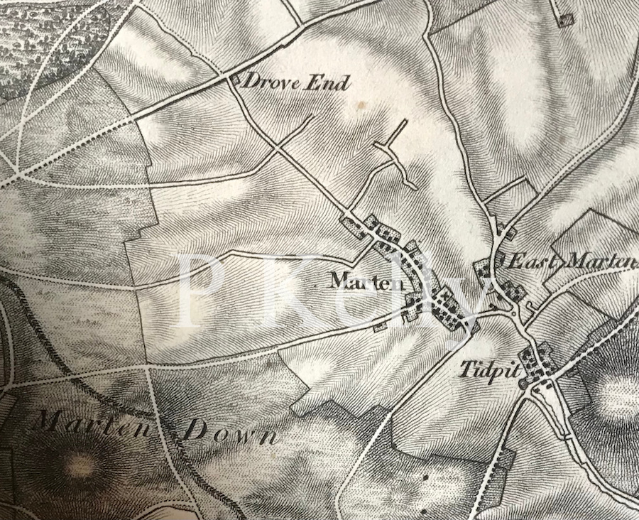
The Battle of Meretun took place two months after the battle at Basing. Alfred and his brother were fighting against the Vikings, but lost, which is what also happened at Basing. There appear to be two main candidates for the location of this battle, one being Martin in Hampshire and the other being Marden in Wiltshire. However, we have very little to go on and other places with similar names are possible. Merdon Castle, in Hampshire, is another possibility, although I have been unable to discover whether this name was acquired after the Norman Conquest. The place that seems to make the most sense to me is Martin in Hampshire, which is a village just south of the A354 main road between Salisbury and Blandford Forum.
King Æthelred (Alfred’s elder brother) died after the Battle of Meretun and he was buried at Wimborne in Dorset. It is therefore possible that he died from wounds sustained in battle but it is also possible that he lived a little longer and died of something else. If he had died of his wounds then it may be relevant to point out that Wimborne is not very far from Martin (about 14 miles). Indeed, the Roman road known as Ackling Dyke runs past Martin on its way to Badbury Rings, which is only four miles from Wimborne.
Bokerley Ditch, Martin Down, Hampshire.
The geographic feature called Martin Down lies a short distance to the west of Martin and there one can explore the famous Bokerley Ditch, which pre-dates the time of Alfred, but perhaps could have been used strategically in battle. Bokerley Ditch also cuts across a Roman road so it could have been used for either side to attack the other coming up that route. To the north this Roman road is still a bridleway and to the south it is now under the A354, so it seems likely that it would have been in use in Anglo-Saxon times. Interestingly, the county boundary between Dorset and Hampshire in this area still follows Bokerley Ditch. One can speculate as to why the Vikings might have been at Martin, and it occurs to me that a contingent from the base at Reading may have been trying to get west, perhaps to Exeter. The Vikings would indeed attack Exeter in 876 and 893, and it therefore seems plausible that they would have liked to have done so in 871.
Map of Marten and Marten Down, Hampshire (later Martin and Martin Down). Detail from map by Mudge 1811
Marden, Wiltshire
It may be impossible to disprove that the battle took place at Marden (Wiltshire) instead, but the place-name of Marden seems to have derived from Mercdene, quite dissimilar to Meretun. A charter issued by King Edmund between 944 and 946 shows Martin in Hampshire being referred to as Mertone, which is not much different from the Meretun of the Anglo-Saxon Chronicles. I therefore think Marden is a less likely location than Martin for the battle of Meretun.
Marten, Wiltshire
I was also tempted by Marten in Wiltshire (yes, this does get confusing), largely because of its proximity to the Inkpen Ridgeway, connecting it to Basing, the location of the previous battle. I have written much more about Alfred’s travels in my book, which also contains maps and references. Tap or click the image.
In 896 there was an engagement between King Alfred’s navy and a Viking fleet of six ships that had arrived at the Isle of Wight and had caused harm all along the coast as far as Devon. It seems that Alfred could not have been present at this engagement because some of the fleeing Vikings were captured and taken to him at Winchester where he had them hanged. The few geographic clues provided by the Anglo-Saxon Chronicles have led to speculation that the engagement took place in Poole Harbour or Christchurch Harbour in Dorset. The Anglo-Saxon Chronicles refer to an ufeweard muða (ð is pronounced “th”) and it has been suggested that this means an “upper harbour.” However, I found it striking that there is an area on the north side of the harbour in Christchurch called Mudeford, with a River Mude running through it and into the harbour. Could this be the muða referred to in the Anglo-Saxon Chronicles?
The River Mude flowing into Christchurch Harbour
Although I have seen it claimed that muða could also mean river, we know from elsewhere in the Chronicles and other documents that rivers were sometimes referred to by their name and that muða appears to usually mean mouth (the similarity between muða and mouth is not a coincidence) with the term for river generally being ea. Furthermore, if muða had been a generic term for river, we might expect to find other survivors such as is the case with the Brittonic language-derived Avon. However, I was unable to find any other examples of a River Mude in England. Update: I have had access to a 1797 map that shows the location as “Midde Ford”, which seems to sever the relationship of the place-name with muða.
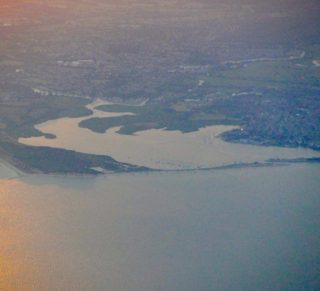
My photograph of Christchurch Harbour, Dorset, taken from an aeroplane at dusk.
The Anglo-Saxon Chronicles tell us that Alfred’s ships blocked the Viking ships in so they could not get to the uter mere. It seems unclear to me whether uter mere means “outer lake” or “outer sea”. However, the usual term for the sea in the Anglo-Saxon Chronicles is sæ, with mere usually meaning a lake. Nonetheless, the Vikings had been blocked into the river and when the tide went out three ships were beached at the upper river mouth and three came forward to attack (making six, matching the number recorded as coming to the Isle of Wight). It appears that at least two Viking ships managed to escape from the trap because we are told that two of the fleeing Vikings crews came ashore in Sussex because their ships were in a poor state. King Alfred had these men hanged at Winchester. It has been suggested that they came aground while trying to get past Selsey Bill. These Vikings would therefore have come aground in Sussex somewhere between East Wittering and Selsey. That they came ashore in Sussex perhaps also makes it less likely that the battle had taken place in distant Devon, after which they would have had to round Portland Bill (or drag their boats across the causeway), near Weymouth in Dorset, first.
My photograph of Poole Harbour, Dorset, taken from an aeroplane at dusk
Perhaps the clue to potential locations for this battle lies in the fact that there were only six Viking ships. We know that Wareham (with access to Poole harbour) and Christchurch are listed in the Burghal Hidage (a list of places defended by King Alfred after 878), and would therefore probably have been defended by 896. It does not seem to make sense to me that the Vikings would have ventured close to defended locations with just six ships.
Weymouth, Dorset
Perhaps the Dorset coastal town of Weymouth (not in the Burghal Hidage, so perhaps a weak point) should be regarded as a possible site. Radipole Lake, fed by the River Wey, is connected to the sea via the town harbour, and one of Athelstan’s charters refers to all the water within the coast of Weymouth, indicating that there was an inland body of water here in Anglo-Saxon times. Indeed, it is thought that the Romans may have had some sort of port at the head of this body of water, and a Roman road ran north from near here to Dorchester. At least parts of this route appear to have remained in use today, which suggests that it might have been in use in 896, thus providing access to any Vikings that intended to raid Dorchester. This area is no stranger to Viking threat. In 840 the Vikings landed at nearby Portland, with fatal consequences for the locals, and in 2009, during construction of the Weymouth Relief Road, near Upwey, fifty-four skeletons of executed Vikings were found, although these dated to a later period than that of King Alfred. Because I live near here, I cannot resist drawing to your attention how rich the South Dorset Ridgeway is in ancient, although very much pre-Alfred, sites. For those who are interested in this, I find this blog particularly good.
The Isle of Wight
However, it seems to me that it is more likely that the events took place at one of the main rivers, including the River Medina, that flow into the Solent on the north coast of the Isle of Wight. The Anglo-Saxon Chronicles do not state that the engagement took place during a Viking raid on the coast of the mainland, although it is easy to assume this because the Chronicles tell us that the Vikings had been undertaking such raiding. It is an interesting coincidence that the Old English term for the River Medina was Meðume, not terribly different from muða. An old map of the Isle of Wight suggests that the main waterways may have had constricted entrances to the sea, thus meeting the description of the location in the Anglo-Saxon Chronicles. It seems to me that King Alfred’s Navy, improved after 878 AD, had managed to root out a small Viking base that had set itself up on the Isle of Wight.
My book mentions a few other locations on the south coast that could have been the site of the engagement between King Alfred’s navy and the Vikings. It also contains much more about Alfred’s travels, and contains maps and references. Tap or click the image to learn more.
This post is adapted from, and provides additional materials for, my book, King Alfred: A Man on the Move, available from Amazon and book shops. If you scroll down you will find a short video that I made on-location about Sherborne.
At least two Kings of Wessex were buried at Sherborne. It was the most important ecclesiastical location in an area covering Dorset, Devon and Cornwall. One of Anglo-Saxon history’s most important characters, Asser, King Alfred’s companion and “biographer” became bishop here. I believe there is a plausible case to be made for this to have been the most important place in Wessex until shortly after King Alfred died (when Winchester appears to have become more important). This of course challenges what you might read elsewhere, in that Winchester was King Alfred’s “Capital”. There is no evidence that this was the case.
Plaque inside Sherborne Abbey, Dorset, informing us that King Æthelberht and King Æthelbald were interred nearbyThe bones to be found near the plaque. Although they are located near the plaque there is no evidence that these are the bones of King Alfred’s brothers. They are viewed through a glass panel fitted into the floor.
Sherborne’s most important feature is its abbey, and it is here that two elder brothers of King Alfred, Æthelbald (died 860) and Æthelberht (died 865) were buried, and I consider it likely that Alfred would have been present at their funerals, or would have at least visited their resting places. He would have been about eleven years old at the time of the first death, and about sixteen at the time of the second. It is also possible that a third brother of Alfred was buried at Sherborne as well. The Anglo-Saxon Chronicles, with the exception of the B version, have this brother, Æthelred, buried at Wimborne (Dorset), but the B version tells us that he was buried at Sherborne. I consider that this contradiction can be resolved by considering that Æthelred may initially have been interred at Wimborne and then later moved to Sherborne, probably because of the relative importance of the latter location. That the other two brothers had been interred at Sherborne supports the idea that this place was more important than Wimborne. However, it should be noted that there is a 10th century charter (S813) issued by King Edgar that tells us that he had ancestors resting at Sherborne, with these being Æthelbald and Æthelberht, with Æthelred unmentioned, and therefore probably not transferred there after all.
Sherborne Abbey, Dorset
There is a plaque in the abbey indicating the approximate location of the burials of Æthelbald and Æthelberht, and there is nearby a small area where the floor has been replaced by glass and some bones can be seen beneath. However, I was told that it is not really known whose remains these are. Asser tells us that when Æthelberht died he was buried next to his brother Æthelbald. Leland, writing in the sixteenth century tells us that he saw no tombs for these kings nor any written indication of where they might be. He also says that they were buried behind the high altar, but he does not disclose how he knew that.
Approximate postulated outline of the Saxon abbey precinct (after Dorset Historic Towns Survey: Sherborne, 2011)
It is significant that Asser, King Alfred’s companion and biographer, and from whose writings we derive so much information, became bishop of Sherborne at some time in the 890s, while King Alfred was still alive, and it appears that he continued in this role until his death in 909, ten years after Alfred had died. In order to understand the importance of Sherborne in Alfred’s time it is important to appreciate that it had a huge diocese, created by King Ine of Wessex in 705, that extended all the way down to Land’s End in Cornwall.
I have see it claimed (in an unpublished work; it perhaps appears elsewhere) that the young Alfred was educated at Sherborne under Bishop Ealhstan. Because Sherborne was a place of importance this cannot be ruled out. However, this would have to mean (Asser chapter 22) that Sherborne was the location of the royal court, and I don’t think that there is enough evidence that it was. The royal court may have been at Winchester or it may not have even had a fixed location.
Stained glass window in Sherborne Abbey showing King Alfred and Asser
The Abbey still has Saxon elements despite much of the earlier church being demolished by Roger of Caen to be replaced by a larger Norman one. As you walk around Sherborne it is easy to be unaware of just how important this place would have been. In my opinion it must have been one of the most important places in Wessex, perhaps even the most important, in a period before Winchester would be able to claim that title.
Statue of Aldhelm inside Sherborne Abbey. Aldhelm became the first bishop of Sherborne in 705 AD. By Marzia Colonna, and erected 2004.
Some background. Sherborne became a bishopric in 705 when the see of Winchester was divided. Aldhelm became its first bishop. However, there is evidence, perhaps unsurprisingly, that there was an ecclesiastic foundation at Sherborne before that date, called Lanprobus. However, I will stop here for fear of drifting too far from the subject of King Alfred. Perhaps I shall post separately with more details in future.
Map of Sherborne (detail). 1802, adapted from a 1735 map by Ladd.
I have written much more about Alfred’s travels in my book, which also contains maps and references. Tap or click the image to learn more.