Bridport and Bredy. Where was Brydian?

River Asker, Bridport, Dorset

Bridport has often been thought to be the location of Brydian, a fortified location mentioned in a document called the Burghal Hidage. However, it is by no means certain that this is the case. This post is part of additional materials relating to my book, King Alfred: A Man on the Move, available from Amazon and bookshops. To buy a copy, and support this project, please click on the image below.

The Burghal Hidage is a document drawn up after King Alfred’s post-878AD development of a network of defended burghs (fortified locations). However, it seems that the version that has come down to us dates to his son, King Edward the Elder, because it includes sites such as Buckingham, which were not fortified by the Saxons of Wessex until his reign. Nonetheless, there may have been earlier versions dating to King Alfred’s reign that have been lost to us. Given Bridport’s location on a Roman road extending between the Saxon locations of Dorchester to Exeter, it seems likely to me that it would have been part of King Alfred’s defensive burgh programme. It must be noted that I have seen it challenged that the Roman road from Dorchester to Exeter ran through Bridport (effectively challenging the direction taken by Margery Road 4f when it reached Eggardon hillfort from Dorchester) However, it is thought possible that the A35 through Bridport might still be a later Roman road if not an early one.

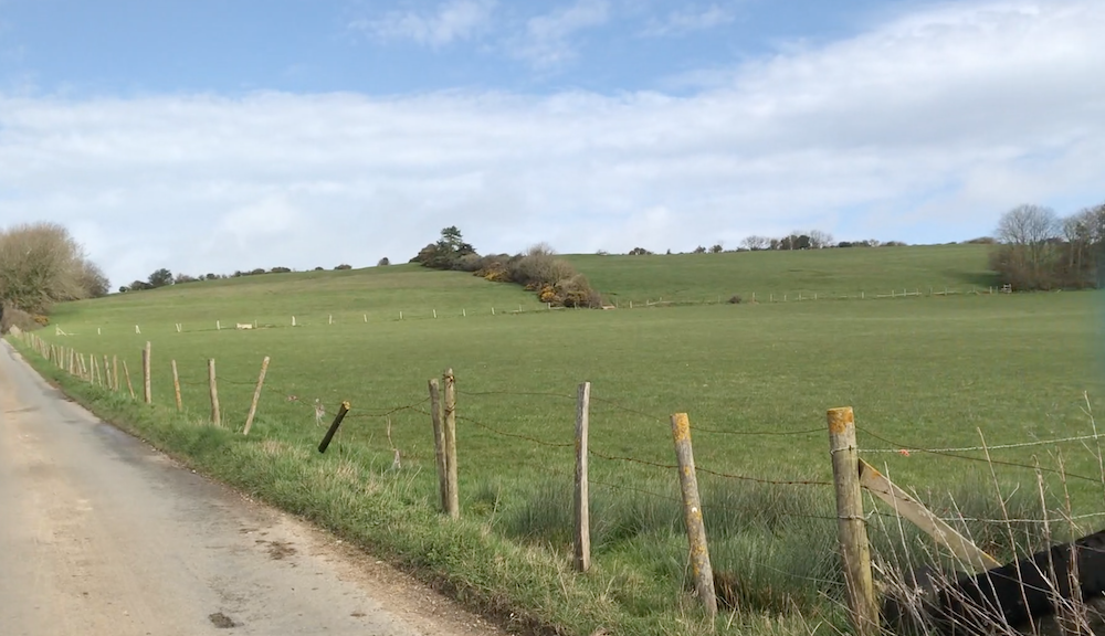
However, there are good reasons to question whether Brydian was at Bridport and not somewhere else. Chief among these options is the charming village of Little Bredy, just seven miles west of Dorchester. It is here that the River Bride rises from the earth. The source is dammed to create a beautiful artificial lake.

View from Little Bredy, Dorset to Warren Hill
Looking across the lake at Little Bredy towards Warren Hill

The important point is this. The Domesday Book (1086) shows that Cerne Abbey owned places called “Littelbred” and Langabride”. But when we go back to the founding charter of Cerne Abbey (987AD) we find that these places are called in Latin “Bridian” and “Ulteriore Bridian.” The meaning of “ulterior” is “further away” or “distant.” As I don’t know the answer to the question “further away from what?”, I have adopted the respected expert on place names A.D. Mills’ opinion that Bridian refers to Little Bredy and that Ulteriore Bridian refers to Long Bredy. The charter (S1217) is referred to here and can be read (in Latin) here. Note that although some elements of the charter may be spurious, much of the information may be correct (e.g. the owning of the Bredys is confirmed by Domesday). That neither of these Brydians were Bridport is shown by Bridport having a separate entry in Domesday. Furthermore, at this time Bridport was owned by the king, and not by Cerne Abbey.

It has been suggested that if Brydian had been at Little Bredy, then the fortified site might have been on Warren Hill, where there might have been an earlier Iron Age hill fort.

St Michael and All Angels, Little Bredy

It is worth mentioning here the confusion to be caused by two rivers with very similar names. The River Bride flows from Little Bredy to the coast near Burton Bradstock. The River Brit flows from the north, passes through Bridport and enters the sea at West Bay. It seems that the River Brit was named after Bridport and was originally called the Woth.

The river Bride flowing through Little Bredy, Dorset
The River Bride, flowing west through Little Bredy, Dorset

Another location that I have seen being referred to in relation to this puzzle is the area around Bredy Farm and Bredy North Hill, just to the east of Burton Bradstock (referred to in Domesday as Brideton). However, I think these are just named after the River Bride that flows by here and I can’t see a reason to place this location above Little Bredy in the hierarchy of places that could have been Brydian (with Bridport at the top, as we shall see). Bredy Farm and Bredy North Hill are on OS maps. Bredy Farm is a great place to get some cider and there is a restaurant that I understand is very good.

Bredy North Hill, Dorset
Looking north east to Bredy North Hill from the road just north of Bredy Farm

So, is it still possible that Brydian could have been at Bridport? I think that the answer is “Yes”. Here are my reasons. Little Bredy is far too close to Dorchester for there to have been a separate fortified settlement there. Bridport is further away (about 15 miles as opposed to 7) and on a significant Roman road. We also know that there was a mint at Bridport in later Anglo-Saxon times and these have inscriptions such as “Bryd”. It seems highly unlikely to me that there would have been a mint at the small location of Little Bredy (or, even less likely, up on Warren Hill). So, if Bridport was Bridian, why was Little Bredy also Bridian (or Brydian)? I believe it is possible that people who lived in the valley of the River Bride (therefore including Little Bredy) moved (or spread) to what we now call Bridport and took their name with them, and that this occurred before the time of King Alfred.

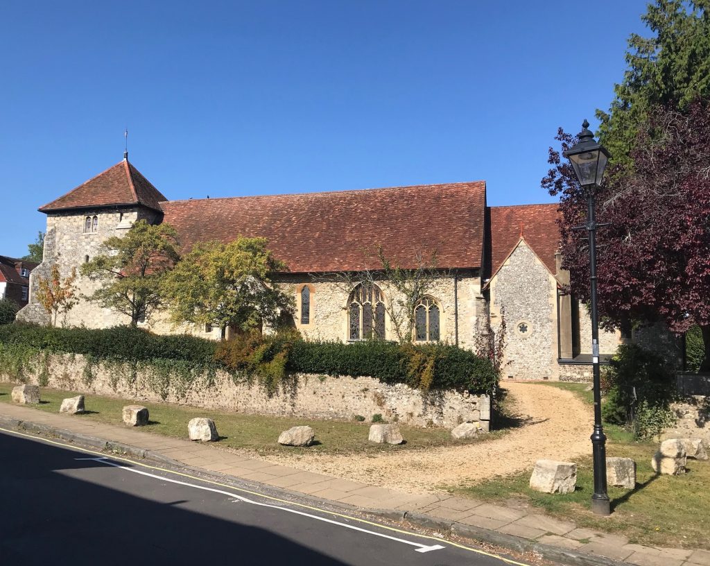
So, taking Brydian to be Bridport, what was this place like at the time of King Alfred. Unfortunately, no Anglo-Saxon defences have been found, but there are a couple of clues. One is the entry in Domesday where we are told that there was a church at Bridport. This would have therefore been Anglo-Saxon (a church at Burton Bradstock – Brideton- is also mentioned). In the absence of any conflicting evidence it seems likely that this church would have been where St Mary’s church now stands.

St Mary's church, Bridport, Dorset
St Mary’s church, Bridport. Possibly on the site of an Anglo-Saxon church.

It is interesting to note how the land around the church lies between two rivers, something which crops up in other significant Wessex Anglo-Saxon locations (such as Christchurch, Wareham and Reading). The two rivers are the River Brit and the River Asker. It seems to be a good working hypothesis that the Saxon settlement would have extended from this confluence north to at least the east-west Roman road. The confluence is easy to observe from the bridge near Palmer’s brewery.

The confluence of the River Brit and the River Asker, Bridport, Dorset
The confluence of the River Brit (from the left) and the River Asker (from the right). The view is looking north from the bridge near Palmers Brewery.

To conclude, I believe that it is more likely that the Brydian mentioned in the Burghal Hidage was at Bridport. This does not, however, mean that other locations can be ruled out entirely.

On another subject, King Alfred pursued the land-based component of the Viking army from Wareham all the way to Exeter in 876AD. It seems plausible that this pursuit would have taken place along what is now East Street and West Street in Bridport.

Map of Bridport, Dorset. Hutchins.
Map of Bridport, Dorset, from Hutchins, 3rd Edition (1870)

Looking west up East Street, towards the junction with South Street, in Bridport. Did King Alfred pursue the Vikings along this road in 876AD?

This post is one of several sequels to my book on King Alfred. Click on the image to find out more about the book at Amazon.

A hot-spot in the Saxon history of Devon

This post provides additional material relating to my book: King Alfred: A Man on the Move, available from Amazon and through bookshops.

I refer to Tiverton, Silverton, Cullompton and Bickleigh as being a mid-Devon hot-spot because I came across evidence relating to King Alfred and his son, King Edward the Elder, for these close-together places. It seems that this area was particularly important in the Saxon history of Devon in and around King Alfred’s time.

King Alfred, in his will, left estates at Mylenburnan, Tiverton (Twyfyrde – refering to two former fords across the rivers Exe and Lowman) and Cullompton to his youngest son Æthelweard. The historians Keynes and Lapidge, in their analysis of King Alfred’s will, favour Silverton as the site of Mylenburnan. In addition, there were four charters issued by King Edward the Elder nearby at a place called Bicanleag, which is believed to be Bickleigh. Although most charters seem to have been challenged at some point as to their authenticity (either in whole or part), it seems to me that the presence of four of them means that it is likely that Bickleigh was a high status location at the time. Bickleigh is not far from the important location of Crediton, which I have written about in an earlier post. Transcripts of the charters can be seen here: S372, S373, S1286, S374. To give an indication of the proximity of the locations, the modern distances by road are: Bickleigh to Tiverton = 4 miles, Bickleigh to Silverton = 4 miles, Bickleigh to Cullompton = 10 miles, Bickleigh to Crediton = 9 miles. This area was clearly significant in the Saxon history of Devon.

I have not seen anything to tell me that Bickleigh was a royal estate at the time of King Alfred. For example it does not appear in King Alfred’s will. However, I wonder whether Bickleigh’s location between Tiverton and Silverton may be more than coincidence.

St Peter's church, Tiverton, Devon
St Peter’s church, Tiverton, Devon

Tiverton

Tiverton was, and remains, an important place in the history of Devon. It is well worth a visit, although most people (myself included) will have passed the town on the A361 dual carriageway to the North Devon coast without realising this. It has a majestic parish church which, although 15th century, includes a re-sited 12th century doorway. It is possible that there might have been an earlier ecclesiastical building on the same site. There are the remains of a 12th century castle adjacent to the church, and the road to the east of the castle and church may have been the market in Saxon times.

View north from the bridge at Tiverton, Devon
Looking north from the bridge at Tiverton, Devon. The likely site of the royal Saxon estate is where St Peter’s church can be seen on the right.

It is interesting to note how the focus of the commercial centre of Tiverton has shifted (to the south) over time, as it also seems to have done at Shaftesbury (where it shifted to the east). It seems sensible that the royal estate would have been where the remains of the castle and the church are located, because if the Normans found a position to be defendable, then the Saxons had probably discovered that fact previously. It isn’t entirely obvious from maps, but when on location it was clear to me that the location is high above the River Exe, making it easier to defend.

Silverton

Silverton is a village just off the main road between Exeter and Tiverton (and south of Bickleigh). Not only did King Alfred leave an estate here in his will, but by Domesday, the hundred that included Cullompton was called Sulfretone (Silverton) Hundred. The parish church here is 15th century (as is the case in many places, there could have been an earlier structure) and, when arriving by car, is not at first easy to find because it is set back from the road. There is a footpath that leads from more or less opposite the shops on Newport Road. Unfortunately when I arrived the church was shut to visitors because of internal scaffolding. It seems that this place was more important in the Saxon history of Devon than is currently popularly realised.

St Mary the Virgin church at Silverton, Devon

Bickleigh

Now to Bickleigh, where it seemed to me that there were two contenders for the location of the estate called Bicanleag from which King Edward the Elder seems to have been issuing charters. The first was the current village centre, focused on St Mary the Virgin church, up a steep hill near Bickleigh Bridge and Bickleigh Mill. The other location was Bickleigh Castle, a manor house and wedding venue. This has been an important location over time, with Queen Henrietta Maria (wife of Charles I) staying here when on the way to Exeter (after which she would flee to France from Falmouth, Cornwall). The main point of interest for this blog post, however, is the chapel, which is thought to go back to Saxon times. Although I have not found proof of this (any help greatly appreciated) it is at least thought to predate the 15th century church of St Mary the Virgin in the village centre, which has a 12th century font (and I was told that the font came from the chapel at Bickleigh Castle). Although it cannot be said with certainty, it seems to me that the most likely location at Bickleigh for the signing of charters is the general area of Bickleigh Castle.

The chapel at Bickleigh Castle, Devon

Cullompton

An estate at Cullompton was also left to Æthelweard in King Alfred’s will. I also found it fascinating that by the time of the Domesday Book (1086), Cullompton was a vill (referred to as Colitone) within the hundred of Silverton. This is revealed in the Liber Exoniensis (searchable here), which contains assessments for Domesday in the South West based on land-owners. This seems to mark Silverton as being a more significant place than Cullompton, whereas today it is the other way around. A word of caution though: Hundred names might sometimes refer to convenient meeting places or local well-known place-names. A case in point would be Culliford Tree in Dorset where, to this day, there is no habitation at this Bronze Age barrow on the crest of a ridge. But where in Cullompton was King Alfred’s estate? Was it the whole of Cullompton as it existed at that time?

St Andrew's church, Cullompton, Devon
St Andrew’s church, Cullompton, Devon

Importantly, the entry for Cullompton in the main Domesday record makes reference to a church. There was therefore a Saxon church at Cullompton and it seems likely that this would have been at the location of the current 15th century St Andrew’s church in the centre of Cullompton. Unfortunately, the church was locked when I visited, which was a shame as I understand it has a great interior and even a King Alfred window. The Saxon church would have probably been associated with the royal estate, so it seems that we can place this somewhere in the general area around the church. It is interesting to note that settlement in Roman times seems to have been around St Andrew’s Hill (with a fort on top), a short distance to the north. Indeed, in various places, Saxon settlement seems to have been at different locations to earlier Roman settlement. Perhaps the most well known is London, with a shift away from what we call The City to the area around Aldwych.

This blog post relating to the Saxon history of Devon is part of a sequel to my book on King Alfred the Great, available from Amazon and bookshops. Click the image to find out more (it takes you to the description on Amazon).

Saxon Crediton, Devon

Saxon Crediton was clearly an important place and, in my opinion, King Alfred probably came here, although there is no written evidence for this. Its importance is revealed when in 909 (King Alfred died in 899 and in 909 his son, Edward the Elder was king) the huge diocese of Sherborne, which extended from Dorset to Lands End, was divided up. A new diocese was created in Somerset, based on Wells, and a new diocese for Devon and Cornwall was created, based on Crediton.

The church of the Holy Cross, Crediton, Devon.
The church of the Holy Cross (Crediton parish church), Devon

It is important to note that Crediton was chosen instead of nearby Exeter. Saxon Crediton was clearly a very important place ecclesiastically and it seems unlikely to me that Crediton would have suddenly became important in 909. It seems more probable that it would have been a significant religious site prior to this. We know that King Alfred was pious and it is recorded that he spent time in Devon and Cornwall, so it seems probable to me that he would therefore have visited Crediton at some point. Exeter would, eventually, have its day when the seat of the diocese was moved from Crediton to Exeter in 1050. Crediton may have been favoured over Exeter because of its association with St Boniface (see below), but a charter dated 739 suggests perhaps an additional reason. In this charter (S255), King Æthelheard grants to Bishop Forthere 20 hides at Crediton to build a monastery, which seems to have been later suitable for adaptation to form the seat of a bishopric.

The parish church that one sees today has some 12th century components, but is largely 15th century. It is thought that this church is built over the earlier church (or cathedral as it should be called between 909 and 1050). We don’t know if anything new was built when Saxon Crediton rose to greater prominence or whether it carried on with the same religious buildings that would have been there anyway.

A wood carving of St Boniface inside Crediton parish church

St Boniface

It is claimed that St Boniface was born at Crediton in about 680AD. He was a very prominent saint across northern Europe, becoming the patron saint of Germany, and there are moves to make him the patron saint of Devon (I cannot confirm that this has taken place at the time of writing). He was venerated after his death in Fulda (Germany) in 745, so it seems likely that Alfred would have known about him and may have visited Crediton, the claimed birth-place of St Boniface, for this reason as well. If St Boniface had indeed been born at Crediton, this may have been at least part of the reason why Crediton was favoured over Exeter in 909.

St Boniface's Well (or Winfrith's Well - after his original name), Crediton, Devon.
St Boniface’s Well (or Winfrith’s Well – after his original name), Crediton, Devon.

The Wells

Crediton was created the focus of a diocese at the same time as Wells (Somerset). However, the comparisons do not end there. Both places are closely connected with springs. It may be that many more significant religious locations were associated with water. Perhaps the association has become less obvious over time. At Crediton there are two springs that can be easily visited. One is called Libbets Well, and is just north west of the church. It is not easy to find. You need to go up an unnamed track coming off Church Street, not far opposite the footpath that leads from the church car park. The other is called St Boniface’s Well (or Winfrith’s well – after St Boniface’s original name) and is at the south end of the park that is a short distance west of the cathedral. This well is marked by a “W” on the Ordnance Survey map.

Libbett’s Well, Crediton, Devon.

Although a fair bit further away, there is another interesting well in the lovely settlement at Shobrooke, to the north-east of Crediton. This can also be tricky to find. If you can find St Swithun’s church, Shobrooke, you will see a large thatched farmhouse. The road that goes down past this leads to the well (which is on the right). There is no evidence that any of these wells are ancient (but also no evidence that they are not) and the two in Crediton may be associated with the culverted Littleburn Stream. Perhaps more significant in this regard is a spring marked on the 1890 Ordnance Survey map just north of the church car park. Incidentally, the same map shows the church car park to have once been the site of a (St Gregory’s) cathedral. We now know that the cathedral was not at that location.

The Holy Well, Shobrooke, near Crediton, Devon

Copplestone

For those interested in Anglo-Saxon history a visit to the nearby Copplestone Cross, in Copplestone village, is a must. Located on a busy traffic island (it was moved to this location to ease the flow of traffic in 1969), it is a wayside cross thought to date to the 10th century . It is thought to have been erected in memory of a murdered bishop.

Copplestone Cross, Copplestone, Devon.

Saxon Wells, Somerset

Wells Cathedral, Somerset

This is one of the places where, although there is no record of his presence, I feel that King Alfred probably would have visited Saxon Wells some point. I excluded many such places from my book (although I included some, like Guildford and Somerton), but I thought it might be good to write a few words about Wells for the blog, especially as I found a few things commemorating King Alfred in the city.

Wells Cathedral, Somerset. Stained glass window showing King Alfred the Great and his son King Edward the Elder

It is said that a church at Wells was created by Ine, King of Wessex, in 705. This would have survived up to about 1175, when work on the current Cathedral is thought to have commenced. Outside the cathedral, near the south transept, a map on an information board shows where the Saxon church would have been in the early and late Saxon periods.

Wells cathedral, Somerset. An information board in the grounds showing the location of the earlier Saxon church
showing the probable location of the altar of the Saxon church at Wells Cathedral, Somerset
Wells cathedral, Somerset. Using the above map, it seems that the altar of the Saxon church would have been near the wooden bench (to the right of the middle of the picture). I have taken the photo down the line of the orientation of the Saxon church.

I found the parallels between Saxon Wells and Winchester to be striking in that the cathedral is to the side of the Saxon church (although in Winchester it is to the north instead of the south at Wells), and the mis-alignment between the Saxon church and the cathedral is about the same in both cases. Perhaps the cathedrals were built to the side in order to allow people to worship in the earlier building while the new one was being constructed.

Wells cathedral, Somerset. Stained glass window showing King Alfred the Great. St Martin of Tours is shown to the left

There are also striking similarities between Saxon Wells and Crediton, in Devon. Not only did they both become the base of new dioceses after 909 upon the division of the diocese of Sherborne, but the main ecclesiastical establishments at both locations are closely associated with wells or springs. It might, however, be that the associations between important religious buildings and such water sources may have been lost in other locations. At Wells, the association has survived in the name of the city, and the well that is thought to have been the inspiration (St Andrew’s well) can still be seen beyond the east end (and slightly to the south) of the cathedral. It lies in the grounds of the Bishop’s Palace, but can also be espied through a hole in the wall in the cathedral’s grounds.

St Andrew's Well seen from a gap in the wall from the grounds of the cathedral
St Andrew’s Well seen from a gap in the wall from the grounds of the cathedral

Although there is no evidence that King Alfred was at Wells, I feel that he would have been present at some time. The church was founded by the Wessex King Ine and was significant enough to become a diocese after 909AD after the enormous diocese of Sherborne was divided. King Alfred is certainly remembered in the cathedral. There are two stained glass windows of him, and a seat cover that recalls his presence at Wedmore. There are more details about King Alfred and Wedmore in this post.

Wells Cathedral, Somerset. Seat cover commemorating King Alfred's presence at Wedmore in 878
Wells Cathedral, Somerset. Seat cover commemorating King Alfred’s presence at Wedmore in 878
Wells, Somerset. A sign of a pub called The King's Head.
This is a sign on a closed pub in Wells. Is it King Alfred, King Ine, or King Arthur (or another king?)
Wells Cathedral, Somerset
The magnificent Wells Cathedral, Somerset
Wells Cathedral, Somerset
Wells Cathedral, Somerset. From Winkles’ Cathedrals, 1836
Wells Cathedral, Somerset
Wells Cathedral, Somerset. From Winkles’ Cathedrals, 1836

Hyde Abbey, Winchester

This post on Hyde Abbey is adapted and condensed from my book, King Alfred: A Man on the Move, available through Amazon and bookshops. This is my second post on Winchester, the first is located here.

King Alfred was buried at Winchester, in Hampshire, but the location of his remains are unknown. His remains were moved at least twice and the different religious buildings built at different times can cause confusion in trying to work out where these remains went. I refer you to my first post on Winchester for the first two locations of Alfred’s remains, the Old Minster and the New Minster.

In 1109 Henry I ordered that the New Minster be moved to land that he had provided at Hyde, which was then just outside Winchester. It is possible that the New Minster had suffered from a fire prior to 1109, which might have made the move opportune, or perhaps Henry I did not want the Saxon New Minster cramping the style of the gleaming Norman Winchester Cathedral. The re-located New Minster would then become known as Hyde Abbey. In my opinion, the location of this abbey must be one of the most important of the lesser-known sites in British history, and it deserves to be much more famous.

The three stone slabs at Hyde Abbey Gardens, Winchester,marking the location near the high altar where King Alfred, King Edward the Elder (his son) and Ealhswith (his wife) would have been once buried. Their (or some of) their remains may still be present in the vicinity.

Documents indicate that Alfred was transferred to Hyde Abbey in 1110 and that he was interred in front of the altar. Today, Hyde is just north of the city centre and can be easily visited by walking north up Hyde Street, and then turning right into King Alfred Place. This leads to the location of the altar of Hyde Abbey where three stone slabs show where Alfred, his wife and his son were once buried.

Hyde Abbey fifteenth century gateway, Winchester.
Hyde Abbey fifteenth century gateway, Winchester. A reminder of what once stood elsewhere in this part of Winchester.

Hyde Abbey was destroyed in 1539 in Henry VIII’s dissolution of the monasteries. Furthermore, the Annals of Winchester tell us that Hyde Abbey was burnt in 1141, which fits with another record that tells us that the abbey laid “in ruins” after having been set alight in a battle between King Stephen and Matilda in 1141. It seems possible to me that Alfred’s and other important remains could have been relocated in 1141, or prior to the 1539 dissolution. However, the discovery of part of a pelvis (see below) shows that bones from the Anglo-Saxon period remained.

There is a detailed story (for those interested, this is in my book) about how eventually some bones, thought to include those of King Alfred, ended up being interred in the grounds of St Bartholomew’s church, which is located within the footprint of the precinct of Hyde Abbey. However, when these bones were radio-carbon dated, they were found to be more recent than the Anglo-Saxon period. This was the subject of a TV documentary, which you may have seen. To cut a long story short a prison was built on the site in the 1780s and about a decade or so later a Henry Howard made enquiries and was informed by Page (the overseer of the prison construction) about what was found, from which Mellor made a “rough drawing”. The following quote from Howard’s text, which appeared in Archaeologia in 1800, along with his sketch, is most interesting:

“About a [on Howard’s drawing] was also found a stone coffin cased with lead both within and without, and containing some bones and remains of garments. The lead in its decayed state sold for two guineas; the bones were thrown about, and the stone coffin broken into pieces. There were two other coffins, and no more, found in this part, which were also for the sake of the garden, in which they lay, broken and buried as low as the spring.”

I apologise for not putting up an image of his sketch because of copyright etc.

Point a on his drawing seems a plausible location for near the high altar. However, he goes on to say that many more stone coffins were found both to the east (outside the east wall) and the west of this location (in the nave). Clearly, in a situation where bones had been “thrown about”, bones near the altar may not have started off there. The point about the well was taken up by a Mellor who indeed found bones there and sold them to the vicar of St Bartholomew’s, and it seems that these are the bones that ended up collectively buried to the east of that church.

St Bartholomew's church, Hyde, Winchester
St Bartholomew’s church, Hyde, Winchester

Nonetheless, testing was carried out on bones from an excavation at the main site of the abbey undertaken in the 1990s, and a sample from an approximately middle-aged (to us!) male pelvis was dated to 895-1017. Although dating to the correct period, because King Alfred died in 899, it is not possible to say whether this pelvis once belonged to him. King Edward the Elder, who died in 924, was also buried at Hyde Abbey and there is evidence that other individuals may have been too: Æthelweard (a son of Alfred), or Ælfweard (son of King Edward the Elder, although he may have been too young to match the profile of the bone), a monk called Grimbald (although he died quite old) and St Judoc (who, however, died in the 7th century). There may, of course, have been other individuals for which we have no record. Because the bones were found in the vicinity of the high altar (even if it was in back-fill from a Victorian dig) it seems to me not impossible that the bone is from King Alfred, King Edward the Elder, or Æthelweard. Slightly worrying, though, is a record from 1798 that tells us that when a prison was built on the site, bones that were found were “thrown about.” This might mean that what is found near the high altar might not have started off there. Furthermore, would the builders then build over these scattered bones or have them removed? The latter seems more likely. We must remember that Richard III was discovered under a car park in Leicester, so we should perhaps always be ready to be surprised. Richard III, however, died almost 600 years more recently than King Alfred, something that I assume made using a live relative for a DNA comparison (as was done with Richard III) more straight forward. There may have also been less change in use of the land over time in the case or Richard III.

It was hoped that DNA from the pelvis fragment could be matched with those of King Alfred’s grand-daughter, Eadgyth, who was buried at Magdeburg, in Germany. However, although it was thought that it would be possible to extract DNA from the pelvis fragment, it seemed that the remains of Eadgyth were too poorly preserved to attempt a match.

This is a special place to visit, and I always make time to come here whenever I am in Winchester. In fact, this location was one of my main inspirations for writing my book. It is a hugely important location in the history of England.

The for refreshment. There is even a King Alfred pub close to Hyde Abbey Gardens. I had a beer and a meal in here and both were very good.

There is a community group called Hyde 900 that has done a lot of work in relation to the former abbey, and they deserve a mention. Their website also has more information.

Iglea

This post on Iglea is adapted and condensed from my book, King Alfred: A Man on the Move, available through Amazon and bookshops.

The Anglo-Saxon Chronicles tell us that one day after Alfred’s troops came together at Egbert’s Stone, they went to a place called Iglea, a place that is referred to in the Latin of Asser (companion and “biographer” of King Alfred) as Æcglea. Unfortunately, we do not know with certainty the location of this place.

Æcglea was Alfred’s final stop before the Battle of Ethandun, which took place in Wiltshire at Edington or, less likely in my opinion, at the location of the Iron Age hillfort called Bratton Camp. In another post I explained that the most probable location for Egbert’s Stone (King Alfred’s previous stop) was the Upper Deverills, and it seems to me that after leaving there he would have had two main routes to get to the battle site. One would be to follow the Ridgeway to skirt around the north-west of Salisbury Plain in order to reach Bratton Down or to continue on to Edington. The other option being to go straight across Salisbury Plain instead of around it. It seems likely that the location of the encampment at Iglea would depend on which route was taken. Alfred had lost Wessex and was operating in enemy territory and it therefore seems likely that he would have gone across Salisbury Plain rather than around it in order to avoid as many significant settlements as possible, and this is what I focus on in this post. In the video below I refer to Edington being close to Sutton Veny. It is indeed not far, but it is on the other side of Salisbury Plain.

Iglea is similar phonetically to “Iley” and there was an ancient meeting place called Iley Oak in what is today known as Southleigh Wood, previously called Sowley Wood, to the south-west of Sutton Veny. The precise location of Iley Oak in this area may have been where five roads and paths used to meet at a point where today the access to a farm comes off the road connecting Longbridge Deverill to Sutton Veny at the southern edge of Southleigh Wood. I find it striking, and perhaps relevant, that there are the remains of a henge very close to this location. The henge is on private land and is not easy to see. Please be careful if you try to view it from the very fast (nearly) adjacent road.

Although they date to the Late Neolithic, it is possible that some henges, or the places at which they were located, might have retained a societal significance beyond that period, perhaps even through Anglo-Saxon times. In the absence of other evidence, I favour the site of this henge as the site of Iglea/Æcglea.

Southleigh Wood provides one more tempting possibility, which is to be found immediately north of the location described above. I refer to Robin Hood’s Bower. I am aware that this has been put forward by others as the site of Iglea/Aecglea but, for me, it does not outweigh the location of the henge. This is a small ancient enclosure that, like the henge referred to above, would have been present long before the time of King Alfred. The outline of the enclosure is clearly discernible and it has been enigmatically planted with many monkey-puzzle trees.

Robin Hood's Bower (possibly Iglea), near Sutton Veny, Wiltshire
The track running across the centre of Robin Hood’s Bower, near Sutton Veny, Wiltshire

It has also been suggested that Iglea was at nearby Bishopstrow. The argument that Iley Oak was located here seems to be tied up with an idea that Iglea would probably have been an island (with the Ig part of the word Iglea meaning island) in the River Wylye. There is an island in the Wylye as it flows past Bishopstrow at Boreham Mill and the road that leads north out of Bishopstrow goes right across the middle of it (look out for the two bridges). However, it seems that we cannot prove that there was an island there in Alfred’s time (it could be the result of later human alteration to the watercourse). All in all, I did not find the arguments for this location to be strong enough to outweigh those that can be applied to the location near the henge at the south edge of Southleigh Wood. I did, however, find the argument that Ig indicates an island sufficiently plausible to make this my second favourite. Bishopstrow could also be relevant as a place where legend has it that the staff of St Aldhelm had grown into an ash tree. St Aldhelm’s church at Bishopstrow is 14th century, but it could have been built over an earlier Saxon church. It is therefore possible, had he been close by, that the pious Alfred could have prayed here before the final march to the battle at Ethandun.

St Aldhelm's church, Bishopstrow, Wiltshire
St Aldhelm’s church, Bishopstrow, Wiltshire

There is another (in my opinion, less likely) candidate for Iglea where an unusual number of paths met to the south of Sutton Veny. This, along with possibilities relating to King Alfred going across Salisbury Plain instead of across it, will have to wait for a later post.

There is much more about the travels of King Alfred in my book, including maps and references. Tap or click the image of the front cover below.

Wedmore, Somerset: King Alfred hosts Guthrum

St Mary's church, Wedmore, Somerset Levels

This post on Wedmore is adapted from, and provides additional information for, my book, King Alfred: A Man on the Move, available through Amazon and bookshops.

King Alfred defeated the Vikings at the Battle of Ethandun in 878. Alfred then oversaw the Viking leader Guthrum‘s baptism at Aller, on the Somerset Levels, and not far from Athelney, which had been the location of Alfred’s base after the Vikings appear to have taken control of Wessex after their raid on Chippenham in January 878.

We are told by both Asser and the Anglo-Saxon Chronicles that after his baptism Guthrum spent twelve days with Alfred, and at least part of this time was spent at Wedmore, which Asser describes as a villa regia (royal estate). We are told that after this period the Vikings left Chippenham, where they had a base, and went to Cirencester and then re-located again to settle in East Anglia.

Before they left, we are told that they were honoured with a large amount of riches. It is impossible to know by how much, if at all, these were gifts voluntarily provided by Alfred or whether this was some sort of ransom demanded by the Vikings as part of a peace settlement.

A plaque inside St Mary's church, Wedmore, Somerset Levels recognising Alfred's making of peace with the Vikings
A plaque inside St Mary’s church, Wedmore, Somerset Levels recognising Alfred’s making of peace with the Vikings. NB. The year of King Alfred’s death has been revised to 899

It has been suggested that the royal site at Wedmore was north-west of St Mary’s church at or near the location of a manor house and it seems to me that the wall visible from the churchyard could have been the perimeter of the manor’s grounds. It occurred to me that the location could have been elsewhere in or around Wedmore, so I decided to explore further. I had been intrigued by marks in the ground visible in an aerial photograph in a field north of Manor Lane, although I could see nothing relevant when I arrived there at ground level. I also explored the hill to the north-west by taking the footpath heading west off Lascot Hill. I eventually decided that I could not improve on the suggestion that the royal estate was at the location of the former manor house.

St Mary's church, Wedmore, Somerset Levels
St Mary’s church, Wedmore, Somerset Levels

St Mary’s is a delightful place to visit (as is Wedmore itself).

Map of Wedmore, Somerset. Mudge 1817
Map of Wedmore, Somerset. Detail from map by Mudge 1817.

It was once thought that the Saxon royal residence was at Mudgley, just a short distance south of Wedmore. However, I could find no evidence that this was the case.

There is much more about the travels of King Alfred in my book, including maps and references. Tap or click the image of the front cover below.

Saxon Exeter: King Alfred

This post on Saxon Exeter at the time of King Alfred is adapted from my book, King Alfred: A Man on the Move, available from Amazon. Please also scroll down for my Youtube video on Exeter.

The Anglo-Saxon Chronicles tell us that in 876 King Alfred pursued the land-based Vikings that had fled from Wareham (Dorset) to Exeter. However, their accompanying navy lost 120 ships in bad weather near Swanage (Dorset). Alfred was unable to catch up with the fleeing land-based Vikings before they got to Exeter. On reaching Exeter the Vikings secured themselves in a fortress, but their situation does not appear to have been particularly positive, perhaps because of the large loss of ships, and they settled for peace with Alfred. After over-wintering (permission to do this being presumably part of the peace settlement), the Vikings left Exeter and went to Mercia, and specifically to Gloucester according to a chronicle written by Æthelweard.

I asked myself whether it was possible to work out from the available information where exactly in Exeter the Vikings went. The Anglo-Saxon Chronicles imply that the Vikings occupied a fortress that had already been there, as opposed to building one when they got there, as they would do in Rochester, in Kent, in 884. Exeter’s Rougemont Castle goes back to 1068, so we are looking for something else, but perhaps this would have been on the same site as Rougemont Castle. The case for this is strengthened by the discovery of Anglo-Saxon masonry at Rougemont Castle.

Walls at Exeter, Devon, where Saxon masonry found. The path leading up to Athelstan's Tower in Northernhay Gardens.
A section of the walls at Exeter where Saxon masonry has been found. This is the path leading up to Athelstan’s Tower in Northernhay Gardens.

We also know that Exeter had (and largely still has, although much repaired) Roman walls with four entrances and it appears that these were repaired and strengthened in Anglo-Saxon times. The Old English of the Chronicles says that the Vikings came into Exeter, which fits with the idea that the Vikings had managed to get into Exeter through one of the four entrances in the walls and then either occupied a fortification within the walls, or used the walls themselves as a fortification. The length of the circuit of the walls was would have stretched the Viking troops, but with only four entrances, it may have been possible for them to secure the site. I feel that it is more likely that the depleted Viking force took over a fortification within the walls rather than the walls themselves, and it seems to me that the site of (or part of the site of) Rougemont Castle would have been the most likely location for this fortification. From Northernhay Gardens elements of Anglo-Saxon construction in the remains of the wall can be seen. It is thought that King Athelstan (King Alfred’s grandson) restored the city walls in around 928. The site of Rougemont Castle is now called Exeter Castle, and is a commercial enterprise.

It is possible that the land-based Viking contingent, with Alfred in pursuit took the Roman road to Bridport via Dorchester and then the Roman road that now approximates to route of the A35 to Honiton, and then finally the Roman road that is more or less on the current route of the A30 to Exeter. Alternatively, they could have branched off this route onto another Roman road near Charmouth in order to reach Exeter via Colyford and Sidford, approximately following the route of the current A3052. It seems likely that these routes would have been in use in Alfred’s time, because much of these routes have persisted from Roman times right through to today. It also seems likely that the best available route would have been taken by both parties as, speed would have been important, and these would probably have been the remaining Roman routes.

Plaque marking the location of the South Gate in the walls of Exeter
A plaque marking the location of the South Gate in the walls of Exeter, Devon

It seems that either route would have brought them to a gate to the south-west of the walled city at a spot that is towards the southern end of South Street of today’s Exeter. There is still some wall there today (and a plaque) to help you find the precise spot. This South Gate must be, therefore, the most likely point of entry for the Vikings, and also for King Alfred in pursuit, in 876. Unfortunately, there is no gate present there now as, after serving as a prison, it was finally demolished in 1819. Nonetheless, it is possible to explore on foot how these routes come together just outside the former location of the South Gate. If you do make it down here, there are other places of interest such as the old Eye Hospital and the Dissenters’ Graveyard.

The South Gate of the walls of Exeter, Devon. Outline marked in pavement.
The South Gate of the walls of Exeter, Devon. The markings in the pavement referred to by the plaque in the previous image.
The former location of the South Gate in the walls of Exeter, Devon.
The former location of the South Gate in the walls of Exeter, Devon. Just follow the line of the wall across the road

Having come through the South Gate, and with Rougemont Castle (as it was later called) at the extreme north end of the walled city, Alfred would have needed to cross the centre of Exeter. Although these events took place prior to Alfred’s post-878 rebuilding programme, it seems likely that there would have been a road leading from the South Gate up to the main city intersection where today South Street, North Street, Fore Street and High Street meet. It seems that High Street would have been present in Alfred’s time, and this leads in the general direction of Rougemont Castle. I therefore suggest that, if the Vikings were at the location of Rougemont, Alfred and his troops would have proceeded up what is now South Street and turned right on to what is now High Street, with the land-based Vikings having taken the same route just a short time before. Any surviving sea-borne Vikings would have made their way up from the harbour, via the West Gate or perhaps via a lost Roman gate in the wall nearer to the port (the Water Gate may have been a later development not present in Alfred’s time). They may have even disembarked at nearby Topsham and then made their way, like the others, to the South Gate.

Exeter, Devon. Ancient crossroads.  From South Street, looking across to North Street, with High Street to the right and Fore Street to the left.
Exeter, Devon. It is likely that roads crossed here in the time of King Alfred. This is where South Street, North Street, Fore Street and High Street meet. The photo is taken from South Street, looking across to North Street, with High Street to the right and Fore Street to the left.

There is a reference in the Anglo-Saxon Chronicles to King Alfred heading again to Exeter in 893. While on his way to assist his troops that were besieging a Viking contingent near London, he received word that other Viking forces had landed in North Devon and that Exeter, in South Devon, had also been besieged. Alfred and his troops therefore diverted towards Exeter. There are no records of any engagement with the Vikings either at Exeter or in North Devon at this time, although the Anglo-Saxon Chronicles do imply that he got there.

It is worth noting that in 1003 the Vikings stormed (the word used is abrocen) Exeter. It seems that this would have been much worse than anything that happened in King Alfred’s time (see versions E and F of the Anglo-Saxon Chronicles).

Many thanks to BBC Radio Devon and The Voice (Barnstaple) for having me on air to talk about my book and Saxon Exeter at the time of King Alfred.

There is much more about the travels of King Alfred in my book, including maps and references. Tap or click the image of the front cover below.

Saxon Kent and King Alfred. Part 3

A wall of the Archbishop's Palace in Charing, Kent

This post on Saxon Kent at the time of King Alfred is adapted from my book, King Alfred: A Man on the Move, available from Amazon.

The Anglo-Saxon Chronicles tell us that in 893 Alfred camped with his army between the two raiding armies and therefore it would have been between Milton Regis on the north coast of Kent and Appledore towards the south coast of Kent. Anyone who travels around Kent will soon appreciate how difficult it would have been to monitor these distant locations from a single site. I therefore feel that any central camp must have had additional outposts in order to monitor what was going on over a wide area. This would fit with the Anglo-Saxon Chronicles telling us that burga (fortresses), noting the plural, were being held by Alfred.

Maidstone, a location that has been put forward, is considered separately in this other post. I now continue with a few others, ending with the locations that I believe to be more plausible.

The village of Bredgar, just south of the M2 motorway has been suggested. The village has a lovely church yard, and is somewhat elevated. However, I could see no special reason to consider that this was Alfred’s main camp, although it could have been one of potentially many outposts. Bredgar lies close to a line drawn between Appledore and Milton, but it is very much closer to the latter, making it an awkward fit with the description of King Alfred being between the two raiding armies.

Church of St John the Baptist, Bredgar, Swale, Kent, with the earliest elements dating to the 12th century.

Stockbury, just a few miles west of Bredgar, has also been put forward, although the earthworks there are thought to be Norman, and therefore more recent than King Alfred’s time. However, it is possible that the Norman construction may have been built over earlier earthworks, and this may be supported by the possibility that part of the name may derive from the Old English burh (stronghold).

St Mary Magdalene Church, Stockbury, Kent and the Norman earthworks
St Mary Magdalene Church, Stockbury, Kent and the Norman earthworks (to the right). Photograph taken from the road.

To find these earthworks it is easiest to find the church first, which is located a little way east from the centre of the village, adjacent to Church Farm. Although the rings are on private land they are easily viewed from the road and the church yard. In fact, the outermost visible ring appears to clip the churchyard. Whilst I accept that the location commands views that could have made it a useful outpost, there did not seem to be any particular reason to believe that this would have been Alfred’s camp. Stockbury, like Bredgar, lies close to a line drawn between Appledore and Milton, but it is very much closer to the latter.

There is a feature to the north-east of the village of Newenden that is called Castle Toll, and you can get quite close to it on a public footpath. Whilst Castle Toll is perhaps 13th century, some of the earthworks marked on the Ordnance Survey map to the south are thought to be the remains of an Anglo-Saxon burgh. It has, however, been suggested that this was the site of Eorpeburnan, a previously lost burgh that is listed in the Burghal Hidage, a document compiled in the reign of Alfred’s son, Edward the Elder. Newenden is not at all on a line connecting Milton Regis and Appledore, so, although I believe it may have played a role, it does not fit the description of Alfred’s camp.

The Saxon earthworks near Castle Toll, Newenden, Kent
The Saxon earthworks near Castle Toll, Newenden, Kent, are difficult to see. They are on private land but if you look south east from the path near Castle Toll (see OS map), you will be looking in the right direction.
The 13th Century Castle Toll, near Newenden, Kent

When the Vikings landed on the north and south coasts of Kent, I feel that Alfred must have been concerned that Canterbury may have been a target. When I disregarded previous suggestions (for which there is no real evidence) and considered an approximate line between Appledore and Milton Regis, I found that there were a few places that could have better met the description of being between these locations and which may also have allowed easier access to Canterbury. I considered two locations in particular: The villages of Great Chart and Charing. However, the landscape feature known as the Greensand Ridge may also be relevant.

It is known that in King Alfred’s time there was a settlement at Great Chart under the ownership of the Archbishop of Canterbury. Interestingly, there has been a legend that Great Chart had been burned by the Vikings, and this led to the subsequent development of Ashford.

The Millennium Sign at Great Chart, near Ashford, Kent
The wonderful Millennium Sign at Great Chart, near Ashford, Kent

Charing is approximately half way between Milton and Appledore and has an Archbishop’s Palace associated with Canterbury that dates back to the 8th century, making it a significant location in Saxon Kent. One could be misled into thinking that Alfred’s piety may have led him here because of a legend that the block on which John the Baptist had been beheaded had been located at the church. However, the tradition is that this was brought to England by King Richard I, well after the time of King Alfred. Nonetheless, I feel that this location is the strongest contender for the location of Alfred’s camp. It is located on an approximate line between Milton and Appledore, without being too close to either, and is located by the ancient track to Canterbury that later became known as the Pilgrims’ Way.

The 13th century church of St Peter and St Paul at Charing, Kent.

The discovery in 2012 of a large Saxon hall near the location of a former Anglo-Saxon abbey at Lyminge generated much interest (resources here). These may go back to the 6th to 9th centuries. Although Lyminge appears to have been an important Saxon location, it does not seem to meet the geographical requirements of those unnamed places mentioned in the Anglo-Saxon Chronicles.

There is much more about the journeys of King Alfred in todays landscapes and cityscapes in my book, including maps and references. Tap or click the image to learn more about it.

King Alfred’s Navy. The lost battle site of 896AD

This post on King Alfred’s navy and the lost battle site is adapted from my book, King Alfred: A Man on the Move, available from Amazon and book shops.

In 896 there was an engagement between King Alfred’s navy and a Viking fleet of six ships that had arrived at the Isle of Wight and had caused harm all along the coast as far as Devon. It seems that Alfred could not have been present at this engagement because some of the fleeing Vikings were captured and taken to him at Winchester where he had them hanged. The few geographic clues provided by the Anglo-Saxon Chronicles have led to speculation that the engagement took place in Poole Harbour or Christchurch Harbour in Dorset. The Anglo-Saxon Chronicles refer to an ufeweard muða (ð is pronounced “th”) and it has been suggested that this means an “upper harbour.” However, I found it striking that there is an area on the north side of the harbour in Christchurch called Mudeford, with a River Mude running through it and into the harbour. Could this be the muða referred to in the Anglo-Saxon Chronicles?

The River Mude flowing into Christchurch Harbour

Although I have seen it claimed that muða could also mean river, we know from elsewhere in the Chronicles and other documents that rivers were sometimes referred to by their name and that muða appears to usually mean mouth (the similarity between muða and mouth is not a coincidence) with the term for river generally being ea. Furthermore, if muða had been a generic term for river, we might expect to find other survivors such as is the case with the Brittonic language-derived Avon. However, I was unable to find any other examples of a River Mude in England. Update: I have had access to a 1797 map that shows the location as “Midde Ford”, which seems to sever the relationship of the place-name with muða.

View of Christchurch Harbour, taken from an aeroplane at dusk.
My photograph of Christchurch Harbour, Dorset, taken from an aeroplane at dusk.

The Anglo-Saxon Chronicles tell us that Alfred’s ships blocked the Viking ships in so they could not get to the uter mere. It seems unclear to me whether uter mere means “outer lake” or “outer sea”. However, the usual term for the sea in the Anglo-Saxon Chronicles is , with mere usually meaning a lake. Nonetheless, the Vikings had been blocked into the river and when the tide went out three ships were beached at the upper river mouth and three came forward to attack (making six, matching the number recorded as coming to the Isle of Wight). It appears that at least two Viking ships managed to escape from the trap because we are told that two of the fleeing Vikings crews came ashore in Sussex because their ships were in a poor state. King Alfred had these men hanged at Winchester. It has been suggested that they came aground while trying to get past Selsey Bill. These Vikings would therefore have come aground in Sussex somewhere between East Wittering and Selsey. That they came ashore in Sussex perhaps also makes it less likely that the battle had taken place in distant Devon, after which they would have had to round Portland Bill (or drag their boats across the causeway), near Weymouth in Dorset, first.

Poole Harbour, Dorset, taken from an aeroplane at dusk
My photograph of Poole Harbour, Dorset, taken from an aeroplane at dusk

Perhaps the clue to potential locations for this battle lies in the fact that there were only six Viking ships. We know that Wareham (with access to Poole harbour) and Christchurch are listed in the Burghal Hidage (a list of places defended by King Alfred after 878), and would therefore probably have been defended by 896. It does not seem to make sense to me that the Vikings would have ventured close to defended locations with just six ships.

Weymouth, Dorset

Perhaps the Dorset coastal town of Weymouth (not in the Burghal Hidage, so perhaps a weak point) should be regarded as a possible site. Radipole Lake, fed by the River Wey, is connected to the sea via the town harbour, and one of Athelstan’s charters refers to all the water within the coast of Weymouth, indicating that there was an inland body of water here in Anglo-Saxon times. Indeed, it is thought that the Romans may have had some sort of port at the head of this body of water, and a Roman road ran north from near here to Dorchester. At least parts of this route appear to have remained in use today, which suggests that it might have been in use in 896, thus providing access to any Vikings that intended to raid Dorchester. This area is no stranger to Viking threat. In 840 the Vikings landed at nearby Portland, with fatal consequences for the locals, and in 2009, during construction of the Weymouth Relief Road, near Upwey, fifty-four skeletons of executed Vikings were found, although these dated to a later period than that of King Alfred. Because I live near here, I cannot resist drawing to your attention how rich the South Dorset Ridgeway is in ancient, although very much pre-Alfred, sites. For those who are interested in this, I find this blog particularly good.

The Isle of Wight

However, it seems to me that it is more likely that the events took place at one of the main rivers, including the River Medina, that flow into the Solent on the north coast of the Isle of Wight. The Anglo-Saxon Chronicles do not state that the engagement took place during a Viking raid on the coast of the mainland, although it is easy to assume this because the Chronicles tell us that the Vikings had been undertaking such raiding. It is an interesting coincidence that the Old English term for the River Medina was Meðume, not terribly different from muða. An old map of the Isle of Wight suggests that the main waterways may have had constricted entrances to the sea, thus meeting the description of the location in the Anglo-Saxon Chronicles. It seems to me that King Alfred’s Navy, improved after 878 AD, had managed to root out a small Viking base that had set itself up on the Isle of Wight.

My book mentions a few other locations on the south coast that could have been the site of the engagement between King Alfred’s navy and the Vikings. It also contains much more about Alfred’s travels, and contains maps and references. Tap or click the image to learn more.