This post is adapted from my book, King Alfred: A Man on the Move, available from Amazon. It would be great if you could support this project by purchasing a copy.
Burrow Mump, which looks a bit like a smaller version of Glastonbury Tor, is a literally unmissable natural hill close by the settlement of Burrowbridge in the Somerset Levels.

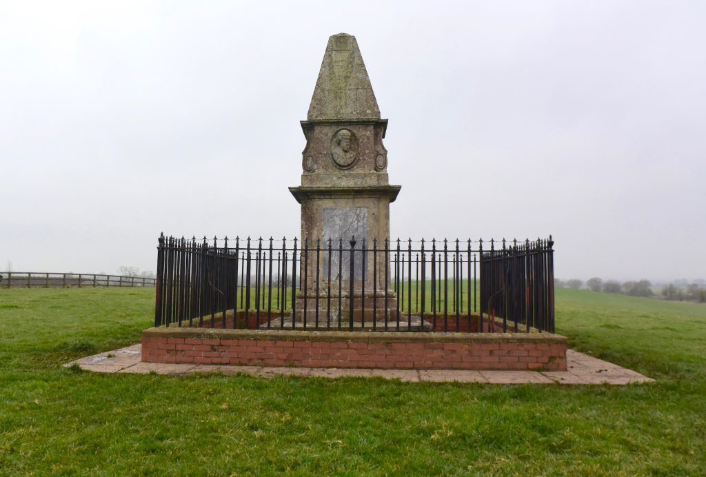
The location is close to where the River Tone flows into the River Parrett , and it is important to note that the River Tone runs past Athelney, where King Alfred was hiding out in 878. The location would therefore have been strategic for defending Athelney. It is possible to see Burrow Mump from Athelney and, of course, vice-versa. The location is also close to where the River Cary once joined the Parrett, although the Cary now runs into King’s Sedgemoor Drain to the north. It should be noted, however, that particularly in Winter and Spring (covering the period when Alfred was at Athelney), the concept of getting to Athelney by travelling down the Parrett and then the Tone would have made no sense, as the area would have been largely flooded, making individual rivers indistinguishable. There is a half built 18th century church atop Burrow Mump, which is incomplete because funding ran out, and the structure is now a war memorial. However, there is evidence of earlier building going back to the 12th century. There is a car park, and those who walk up the steep incline are rewarded with great views.

An interesting story was toldto me regarding the King Alfred pub in Burrowbridge. This related to a three-legged so-called “Alfred Table.” Although I was told that it was eventually dated to be much more recent, it still apparently sold for a handsome sum to an American.
Asser tells us that the fortress on the western summit of Athelney Hill was connected to another fortress by a causeway. This second fortress appears to have been at the settlement of East Lyng which, like Athelney, was on higher ground. However, it is important to note that Asser tells us about the causeway and the second fortress in relation to the later founding of a monastery at Athelney by Alfred. There appears to be no evidence that the fortress at Lyng or the causeway were present in 878. The monastic foundation was developed around 893, and the causeway may have been built to facilitate access to and from this. The second fort may have been built as part of Alfred’s defence programme, which he started after 878.
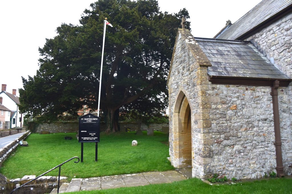
I wondered whether it was possible to see any remains of this second fortification. Whilst not being able to specifically find the fortification it was possible to find evidence of the burgh’s perimeter. Lyng is named in the Burghal Hidage, and a bank and ditch to the west of East Lyng may be the remains of the western perimeter of the burgh defences. I saw it suggested that this ditch and bank was in line with the east wall of St Bartholomew’s church. So, after struggling to find a parking place for the church, that is where I went, and I could indeed see what looked like possible earthworks in the field to the south of the church. I could not explore further because the field appeared to be private land. Fortunately, the presenters in the first ever episode of Time Team (here) appear to have gained access and their programme confirmed that I had indeed been looking across at the correct spot, although the alignment appeared to be more with the the west wall of the church! The bank and ditch would have extended north on the other side of the A361, but there appears to be nothing left to see there. It seems likely that the eastern boundary would be near Cuts Road, and the causeway itself, although the causeway could have taken a different line in Alfred’s time. Therefore it seems that most of the settlement of East Lyng might be sited within the burgh developed by Alfred.

I also wanted to investigate the causeway between Athelney and East Lyng recorded by Asser. There is a structure which can still be seen that goes right up to Athelney Hill. Coming from East Lyng one drives over the first section, and it then passes onto private land (with the route of the causeway remaining visible). This structure is now called the Balt Moor Wall. I have not seen any reference that dates this to before the 12th century, so we cannot be sure that the causeway that we see today follows precisely the same route as it did in King Alfred’s time.
There is much more about the travels of King Alfred in my book, including maps and references. To learn more about the book, click or tap the image below: