This post is one of several providing information on places not necessarily covered in my book, King Alfred: A Man on the Move, available from Amazon and bookshops.
Langport is not far from Athelney, where King Alfred prepared for the reconquest of his kingdom in 878, and even closer to Aller, where King Alfred baptised the Viking Guthrum after he had been defeated at Ethandun later on in 878.
There is, however, no record of King Alfred having visited Langport, although it seems to me to be likely that he would have been there on occasions, particularly as it was also a burh listed in the Burghal Hidage, a list of fortified sites that in the version that has come down to us today seems to date to the reign of his son, King Edward the Elder, although many of these defended sites may date to King Alfred’s defended post-878 settlements programme. Other listed burhs in Somerset are Watchet, Axbridge and Lyng . Bath is also included, but this might not have been in Somerset in King Alfred’s time.
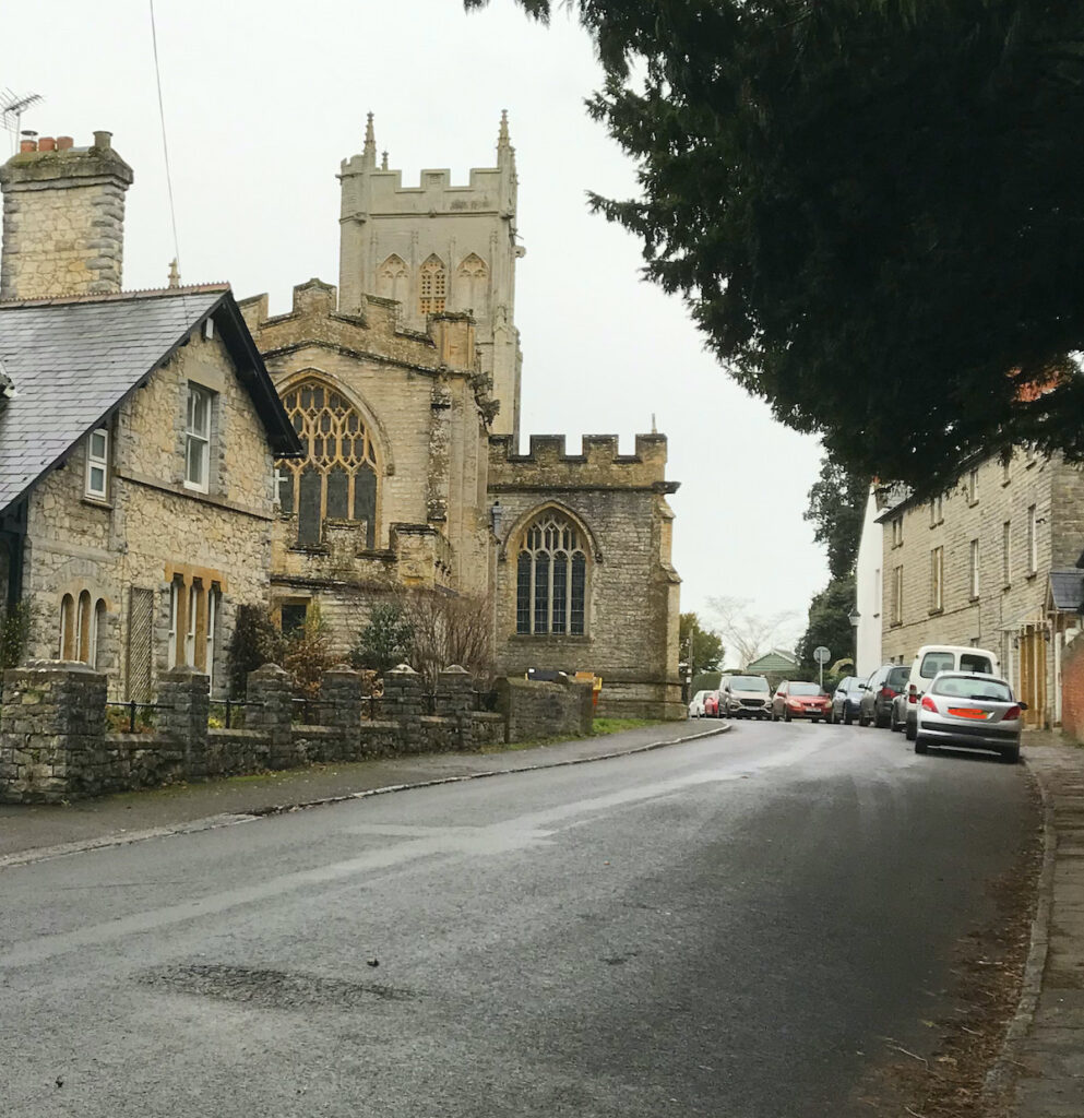
All Saints’ Church, Langport, Somerset. Was this the centre of the Saxon burh?
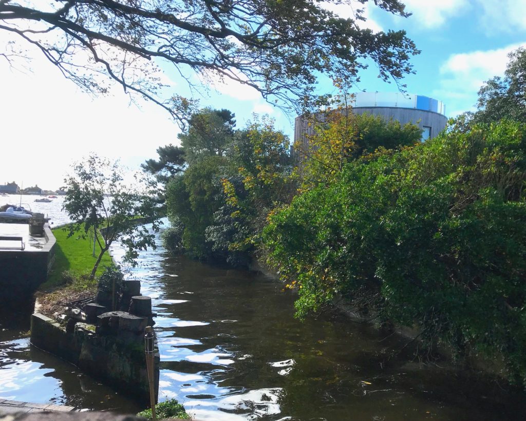
There is little to see in today’s Langport to remind us of its Saxon past, but we can look for clues in things like road layout, the river, the position of the church etc. Langport is not far from Somerton and one of its functions may have been to protect that place, with another function being to act as a port for Somerton, because it is on the Parrett (although note that “Port” can also mean trading place in addition to what we today think of as being a port). The River Yeo flows into the Parrett just south of Langport, which provided it with a connection to another important location – Ilchester. However, we must be careful in this area when describing water courses as the Somerset Levels would have not been drained at this time.
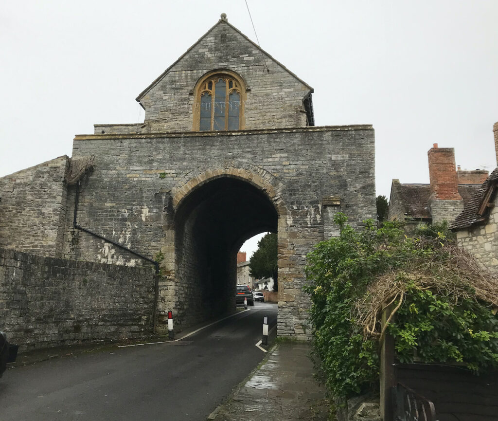
The Hanging Chapel, Langport, Somerset. As seen from the east
It is speculative, but it seems possible to infer a possible Saxon burh on the area around the hill on which All Saints’ Church is located, with the eastern boundary being in line with the Hanging Chapel, the western boundary being at the junction of The Hill and North Street, and perhaps the northern extent being at the end of the pedestrian route called Priest’s Lane.
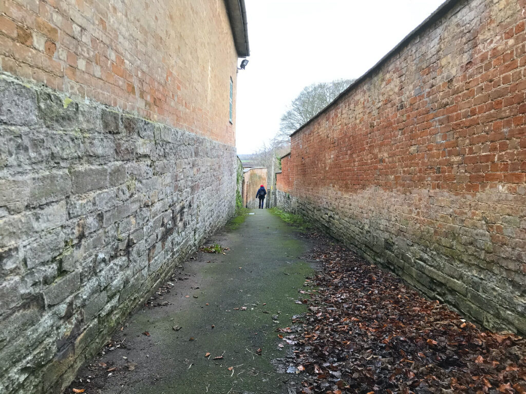
Priest Lane (looking north), Langport, SomersetJunction of The Hill with North Street and Bow Street, Langport, Somerset. Taken from the south side of Bow Street. Is this the site of the West Gate of the former Saxon burh?
This area is, of course, well away from the river and it seems unlikely that there would not have been a settlement near the river as well (wherever that precisely was at that time). Indeed, it has been suggested that the name Langport literally means a long port (with port in this case meaning a trading place), and that this is because there could have been a long market along the long Bow Street. This seems plausible. I have also seen it suggested that the “lang” element is related to the Welsh word for boat (llong). This word may have been part of the Celtic vocabulary so cannot be ruled out, although it seems less likely to me than the perhaps more obvious “long port”.
Bridport has often been thought to be the location of Brydian, a fortified location mentioned in a document called the Burghal Hidage. However, it is by no means certain that this is the case. This post is part of additional materials relating to my book, King Alfred: A Man on the Move, available from Amazon and bookshops. To buy a copy, and support this project, please click on the image below.
The Burghal Hidage is a document drawn up after King Alfred’s post-878AD development of a network of defended burghs (fortified locations). However, it seems that the version that has come down to us dates to his son, King Edward the Elder, because it includes sites such as Buckingham, which were not fortified by the Saxons of Wessex until his reign. Nonetheless, there may have been earlier versions dating to King Alfred’s reign that have been lost to us. Given Bridport’s location on a Roman road extending between the Saxon locations of Dorchester to Exeter, it seems likely to me that it would have been part of King Alfred’s defensive burgh programme. It must be noted that I have seen it challenged that the Roman road from Dorchester to Exeter ran through Bridport (effectively challenging the direction taken by Margery Road 4f when it reached Eggardon hillfort from Dorchester) However, it is thought possible that the A35 through Bridport might still be a later Roman road if not an early one.
However, there are good reasons to question whether Brydian was at Bridport and not somewhere else. Chief among these options is the charming village of Little Bredy, just seven miles west of Dorchester. It is here that the River Bride rises from the earth. The source is dammed to create a beautiful artificial lake.
Looking across the lake at Little Bredy towards Warren Hill
The important point is this. The Domesday Book (1086) shows that Cerne Abbey owned places called “Littelbred” and Langabride”. But when we go back to the founding charter of Cerne Abbey (987AD) we find that these places are called in Latin “Bridian” and “Ulteriore Bridian.” The meaning of “ulterior” is “further away” or “distant.” As I don’t know the answer to the question “further away from what?”, I have adopted the respected expert on place names A.D. Mills’ opinion that Bridian refers to Little Bredy and that Ulteriore Bridian refers to Long Bredy. The charter (S1217) is referred to here and can be read (in Latin) here. Note that although some elements of the charter may be spurious, much of the information may be correct (e.g. the owning of the Bredys is confirmed by Domesday). That neither of these Brydians were Bridport is shown by Bridport having a separate entry in Domesday. Furthermore, at this time Bridport was owned by the king, and not by Cerne Abbey.
It has been suggested that if Brydian had been at Little Bredy, then the fortified site might have been on Warren Hill, where there might have been an earlier Iron Age hill fort.
St Michael and All Angels, Little Bredy
It is worth mentioning here the confusion to be caused by two rivers with very similar names. The River Bride flows from Little Bredy to the coast near Burton Bradstock. The River Brit flows from the north, passes through Bridport and enters the sea at West Bay. It seems that the River Brit was named after Bridport and was originally called the Woth.
The River Bride, flowing west through Little Bredy, Dorset
Another location that I have seen being referred to in relation to this puzzle is the area around Bredy Farm and Bredy North Hill, just to the east of Burton Bradstock (referred to in Domesday as Brideton). However, I think these are just named after the River Bride that flows by here and I can’t see a reason to place this location above Little Bredy in the hierarchy of places that could have been Brydian (with Bridport at the top, as we shall see). Bredy Farm and Bredy North Hill are on OS maps. Bredy Farm is a great place to get some cider and there is a restaurant that I understand is very good.
Looking north east to Bredy North Hill from the road just north of Bredy Farm
So, is it still possible that Brydian could have been at Bridport? I think that the answer is “Yes”. Here are my reasons. Little Bredy is far too close to Dorchester for there to have been a separate fortified settlement there. Bridport is further away (about 15 miles as opposed to 7) and on a significant Roman road. We also know that there was a mint at Bridport in later Anglo-Saxon times and these have inscriptions such as “Bryd”. It seems highly unlikely to me that there would have been a mint at the small location of Little Bredy (or, even less likely, up on Warren Hill). So, if Bridport was Bridian, why was Little Bredy also Bridian (or Brydian)? I believe it is possible that people who lived in the valley of the River Bride (therefore including Little Bredy) moved (or spread) to what we now call Bridport and took their name with them, and that this occurred before the time of King Alfred.
So, taking Brydian to be Bridport, what was this place like at the time of King Alfred. Unfortunately, no Anglo-Saxon defences have been found, but there are a couple of clues. One is the entry in Domesday where we are told that there was a church at Bridport. This would have therefore been Anglo-Saxon (a church at Burton Bradstock – Brideton- is also mentioned). In the absence of any conflicting evidence it seems likely that this church would have been where St Mary’s church now stands.
St Mary’s church, Bridport. Possibly on the site of an Anglo-Saxon church.
It is interesting to note how the land around the church lies between two rivers, something which crops up in other significant Wessex Anglo-Saxon locations (such as Christchurch, Wareham and Reading). The two rivers are the River Brit and the River Asker. It seems to be a good working hypothesis that the Saxon settlement would have extended from this confluence north to at least the east-west Roman road. The confluence is easy to observe from the bridge near Palmer’s brewery.
The confluence of the River Brit (from the left) and the River Asker (from the right). The view is looking north from the bridge near Palmers Brewery.
To conclude, I believe that it is more likely that the Brydian mentioned in the Burghal Hidage was at Bridport. This does not, however, mean that other locations can be ruled out entirely.
On another subject, King Alfred pursued the land-based component of the Viking army from Wareham all the way to Exeter in 876AD. It seems plausible that this pursuit would have taken place along what is now East Street and West Street in Bridport.
Map of Bridport, Dorset, from Hutchins, 3rd Edition (1870)Looking west up East Street, towards the junction with South Street, in Bridport. Did King Alfred pursue the Vikings along this road in 876AD?
This post is one of several sequels to my book on King Alfred. Click on the image to find out more about the book at Amazon.
In 896 there was an engagement between King Alfred’s navy and a Viking fleet of six ships that had arrived at the Isle of Wight and had caused harm all along the coast as far as Devon. It seems that Alfred could not have been present at this engagement because some of the fleeing Vikings were captured and taken to him at Winchester where he had them hanged. The few geographic clues provided by the Anglo-Saxon Chronicles have led to speculation that the engagement took place in Poole Harbour or Christchurch Harbour in Dorset. The Anglo-Saxon Chronicles refer to an ufeweard muða (ð is pronounced “th”) and it has been suggested that this means an “upper harbour.” However, I found it striking that there is an area on the north side of the harbour in Christchurch called Mudeford, with a River Mude running through it and into the harbour. Could this be the muða referred to in the Anglo-Saxon Chronicles?
The River Mude flowing into Christchurch Harbour
Although I have seen it claimed that muða could also mean river, we know from elsewhere in the Chronicles and other documents that rivers were sometimes referred to by their name and that muða appears to usually mean mouth (the similarity between muða and mouth is not a coincidence) with the term for river generally being ea. Furthermore, if muða had been a generic term for river, we might expect to find other survivors such as is the case with the Brittonic language-derived Avon. However, I was unable to find any other examples of a River Mude in England. Update: I have had access to a 1797 map that shows the location as “Midde Ford”, which seems to sever the relationship of the place-name with muða.
My photograph of Christchurch Harbour, Dorset, taken from an aeroplane at dusk.
The Anglo-Saxon Chronicles tell us that Alfred’s ships blocked the Viking ships in so they could not get to the uter mere. It seems unclear to me whether uter mere means “outer lake” or “outer sea”. However, the usual term for the sea in the Anglo-Saxon Chronicles is sæ, with mere usually meaning a lake. Nonetheless, the Vikings had been blocked into the river and when the tide went out three ships were beached at the upper river mouth and three came forward to attack (making six, matching the number recorded as coming to the Isle of Wight). It appears that at least two Viking ships managed to escape from the trap because we are told that two of the fleeing Vikings crews came ashore in Sussex because their ships were in a poor state. King Alfred had these men hanged at Winchester. It has been suggested that they came aground while trying to get past Selsey Bill. These Vikings would therefore have come aground in Sussex somewhere between East Wittering and Selsey. That they came ashore in Sussex perhaps also makes it less likely that the battle had taken place in distant Devon, after which they would have had to round Portland Bill (or drag their boats across the causeway), near Weymouth in Dorset, first.
My photograph of Poole Harbour, Dorset, taken from an aeroplane at dusk
Perhaps the clue to potential locations for this battle lies in the fact that there were only six Viking ships. We know that Wareham (with access to Poole harbour) and Christchurch are listed in the Burghal Hidage (a list of places defended by King Alfred after 878), and would therefore probably have been defended by 896. It does not seem to make sense to me that the Vikings would have ventured close to defended locations with just six ships.
Weymouth, Dorset
Perhaps the Dorset coastal town of Weymouth (not in the Burghal Hidage, so perhaps a weak point) should be regarded as a possible site. Radipole Lake, fed by the River Wey, is connected to the sea via the town harbour, and one of Athelstan’s charters refers to all the water within the coast of Weymouth, indicating that there was an inland body of water here in Anglo-Saxon times. Indeed, it is thought that the Romans may have had some sort of port at the head of this body of water, and a Roman road ran north from near here to Dorchester. At least parts of this route appear to have remained in use today, which suggests that it might have been in use in 896, thus providing access to any Vikings that intended to raid Dorchester. This area is no stranger to Viking threat. In 840 the Vikings landed at nearby Portland, with fatal consequences for the locals, and in 2009, during construction of the Weymouth Relief Road, near Upwey, fifty-four skeletons of executed Vikings were found, although these dated to a later period than that of King Alfred. Because I live near here, I cannot resist drawing to your attention how rich the South Dorset Ridgeway is in ancient, although very much pre-Alfred, sites. For those who are interested in this, I find this blog particularly good.
The Isle of Wight
However, it seems to me that it is more likely that the events took place at one of the main rivers, including the River Medina, that flow into the Solent on the north coast of the Isle of Wight. The Anglo-Saxon Chronicles do not state that the engagement took place during a Viking raid on the coast of the mainland, although it is easy to assume this because the Chronicles tell us that the Vikings had been undertaking such raiding. It is an interesting coincidence that the Old English term for the River Medina was Meðume, not terribly different from muða. An old map of the Isle of Wight suggests that the main waterways may have had constricted entrances to the sea, thus meeting the description of the location in the Anglo-Saxon Chronicles. It seems to me that King Alfred’s Navy, improved after 878 AD, had managed to root out a small Viking base that had set itself up on the Isle of Wight.
My book mentions a few other locations on the south coast that could have been the site of the engagement between King Alfred’s navy and the Vikings. It also contains much more about Alfred’s travels, and contains maps and references. Tap or click the image to learn more.
This post is adapted from my book, King Alfred: A Man on the Move, available from Amazon. It would be great if you could support this project by purchasing a copy.
I was contacted by somebody who noticed that there was a window depicting King Alfred in a church at Busbridge, not far from Godalming in Surrey. At first I thought that this window was just a random dedication to King Alfred, perhaps associated with the celebration of the 1000th anniversary of his death in 1901 (back then they thought he had died in 901 instead of what it is now know to be, which is 899). However, this for me set off a chain of events that led to me exploring Eashing, Godalming and Guildford. Each place was already significant to me in its own right, but there was no record of Alfred having been at any of them. However, when I looked at these places collectively it seemed to me unlikely that he would never have been at any of these places. Let me explain.
King Alfred stained glass window at St John the Baptist church, Busbridge, near Godalming, SurreyFrom the same stained glass window. This shows the now lost church at Tuesley, Surrey, and the well to the left has become Ladywell Convent.
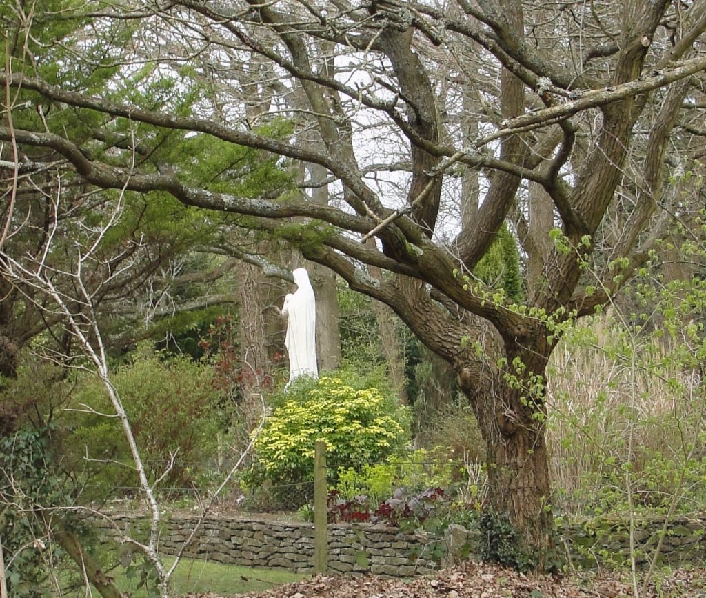
King Alfred’s will includes estates at Guildford, Godalming and Eashing, and the Burghal Hidage (a list of Alfred’s defended settlements after 878, but drawn up under his son, King Edward the Elder) includes Eashing. These three locations are close together and are all on the River Wey, which flows into the Thames. Alfred’s connection to the area is remembered in a beautiful stained-glass window in the already mentioned Victorian church of St John the Baptist in Busbridge, just a couple of miles south of Godalming (there are other stunning windows in this church). He is depicted above an image in the same window of a Saxon church at a place called Tuesley. Tuesley, just to the south-west of Busbridge, is the site of this now lost 7th century Saxon church, and it may be that there was a site of worship here going back to pagan times. It seems that Tuesley derives from the name of the pagan god Tiw , from which we also get “Tuesday”. It has been suggested that the settlement at Tuesley was a predecessor to the settlement at Godalming although, as Tuesley is mentioned in the 1068 Domesday book, the settlement would still have been present in Alfred’s time. The location of this church is now a shrine to the Virgin Mary and is on land now owned by Ladywell Convent. At the time of writing there is access to this location every day except 21st December. It is a peaceful and beautiful site and I highly recommend spending some time there. We know that Alfred was pious and if he was in this area I think he would have come to this significant church. The shrine is on the other side of the road to the convent, and the access is through a gate down a very short track.
The shrine of the Virgin Mary inside a wall depicting the outline of the old Saxon church at Tuesley, Surrey. I have read that this church had been dedicated to the Virgin Mary.
In Godalming there is good evidence that a church on the current site of the church of St Peter and St Paul would have been present in the 9th century , while King Alfred was alive, and it seems plausible that the church would have been associated with the royal estate there. The royal estate may therefore have been in this part of Godalming, potentially around Church Street, to the south of the church. I was told that an archaeological investigation was carried out before some new buildings were built to the south-west of the church and that hundreds of Anglo-Saxon skeletons had been discovered. However, when I visited Godalming’s museum (with its excellent and helpful staff) I found out that more mid to late-Saxon pottery had been found at the site of what is now Waitrose on Bridge Street, than anywhere else in Surrey and it was now thought that the “Royal Manor” could have been at this location instead, which is quite a distance from the church. However, it seems impossible to tell whether particular estates that Alfred left in his will comprised the whole of that named place or just a part of it. In other words, he might have left the whole of Godalming because he owned all of it. In this situation, looking for a separate “Royal Manor” would be a mistake.
Church of St Peter and St Paul, Godalming, Surrey
We cannot be certain of the location of the royal estate at Guildford but it seems most likely that it would have been located where evidence suggests there was a Saxon presence. Indeed, following the argument applied to Godalming, he may have owned all of what comprised Guildford at that time.It appears that the Saxon settlement at this time would have been in the area around St Mary’s church. There is evidence that this church may have been preceded by a timber structure. I was very grateful for the assistance given to me in my research by this church and a local historian, and I thank them here. I found it pleasant to wander around this area,which is essentially around Quarry Street. The remains of Guildford’s Norman castle are also in this area.
St Mary’s Church and Quarry Street, Guildford, Surrey
The main contender for the the fortified site at Eashing is immediately to the east of the famous Eashing Bridges, which are marked on Ordnance Survey maps. There is no public access across the site although a combination of roads and footpaths delineate the perimeter. It may be significant that this site would have been able to defended a crossing over the River Wey at the site of the Eashing Bridges. Today, the location is largely open space, and it is thought that this is because Guildford replaced it as the regional centre.
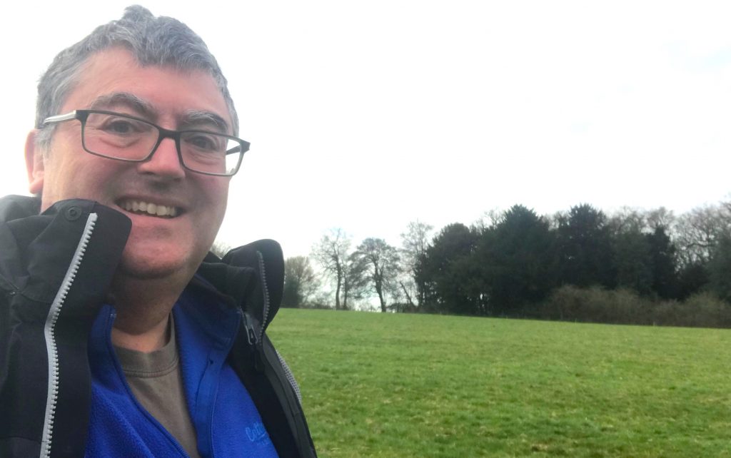
The author at the site of the burgh of Eashing, Surrey
The two sides that have a footpath are easy to find. I parked at the little car park on the other side of the historic bridges,walked across and then up the path leading uphill on the west side. From here I could really appreciate how the burgh would have been in an elevated position above the River Wey. But I could only see the (likely) site of the burgh when I got to the path that runs across the north of the site. It was just an open field, but I found that I could use my imagination. I decided not to follow the road for the two remaining sides of the square as it looked dangerous, with no footpath.
I made a short video about these locations:
There is much more about the travels of King Alfred in my book, including maps and references. To learn more about the book, click or tap the image below.
It would be great if you could support this project by purchasing a copy.
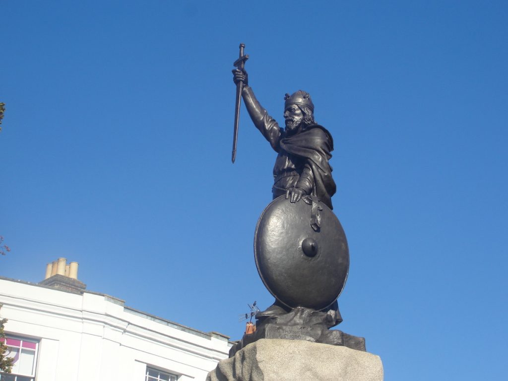
Thorneycroft’s statue of King Alfred the Great in Winchester, Hampshire
Winchester, in Hampshire, is very aware of its associations with King Alfred. But what exactly are these, and what will we uncover if we dig into the detail?
The Anglo-Saxon Chronicles tell us that Winchester had been destroyed by a ship-army in 860, although the attacking forces still lost. Asser (King Alfred’s companion and biographer) tells us that these attackers were Vikings, which perhaps comes as no surprise. However,we do not know where Alfred, who would have been about eleven years old, was at this time.
Although I have seen it implied that Winchester was Alfred’s “capital,” there is little evidence to indicate that Alfred’s court had been centered on a particular location in Wessex. However, we know that Alfred was at Winchester in 896 because he ordered the hanging of captured Vikings after they had run ashore on the Sussex coast. It has also been suggested that Alfred became king in Winchester, although I have seen no evidence to support this.
It seems that there must have been a royal estate at Winchester in Alfred’s time. Alfred does not give any land away at Winchester in his will, although this still allows the possibility that there was a royal estate that was just not owned by him personally, or was somehow under the control of the church instead. Winchester is also listed in the Burghal Hidage, being the account of Alfred’s defended settlements drawn up in the reign of his son, King Edward the Elder. Indeed it shared first place (with Wallingford in Oxfordshire) as the largest settlement in that document. It is indeed possible that the Old Minster (long destroyed – see below) and the royal residence were part of the same complex. It has been claimed that the royal palace was located directly to the west of the Old Minster (and therefore also directly west of the cathedral). I myself once sat on the lawn here (many do) to enjoy my lunch, without having the faintest idea about what might have once been there. As the tourists make a bee-line for the cathedral they may be unwittingly traversing something of competing significance.
The outline of the Old Minster in the lawn adjacent to Winchester Cathedral, HampshireNorth of Winchester Cathedral, and the site of the Old Minster. There isn’t anything left to indicate that the New Minster would have once been here.
Winchester had Roman walls and, although there is some evidence that the area within the walls became depopulated in the early Anglo-Saxon period, it seems that this area may have become repopulated by the time of King Alfred. I have seen it stated that the King’s Gate (or Kingsgate), to the south of the cathedral, had been the entrance through the walls to the royal palace. I have not seen anything to corroborate this, although this is possible as this would have been the closest gate to both the Old Minster and the site claimed to be that of the royal palace. The present gate is a later construction but might be nonetheless on the site or the original gate. It is therefore not beyond the bounds of possibility that King Alfred himself may have walked through here. I strongly recommend the nearby Wykeham Arms as a location in which to consolidate your thoughts. If that is not to your taste then perhaps visit the small church of St Swithun-upon-Kingsgate that is built into the walls above the gate.
King’s Gate from the north. It is possible that there was a gate here in the walls of Winchester in King Alfred’s time, giving access to a royal residence.King’s Gate from the south It is possible that there was a gate here in the walls of Winchester in King Alfred’s time, giving access to a royal residence.
It is generally accepted that what is now called High Street would have been the main street through Winchester in Alfred’s time. Following High Street to the west one comes to the Westgate, which is an impressive structure that includes some Anglo-Saxon fabric. Unfortunately, it isn’t possible to walk a circuit of walls like it is in some other places. However, this did not stop me trying. The most pleasant stretch is to the south-west of the city, where there are actually walls to be seen. These are post-Roman, but generally lie on the route of the Roman walls. Indeed, at one point the wall has been excavated out to show the Roman wall inside. Much of the rest of the route of the wall is covered by buildings, some pleasant and some, in my opinion, quite ugly. There is even a huge multi-story car park on the route.
Winchester Cathedral, Hampshire. From Winkles’ Cathedrals, 1836
At the time of writing the location of the remains of King Alfred is not known. The different religious buildings built at different times can cause confusion in trying to work out the relocations of Alfred’s remains. I therefore hope that what follows will help (alongside the above map). Important to our story are three buildings built close to each other in the centre of Winchester. These buildings, in their order of construction, were the Old Minster, the New Minster, and Winchester Cathedral. Today, the only building that remains is Winchester Cathedral. The Old Minster was just north of the current cathedral, and it is the outline of this building that you can see marked out today on the cathedral lawn. The New Minster was built in the reign of Alfred’s son, King Edward the Elder, to the north of the Old Minster, and he had his father’s remains interred there. However, the New Minster was not consecrated until 901, and Alfred, who had died in 899, was therefore initially interred in the Old Minster while the New Minster was being built. It had been King Alfred’s intention to have the New Minster built in his reign but by the time he died he had only managed to obtain the land. This is why the job of building the New Minster fell to his son. Alfred’s remains were joined in the New Minster by those of his wife Ealhswith when she died in 902. The Old Minster continued to exist alongside the New Minster until the cathedral was consecrated in 1093. The Old Minster was then demolished.
I have provided a short video here:
In 1109 Henry I ordered that the New Minster be moved to land that he had provided at Hyde, which was just outside Winchester at this time. It is possible that the New Minster had suffered from a fire prior to 1109, which might have made the move opportune. Or perhaps Henry I did not want the Saxon New Minster crampimg the style of the gleaming new Norman Winchester Cathedral. The re-located New Minster would then become known as Hyde Abbey. The blog post for Hyde Abbey and the mystery surrounding King Alfred’s remains (Winchester, Part 2) is here.
A perfect place to consolidate one’s thoughts.The Wykeham Arms pub in Winchester, just outside the course of the Roman walls of Winchester
Winchester did not suddenly have greatness thrust upon it at the time of King Alfred. According to version F of the Anglo-Saxon Chronicles, a minster at Winchester was established in 648. In around 660 it became the episcopal seat of the diocese of Wessex, replacing Dorchester-on-Thames. Bede tells us that the remains of the missionary Birinus were transferred here as well while Hedde was bishop, giving us a date range of 649 (around when Birinus died) and 703 (when Hedde died). I argue elsewhere that Sherborne may for a period during King Alfred’s life have been as important, if not more so, than Winchester. However, before and afterwards this would have not been the case, and even during that period Winchester would have remained very important. That it was the seat of the important Swithun is an indication of this.
Winchester Cathedral, Hampshire. From Winkles’ Cathedrals, 1836.
It can be reasonably asked – Why was it that Winchester became so important and not somewhere else? There are no doubt geographical reasons, but I also boldly suggest that it may have been the first settlement of any large (for those times) size made by the Saxons who came to this part of Britain.
There is much more about the travels of King Alfred in my book, including maps and references. Tap or click on the image below to learn more about the book.
The writings of a man called Æthelweard tell us that that Alfred besieged London in 886, and another early writer called Henry of Huntingdon suggested that an opportunity had arisen because the Viking presence had been weakened as a result of some having left to join Viking forces on the continent. Although The Anglo-Saxon Chronicles and Asser record Alfred in London at this time, neither source mentions that Alfred had taken London by force. The Chronicles also tell us that in the same year Alfred entrusted London to his son-in-law and ruler of Mercia, Æthelred. London had been a Mercian city and there may have been some resentment after it had been taken over by Wessex, with this being defused by Alfred handing it over to Mercian Æthelred in order to control on behalf of both of them. We know from the Anglo-Saxon Chronicles that London had been under Viking occupation in 871 when they had moved there from Reading. However, the Chronicles also tell us that these Vikings left for Northumbria in 872, and it was perhaps this that subsequently allowed Alfred to start to extend his power to London. Indeed, there is evidence from coins suggesting that London may have been under Alfred’s protection as early as the late 870s.
Where was London?
But what was this London that Alfred was gaining control over? It has been suggested that after Roman control ended the population left the fortified area at the current site of the City of London and went to a place called Lundenwic, approximately 1 mile to the west, perhaps because this provided easier access to a ford at Westminster. The wic element of Lundenwic persists in the modern name Aldwych. It appears that people later moved back to re-use the earlier Roman fortifications (as also appears to have happened at Winchester), and it seems plausible that this move had been triggered by Viking attacks. So, when Alfred took control of London it could well have comprised what is now the City of London and the area around Aldwych, with the two settlements connected by what we now call Fleet Street. There is also evidence of a high status Saxon site at Whitehall, although this seems to have fallen out of use about the same time as Aldwych.
The Queenhithe mosaic on the north bank of the River Thames, London. There would have been a dock here in King Alfred the Great’s time.
It is thought that Alfred restored London after 868 and it has been suggested that the site of the restored Alfredian burgh extended along the north bank of the Thames from near Queenhithe in the west to near Billingsgate in the east, and extending inland by about 300m. It is interesting to note that this area only occupied a small part of the Roman walled area, but in Alfred’s time much space might have been taken up by crops and livestock. Much of this stretch along the river can be walked and for me the most interesting location is Queenhithe, where there are some information boards and one can look out over what would have been a dock in Alfred’s time. It is a great place to stop and think about the Saxon history of London. Queenhithe is named after Matilda, the wife of King Henry I, but the location had previously been called Æthelred’s Hithe, named after king Alfred’s son-in-law.
Queenhithe, on the north bank of the River Thames in London, with the Millennium Bridge and Tate Modern in the distance. There would have been a dock here in King Alfred the Great’s time.
It may be that the administrative centre of London at Alfred’s time was somewhere near Aldermanbury. If this is the case then it seems likely that Alfred would have been there at some point. However, this is based on the presence of the Old English burh in the place name, and it is not known whether this was acquired after the time of King Alfred.
The ward of Aldermanbury, London.
Aldermanbury is immediately to the north-west of the current Guildhall, with Wood Street running north-south through the middle of it. It is possible, based on the 13th century Matthew Paris quoting an 11th century source, that there had been a Saxon royal palace at Aldermanbury near the site of the former church of St Alban on Wood Street. This does not allow us to confirm that it was there when Alfred was alive, but there must have been at least one royal residence and there are few other potential locations within the circuit of London’s walls (another being the site of the former Roman praetorium, the remains of which are largely under Cannon Street station). This church was a victim of the 1940 Blitz and all that remained, with the exception of the tower, was demolished in the 1950s. The tower, now a private residence, still stands in splendid isolation in the middle of Wood Street. if it was still standing, the church would extend eastwards into where the police station is located.
Also perhaps of significance is that this was in a particularly important part of Roman London, being within the outline of the Roman fort, and also very close to the Roman amphitheatre. You may not wish to miss the remains of the amphitheatre, which are located beneath the Guildhall Art Gallery. It is also possible that the walls of the Roman fort were still intact, and this square area at the north-east aspect of the walled city might itself have served as a base (more details on this, with a map, in this post). There is some evidence that there may have been royal palaces at Brentford and Chelsea in the 8th century, but whether these were still in service at the time of King Alfred is not known.
St Alban’s bell tower, Wood Street, London. Inside the outline of the Roman fort. Was there a Saxon royal residence here?
A predecessor to St Paul’s would have been present at or near the site of today’s cathedral, as this had been founded in 604. All Hallows by the Tower shows evidence of Saxon work, so it is possible that a church was also standing there in Alfred’s time.
The north bank of the River Thames, looking east towards London Bridge
Southwark is mentioned in the Burghal Hidage, issued in the reign of Edward the Elder (Alfred’s son) after Alfred’s death, so it seems likely that there was a burgh in place here on the south side of the Thames before Alfred died. Indeed, it is possible that a London Bridge, as a replacement or a repair of the earlier Roman structure, may have been built, perhaps during Alfred’s lifetime, in order to connect the two burghs on either side of the river and to act as a defence against Vikings trying to proceed upstream.
King Alfred may have also been at Chelsea in 892, 898 or 898 (it depends on which reading of a particular charter one is looking at. The one in Corpus Christi, Cambridge has 892. The one from Lambeth Palace has the other dates. The transcription, in Latin, of the Lambeth Palace document is here). I have some concerns about how what seems to be Chelsea is spelt in these documents, which makes me shy away from saying for sure that he was there. It seems to me, however, that it was more likely than not.
It have seen it suggested that Lothbury (a street in the city of London) may have had its name derived from the 7th century King Hlothere of Kent, and that this may indicate that there was some sort of royal function taking place there. However, this does not seem to fit well with evidence that most of the population of London at that time would have been at Lundenwic.
St Paul’s Cathedral, London. From Winkles’ Cathedrals 1836Thames Embankment, London. From Illustrated London News 1856. Looking east. The dome is that of St Paul’s. To the left, back from the river, are the Strand and Aldwych areas.St Paul’s Cathedral, London. From Winkle’s Cathedrals, 1836
I hope that you enjoyed reading about these important events in the history of London. There is much more about the travels of King Alfred in my book, including maps and references. Tap or click the image below to learn more about the book.
This post is adapted from my book, King Alfred: A Man on the Move, available from Amazon. It would be great if you could support this project by purchasing a copy.
The location is close to where the River Tone flows into the River Parrett , and it is important to note that the River Tone runs past Athelney, where King Alfred was hiding out in 878. The location would therefore have been strategic for defending Athelney. It is possible to see Burrow Mump from Athelney and, of course, vice-versa. The location is also close to where the River Cary once joined the Parrett, although the Cary now runs into King’s Sedgemoor Drain to the north. It should be noted, however, that particularly in Winter and Spring (covering the period when Alfred was at Athelney), the concept of getting to Athelney by travelling down the Parrett and then the Tone would have made no sense, as the area would have been largely flooded, making individual rivers indistinguishable. There is a half built 18th century church atop Burrow Mump, which is incomplete because funding ran out, and the structure is now a war memorial. However, there is evidence of earlier building going back to the 12th century. There is a car park, and those who walk up the steep incline are rewarded with great views.
The unfinished church atop Burrow Mump, Somerset Levels
An interesting story was toldto me regarding the King Alfred pub in Burrowbridge. This related to a three-legged so-called “Alfred Table.” Although I was told that it was eventually dated to be much more recent, it still apparently sold for a handsome sum to an American.
Asser tells us that the fortress on the western summit of Athelney Hill was connected to another fortress by a causeway. This second fortress appears to have been at the settlement of East Lyng which, like Athelney, was on higher ground. However, it is important to note that Asser tells us about the causeway and the second fortress in relation to the later founding of a monastery at Athelney by Alfred. There appears to be no evidence that the fortress at Lyng or the causeway were present in 878. The monastic foundation was developed around 893, and the causeway may have been built to facilitate access to and from this. The second fort may have been built as part of Alfred’s defence programme, which he started after 878.
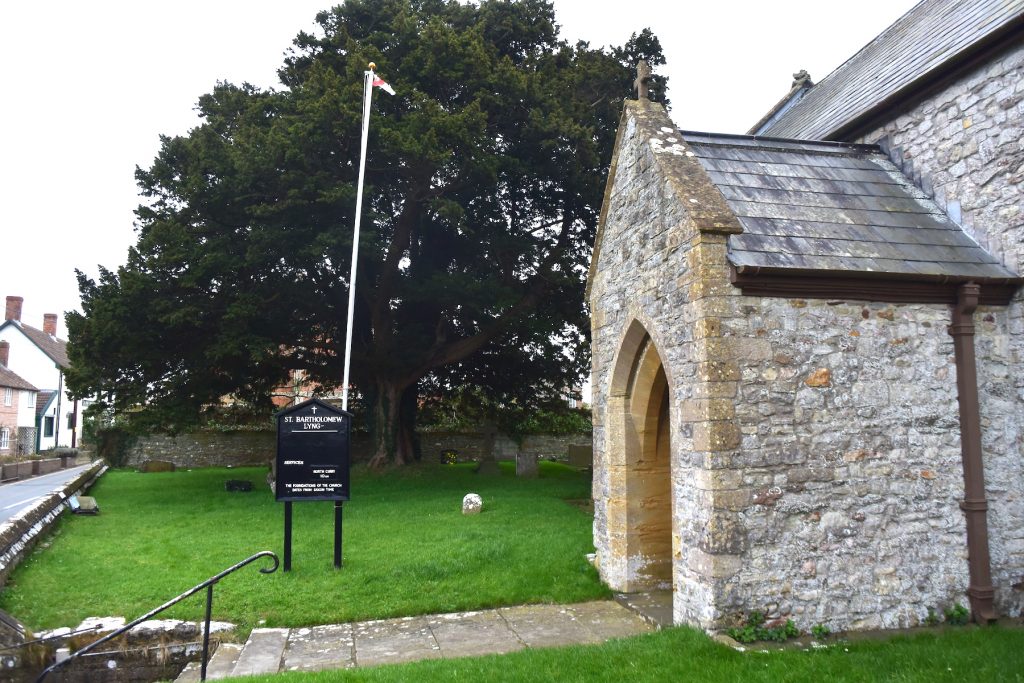
St. Bartholomew’s Church, East Lyng, Somerset Levels
I wondered whether it was possible to see any remains of this second fortification. Whilst not being able to specifically find the fortification it was possible to find evidence of the burgh’s perimeter. Lyng is named in the Burghal Hidage, and a bank and ditch to the west of East Lyng may be the remains of the western perimeter of the burgh defences. I saw it suggested that this ditch and bank was in line with the east wall of St Bartholomew’s church. So, after struggling to find a parking place for the church, that is where I went, and I could indeed see what looked like possible earthworks in the field to the south of the church. I could not explore further because the field appeared to be private land. Fortunately, the presenters in the first ever episode of Time Team (here) appear to have gained access and their programme confirmed that I had indeed been looking across at the correct spot, although the alignment appeared to be more with the the west wall of the church! The bank and ditch would have extended north on the other side of the A361, but there appears to be nothing left to see there. It seems likely that the eastern boundary would be near Cuts Road, and the causeway itself, although the causeway could have taken a different line in Alfred’s time. Therefore it seems that most of the settlement of East Lyng might be sited within the burgh developed by Alfred.
The Balt Moor Wall, between Athelney and East Lyng on the Somerset Levels.
I also wanted to investigate the causeway between Athelney and East Lyng recorded by Asser. There is a structure which can still be seen that goes right up to Athelney Hill. Coming from East Lyng one drives over the first section, and it then passes onto private land (with the route of the causeway remaining visible). This structure is now called the Balt Moor Wall. I have not seen any reference that dates this to before the 12th century, so we cannot be sure that the causeway that we see today follows precisely the same route as it did in King Alfred’s time.
There is much more about the travels of King Alfred in my book, including maps and references. To learn more about the book, click or tap the image below: