Saxon Exeter: King Alfred

This post on Saxon Exeter at the time of King Alfred is adapted from my book, King Alfred: A Man on the Move, available from Amazon. Please also scroll down for my Youtube video on Exeter.

The Anglo-Saxon Chronicles tell us that in 876 King Alfred pursued the land-based Vikings that had fled from Wareham (Dorset) to Exeter. However, their accompanying navy lost 120 ships in bad weather near Swanage (Dorset). Alfred was unable to catch up with the fleeing land-based Vikings before they got to Exeter. On reaching Exeter the Vikings secured themselves in a fortress, but their situation does not appear to have been particularly positive, perhaps because of the large loss of ships, and they settled for peace with Alfred. After over-wintering (permission to do this being presumably part of the peace settlement), the Vikings left Exeter and went to Mercia, and specifically to Gloucester according to a chronicle written by Æthelweard.

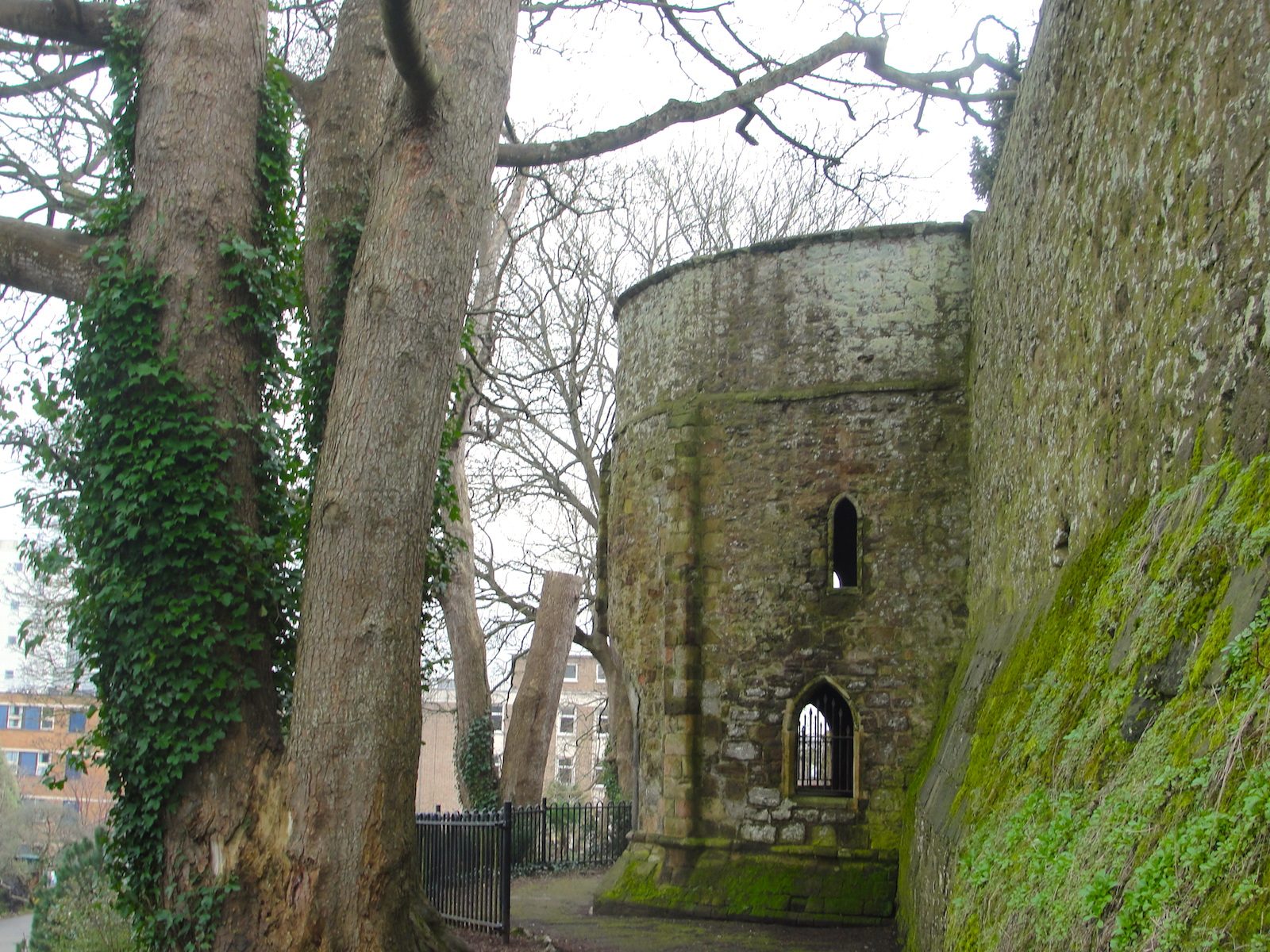
I asked myself whether it was possible to work out from the available information where exactly in Exeter the Vikings went. The Anglo-Saxon Chronicles imply that the Vikings occupied a fortress that had already been there, as opposed to building one when they got there, as they would do in Rochester, in Kent, in 884. Exeter’s Rougemont Castle goes back to 1068, so we are looking for something else, but perhaps this would have been on the same site as Rougemont Castle. The case for this is strengthened by the discovery of Anglo-Saxon masonry at Rougemont Castle.

Walls at Exeter, Devon, where Saxon masonry found. The path leading up to Athelstan's Tower in Northernhay Gardens.
A section of the walls at Exeter where Saxon masonry has been found. This is the path leading up to Athelstan’s Tower in Northernhay Gardens.

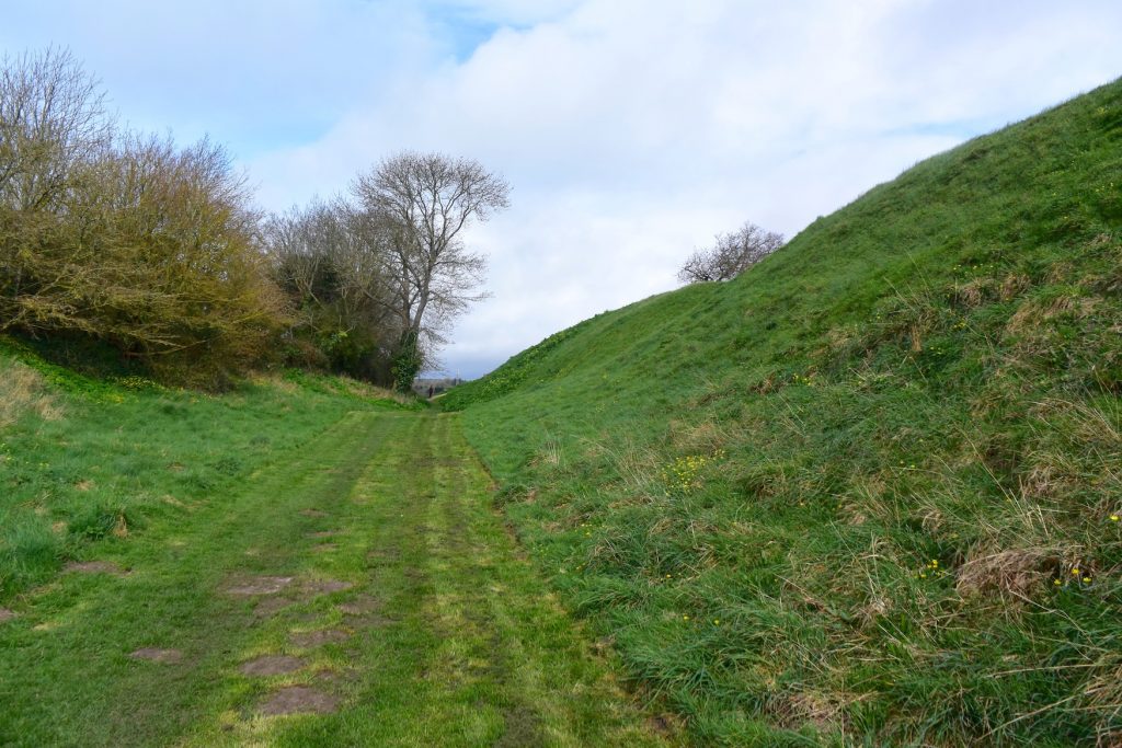
We also know that Exeter had (and largely still has, although much repaired) Roman walls with four entrances and it appears that these were repaired and strengthened in Anglo-Saxon times. The Old English of the Chronicles says that the Vikings came into Exeter, which fits with the idea that the Vikings had managed to get into Exeter through one of the four entrances in the walls and then either occupied a fortification within the walls, or used the walls themselves as a fortification. The length of the circuit of the walls was would have stretched the Viking troops, but with only four entrances, it may have been possible for them to secure the site. I feel that it is more likely that the depleted Viking force took over a fortification within the walls rather than the walls themselves, and it seems to me that the site of (or part of the site of) Rougemont Castle would have been the most likely location for this fortification. From Northernhay Gardens elements of Anglo-Saxon construction in the remains of the wall can be seen. It is thought that King Athelstan (King Alfred’s grandson) restored the city walls in around 928. The site of Rougemont Castle is now called Exeter Castle, and is a commercial enterprise.

It is possible that the land-based Viking contingent, with Alfred in pursuit took the Roman road to Bridport via Dorchester and then the Roman road that now approximates to route of the A35 to Honiton, and then finally the Roman road that is more or less on the current route of the A30 to Exeter. Alternatively, they could have branched off this route onto another Roman road near Charmouth in order to reach Exeter via Colyford and Sidford, approximately following the route of the current A3052. It seems likely that these routes would have been in use in Alfred’s time, because much of these routes have persisted from Roman times right through to today. It also seems likely that the best available route would have been taken by both parties as, speed would have been important, and these would probably have been the remaining Roman routes.

Plaque marking the location of the South Gate in the walls of Exeter
A plaque marking the location of the South Gate in the walls of Exeter, Devon

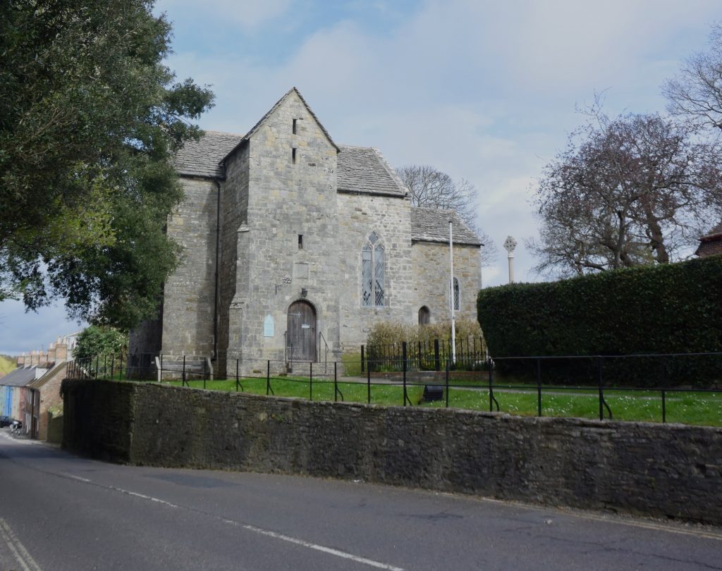
It seems that either route would have brought them to a gate to the south-west of the walled city at a spot that is towards the southern end of South Street of today’s Exeter. There is still some wall there today (and a plaque) to help you find the precise spot. This South Gate must be, therefore, the most likely point of entry for the Vikings, and also for King Alfred in pursuit, in 876. Unfortunately, there is no gate present there now as, after serving as a prison, it was finally demolished in 1819. Nonetheless, it is possible to explore on foot how these routes come together just outside the former location of the South Gate. If you do make it down here, there are other places of interest such as the old Eye Hospital and the Dissenters’ Graveyard.

The South Gate of the walls of Exeter, Devon. Outline marked in pavement.
The South Gate of the walls of Exeter, Devon. The markings in the pavement referred to by the plaque in the previous image.
The former location of the South Gate in the walls of Exeter, Devon.
The former location of the South Gate in the walls of Exeter, Devon. Just follow the line of the wall across the road

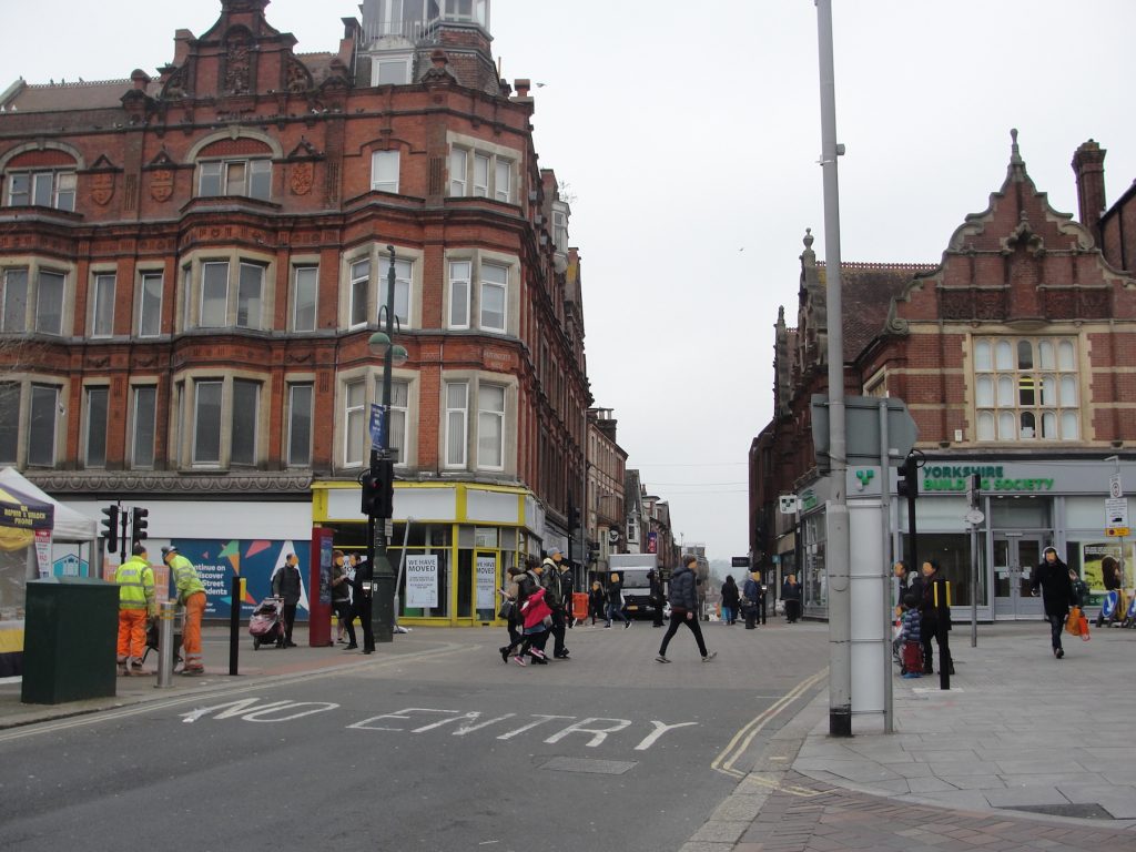
Having come through the South Gate, and with Rougemont Castle (as it was later called) at the extreme north end of the walled city, Alfred would have needed to cross the centre of Exeter. Although these events took place prior to Alfred’s post-878 rebuilding programme, it seems likely that there would have been a road leading from the South Gate up to the main city intersection where today South Street, North Street, Fore Street and High Street meet. It seems that High Street would have been present in Alfred’s time, and this leads in the general direction of Rougemont Castle. I therefore suggest that, if the Vikings were at the location of Rougemont, Alfred and his troops would have proceeded up what is now South Street and turned right on to what is now High Street, with the land-based Vikings having taken the same route just a short time before. Any surviving sea-borne Vikings would have made their way up from the harbour, via the West Gate or perhaps via a lost Roman gate in the wall nearer to the port (the Water Gate may have been a later development not present in Alfred’s time). They may have even disembarked at nearby Topsham and then made their way, like the others, to the South Gate.

Exeter, Devon. Ancient crossroads.  From South Street, looking across to North Street, with High Street to the right and Fore Street to the left.
Exeter, Devon. It is likely that roads crossed here in the time of King Alfred. This is where South Street, North Street, Fore Street and High Street meet. The photo is taken from South Street, looking across to North Street, with High Street to the right and Fore Street to the left.

There is a reference in the Anglo-Saxon Chronicles to King Alfred heading again to Exeter in 893. While on his way to assist his troops that were besieging a Viking contingent near London, he received word that other Viking forces had landed in North Devon and that Exeter, in South Devon, had also been besieged. Alfred and his troops therefore diverted towards Exeter. There are no records of any engagement with the Vikings either at Exeter or in North Devon at this time, although the Anglo-Saxon Chronicles do imply that he got there.

It is worth noting that in 1003 the Vikings stormed (the word used is abrocen) Exeter. It seems that this would have been much worse than anything that happened in King Alfred’s time (see versions E and F of the Anglo-Saxon Chronicles).

Many thanks to BBC Radio Devon and The Voice (Barnstaple) for having me on air to talk about my book and Saxon Exeter at the time of King Alfred.

There is much more about the travels of King Alfred in my book, including maps and references. Tap or click the image of the front cover below.

King Alfred and the history of Wareham

This post is adapted from my book, King Alfred: A Man on the Move, available from Amazon.

The history of Wareham is fascinating and the town and nearby Poole harbour are lovelyplaces to visit. However, not everybody will be aware of the dramatic events that took place here in the 9th century.

Wareham Quay, the Purbecks, Dorset, viewed from the south bank of the River Frome. The Vikings may have disembarked here.

Wareham had been occupied by the Vikings in 875, but Alfred  made piece with them in 876 when the Vikings swore on the halgan beage (holy ring) that they would leave Wessex. However, they left under the cover of darkness and went instead to Exeter, in Devonshire but also part of Wessex. The Anglo-Saxon Chronicles tell us that the Vikings had  given hostages to Alfred as part of the deal, and that these men had been the worthiest in the Viking army. We cannot be sure if this ring was presented in the negotiations by Alfred or by the Vikings, or who it was “holy” to, if not to both parties. It is possible that either the Vikings or Alfred had access to a holy ring as they travelled from place to place. If it was a Viking ring, then Alfred clearly must have had the upper hand to make them swear on it, which would fit with the fact that Alfred was also given important hostages, which could be killed if the Vikings reneged on the deal. The Vikings must have seen Exeter as a great prize if it meant sacrificing  their worthiest men. One can imagine how the Vikings might have viewed the subsequent loss of 120 ships near Swanage in a storm as they fled to Exeter as divine retribution for breaking an oath sworn on a holy ring.

On balance it seems to me that this ring was presented by Alfred. The Anglo-Saxon Chronicles refer to it as “holy” and it seems unlikely to me that something un-Christian would be referred to in this way.

Wareham, the Purbecks, Dorset. A view of Lady St Mary's church from the south bank of the River Frome. Was this the heart of early to middle Saxon Wareham?
Wareham, the Purbecks, Dorset. A view of Lady St Mary’s church from the south bank of the River Frome. Was this the heart of early to middle Saxon Wareham?

But, what was at Wareham when the Vikings attacked? Asser describes Wareham as a castellum (fortification) and the location of a convent for nuns. We know that Alfred embarked on a programme of defending settlements after 878 and it is thought that the origins of the walls that we see today were built then, although we know that they were modified over subsequent centuries. The fortification referred to by Asser is therefore probably not the same as the walls we see today. Castellum could also relate to an ancient or Roman construction, for which there is no remaining evidence, or even Saxon pre-878 defences developed because of a specific risk of Viking attack.

Wareham, the Purbecks, Dorset. The north stretch of the Saxon wall, with the River Piddle disappearing off to the west.
Wareham, the Purbecks, Dorset. The west section of the town's Saxon wall
Wareham, the Purbecks, Dorset. The west section of the town’s Saxon wall

However, things become even more complicated when we look at Æthelweard’s chronicle. He describes the Vikings moving down from Cambridge to near  (iuxta) Wareham and occupying a location alongside (coniecit statum communem cum) a Western Army. There appears to be a significant difference between Æthelweard and Asser as the latter states that the Viking army enterred (intravit) the castellum of Wareham. However these two sources may just be providing two snapshots of a sequence. Taking it all together it appears that the Vikings camped outside of the settlement of Wareham and then took it over, perhaps after besieging it.

But where did the Vikings camp and how did they get there? We know that there must have been a combined land and sea force because that is what left Wareham when they fled to Exeter. We also know that the seaborne force must have been considerable because the Vikings lost 120 ships in a storm near Swanage when fleeing. The ships must have come in to Poole harbour, and perhaps they would have taken some ships up the Frome in order to get closer to Wareham. Presumably, with that many ships, they would have defended their rear by perhaps occupying Brownsea Island and the harbour entrance. This would have been a most serious situation. Try to imagine today over 120 Viking ships in Poole harbour. In fact there would have been more than this as 120, the only figure that we have, is the number that sunk in the storm of Swanage. It is unlikely that all Viking boats had sunk. And on top of this was the  land-basedViking army. It is difficult to see that the native settlement at Wareham would have had a chance. The Vikings broke their oath when they fled to Exeter, but Alfred’s intervention had saved Wareham, and we must remember that when the Vikings got to Exeter they had to deal with Alfred again, and this time they did leave Wessex.

How the Viking land-based forces got to Wareham must be very speculative. There may have been a Roman road from Wareham to Woodbury Hill, near Bere Regis. This may have been in use in Alfred’s time because there is still today a straight road that heads in that direction. However, this seems to be in the wrong place (being north-west instead of north-east) if they had come from Cambridge. There is nothing to indicate where Alfred had travelled from.

The nearby church of Lady St Mary, although subject to much rebuilding, has an important history going back to at least the 8th century. Inside the church are several pieces of masonry that are dated to Anglo-Saxon times.

Wareham, the Purbecks, Dorset. Lady St Mary's church. There would have been a church here at the time of King Alfred the Great.
Wareham, the Purbecks, Dorset. Lady St Mary’s church. There would have been a church here at the time of King Alfred the Great.

Another important location in the history of Wareham is the very old St Martin’s church, . This church is generally locked outside of the main tourist season, but there is usually an indication of where to get the key in normal trading hours (it is kept in a shop). It is thought that the current building dates to about 1030. The church also contains important 12th century wall paintings.

Wareham, the Purbecks, Dorset. St Martin's church
Wareham, the Purbecks, Dorset. St Martin’s church

One version of the Anglo-Saxon Chronicle (E) tells us that King Edward the Martyr was initially buried at Wareham after he had been murdered at nearby Corfe in 978. Although he was later transferred to Shaftesbury, his initial burial would probably have been at or near the site of St Mary’s church. The “A” manuscript of the Anglo-Saxon Chronicles tells us  that King Beorhtric of Wessex had died in 802 and the entry for 786 tells us that his body lies at Wareham (confusingly telling us where his remains are before telling us that he died). The Anglo-Saxon Chronicles for this period are thought to have been composed in the very late 9th century, so it seems that he was not translated in the intervening period to Shaftesbury, Wimborne or Sherborne. The implication is that Wareham may have been a much more important place than it seems to us now. Perhaps Viking raiding had something to do with its loss of status, although it should be born in mind that by the time of the Domesday survey Wareham had two moneyers.

This was not the last that Wareham would see of the Vikings. They attacked Dorset again via the Frome, which then runs past Wareham, in 998 and 1015.

A sword was found in 1927 while widening a bridge. This sword is thought to be Saxon, but some have indicated that it might be Viking. There are inscribed stones in Lady St Mary’s church that are believed to derive from the 7th to 9th centuries (RCHM Dorset, Vol2 Part 2). Unfortunately, what remained of the Saxon church was demolished in 1842. It is thought to have been of a similar size to the current church (RCHM Dorset, Vol2 Part 2). It must have been an impressive Saxon church, sadly no longer. 

You can view my short video on Wareham here:

There is much more about the travels of King Alfred in my book, including maps and references. Click or tap on the image below to learn more about the book.