
This post is one is one of many providing additional materials relating to my book, King Alfred: A Man on the Move, available from Amazon and through bookshops.

In his will, King Alfred left an estate at Carhampton (as Carumtun) to his son and successor, King Edward the Elder. This by itself makes it an important place, but then we must add the two recorded Viking raids, one in 836 when King Egbert, Alfreds grandfather, fought against 35 (in one version of the Anglo-Saxon Chronicles it is 25) ship-loads of Vikings, with the Vikings winning amidst great slaughter. The other engagement was in 843, when King Æthelwulf (King Alfred’s father) fought and lost against another 35 ship-loads of Vikings at Carhampton. It perhaps should be noted that in the Old English of the Anglo-Saxon Chronicles, what is actually said is that the two engagements with the Vikings took place æt Carrum. It seems that all prominent historians take Carrum to be Carhampton. Although I see this as likely, it should be pointed out that it is not proven. It is argued that the place-name derives from the Old-English word Carr, meaning “rock”, with the dative plural being Carrum. So æt Carrum translates to “at the rocks”, meaning that the uninflected place-name of Carhampton (e.g. how it would appear in a list etc) at the time would have been something else, perhaps Carras. It makes me slightly uncomfortable that the word Carr for rock is mainly associated with Northumbria. By Domesday it is called Carentone. For the time being at least, let us side with the mainstream and take Carrum to be Carhampton.
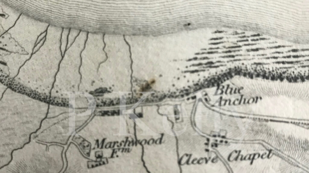
The most obvious landing site for an attack on Carhampton would be Blue Anchor Bay, just a short distance to the north. A 1809 map shows a location called “Blue Anchor” This shows on later maps to probably be the building that became the Blue Anchor Pub (sadly closed when I passed in 2022). I understand that Blue Anchor Bay was once known as Cleeve Bay. This would have been associated with Chapel Cleeve, which was the site of a chapel dedicated to St Mary and built by the monks of nearby Cleeve Abbey. Apparently this chapel replaced one that had fallen into the sea. However, Cleeve Abbey (and therefore the churches referred to above) are post – Norman conquest and would have not been present in the Saxon period.

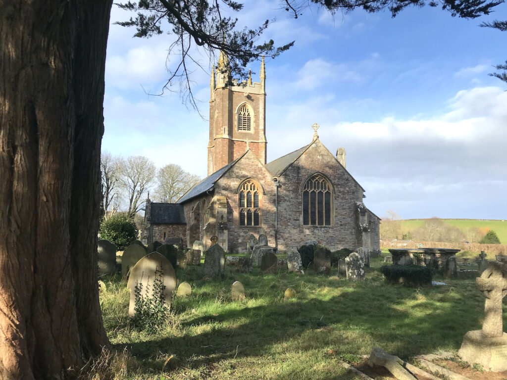
So, what was Carhampton when it was a royal estate, and what did it constitute when there was a battle with the Vikings there. There is little guidance above ground so we have to look for clues. The area around a parish church usually provides a strong clue, but in this case the older church has been demolished (two churches co-existed for many years, with the current church of St John the Baptist dating to the 15th century, although much rebuilt) and tracking down its location proved problematic. My starting point was that I was informed that it was to the east of the current church. Here is perhaps the best point to refer you to an excellent write up by Historic England of what was found in this area. The link (with map) is here. You will see that there is significant and substantial evidence of Saxon occupation between the current church and Eastbury Farm. The area of occupation may have been larger. As always with archaeology, we know far less about areas that have not been investigated). The findings included a cemetery, containing an estimated “several hundred” burials, and evidence of settlement and metalworking. The pottery finds were thought to probably indicate either a high status or a monastic site.

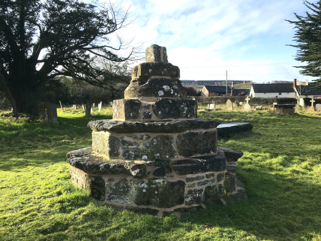
Although we are told that the church of St John the Baptist is fifteenth century (but much rebuilt) it is notable that what remains of a cross in the churchyard is dated by Historic England to about 14th century (link here). Perhaps the church of St John the Baptist is older than 15th century.
It seems that the last record of the older church was by Leland in 1540. Based on the pottery sherds it seems that the higher status part was at or near the Eastbury Farm buildings and to the north of the road there. It therefore seems likely that the Carhampton royal estate was focused on this area. The two battles against the Vikings may have been due to a raid on this site.
Carhampton is also an important location in the legends surrounding St Carantoc. We are told that he founded a monastery at Carhampton after defeating a dragon. While elements are clearly fanciful (i.e. the dragon), the presence of Carantoc and a monastery may not be. It has also been suggested that the name of Carhampton derives in some way from Carantoc.