Watchet in Somerset – a Saxon Settlement

This post is one of several providing information on places not necessarily covered in my book, King Alfred: A Man on the Move, available from Amazon and bookshops.

Watchet is on the North Somerset coast, and is a great place to visit, irrespective of its connections to the Anglo-Saxons.

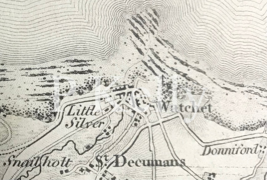
There is no record of Alfred having been at Watchet, although this by no means rules his presence out at some point. Watchet was listed in the Burghal Hidage as Weced and is also referred to in the Anglo-Saxon Chronicles as Wæced. Although this document in the form currently available to us was drawn up under King Alfred’s son, King Edward the Elder, it seems likely that Weced would have also been there at the time of King Alfred, and may indeed have been part of his post-878 improvement of Wessex defences against the Vikings through the development of fortified settlements (burhs). Other listed burhs in Somerset are Watchet, Axbridge and Lyng . Bath is also included, but this might not have been in Somerset in King Alfred’s time.

“Yankee Jack” at the harbour, Watchet, Somerset.

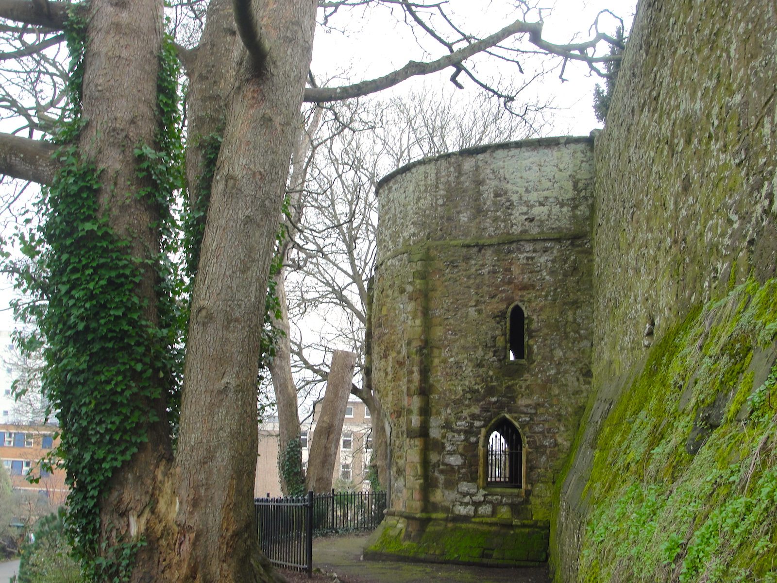
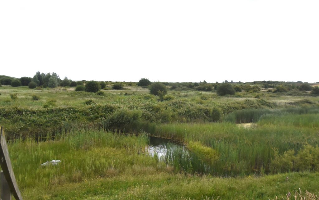
Watchet was clearly vulnerable and a target. The Anglo-Saxon Chronicles tell us that in the harvest-time of 914, in the rule of Edward the Elder, King Alfred’s son, the Vikings landed at night east of Watchet but were repelled by the Saxons and fled to either Steepholm or Flatholm, before crossing to Wales and then Ireland. It is important to note that Weced may not have been where Watchet is today. It is thought that the defended settlement was at what is now called Daw’s Castle, which is on the Coast Path a little to the west of today’s Watchet. It occurs to me that the attack of 914, which we are told took place to the east of Watchet, might just mean that it took place at what is now Watchet harbour. Points further east are, of course, still possible. Although Weced was probably at Daw’s Castle it seems implausible that, even in King Alfred’s times, there would not have been some sort of settlement down at the harbour as well, before the place later became referred to as Wecedport (see below).

View from Daws Castle, Watchet, Somerset, looking west towards Minehead.

Watchet was raided in 988 (and/or 987 – different dates are provided by different versions of the Anglo-Saxon Chronicles) when there was great slaughter, although it seems that the Vikings lost (according to a reference I saw to a document called the Life of St Oswald). It seems possible that Watchet was by now including the harbour as well as Daw’s Castle as, importantly, both the C and E versions of the Anglo-Saxon Chronicle now name the place as Wecedport (although note that the word “port” could also mean trading place as well as what we today generally think of as being a port). The Anglo-Saxon Chronicles tell us that Watchet (Wecedport) was raided again in 997, with much slaughtering and burning.

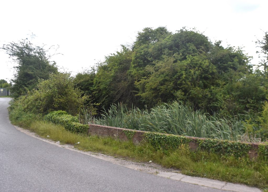
Getting to Daw’s Castle is quite straight forward, but it is quite a long climb out of Watchet up West Street and then Cleeve Hill until the footpath comes off on your right (at the time of writing). This takes you straight into the site of Daws Castle. 

St Decuman's Well, near St Decuman's Church, Watchet, Somerset
St Decuman’s Well, near St Decuman’s Church, Watchet, Somerset

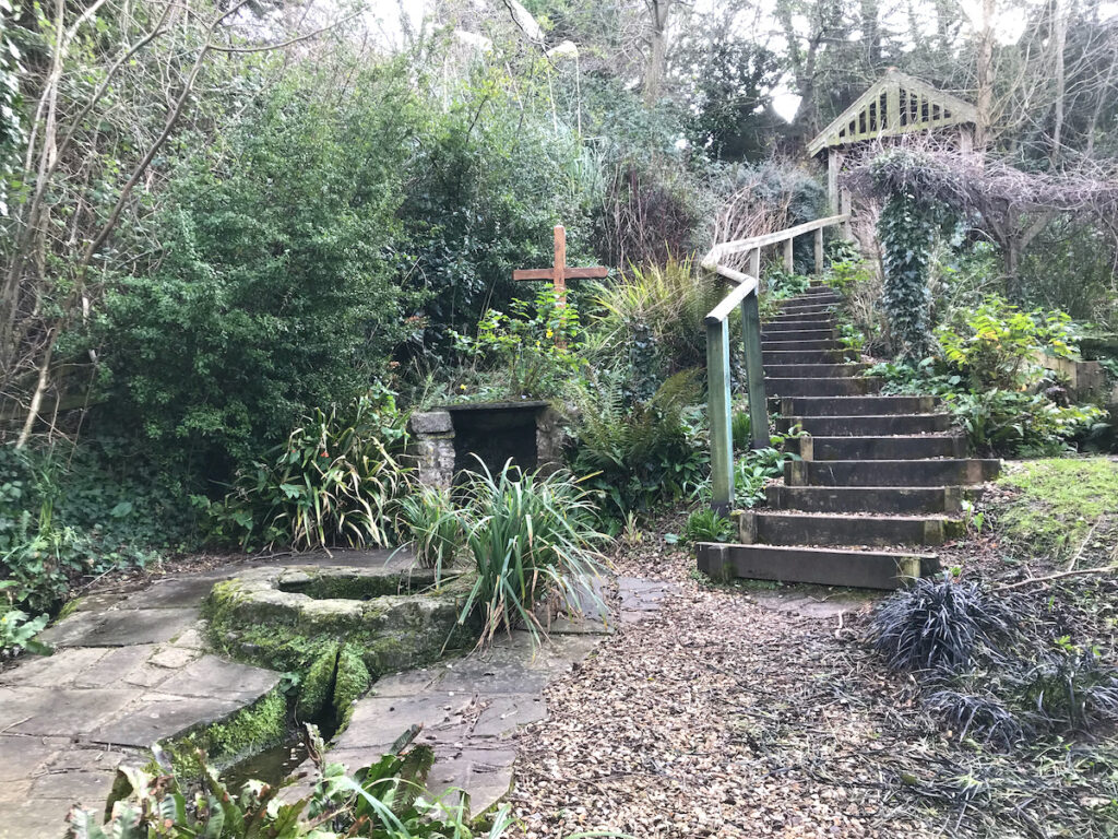
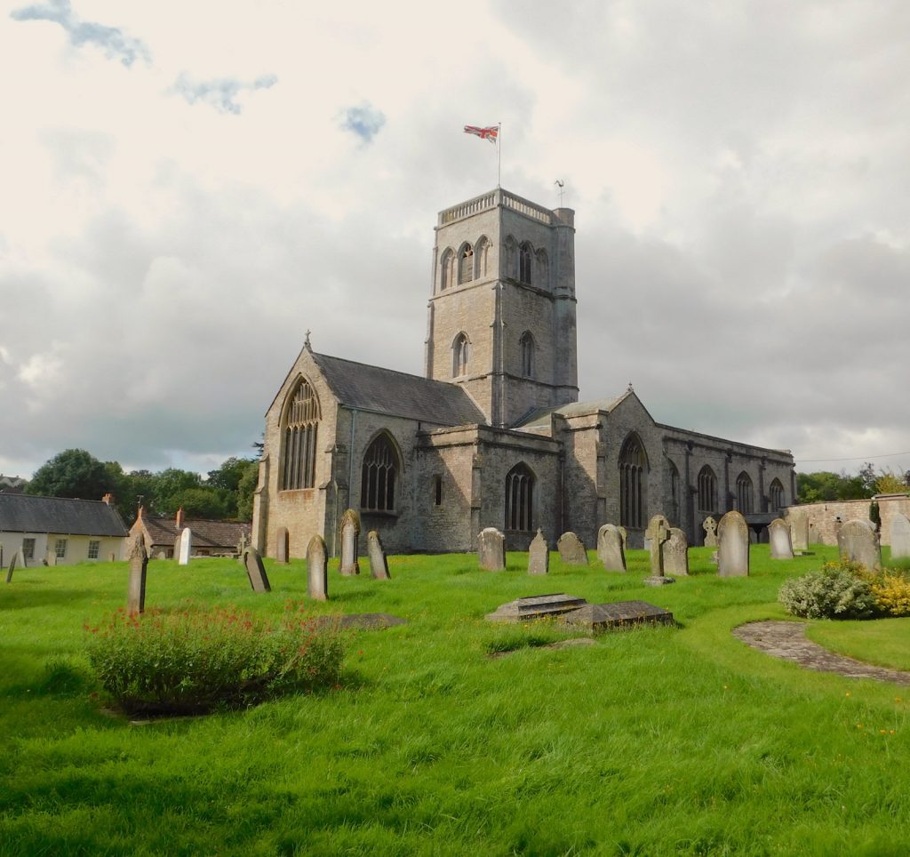
St Decuman’s Church, with its Holy Well should not be missed. St Decuman’s is a short distance (but quite a long walk) south of the centre of Watchet. The well is a lovely location and the church is of great interest. According to legend, Decuman crossed from Wales in Saxon times (in the 600s) on a raft with a cow and lived here as a hermit. He was decapitated by an evil man, but as a miracle he replaced his head on his shoulders and carried on, and local people assisted him in building a church. To visit the well you need to go down the little track past the church (not down the track that leads down to Watchet -there is a sign pointing the way).

St Decuman's Church, Watchet, Somerset
St Decuman’s Church, Watchet, Somerset

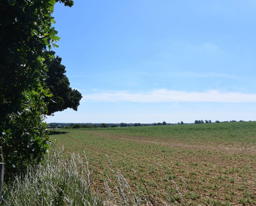
You may wish to take time to visit the “traditional” site of a battle between the Saxons and the Danes near Williton, a short distance south of Watchet. It is located near Danesfield School and there is a convenient lay-by where you can look across into the field. Please note that the field is private land. A tumulus (these typically, but not always, date to the Bronze Age) can be easily seen from the lay-by. On old Ordnance Survey maps the location is called “Battle Gore” and is marked on the 1888 to 1930 maps as “Site of Battle A.D. 918”. The lines of earthworks are also indicated. The field is the one to the south of where the small stream flows. Please note that this may just be legensd and I am not aware of any corroboration that a battle took place here. The year 918 does not fit well with the years of recorded attacks stated in the Anglo-Saxon Chronicles. 

Map of Watchet, Somerset by Mudge
Map. Watchet, Somerset. Detail from 1809 map by Mudge

Saxon Hertford, Hertfordshire

This post on King Alfred and Saxon Hertford is adapted and condensed from my book, King Alfred: A Man on the Move, available through Amazon and bookshops.

Those of you who have read the previous post will know that in 895 the Vikings built a fortress on the River Lea about 20 miles north of London and that King Alfred arrived and set up camp nearby. King Alfred then rode up the River Lea to see where the river could be obstructed in order to block the Viking ships in. The river was indeed obstructed and King Alfred started to build a fortification on either side of the river. The Vikings then fled. Hertford and Ware are possible locations for these events and here I shall look a little closer at Hertford.

It is worth pointing out at the start that there is a risk of confusion with the two fortifications that were built in Saxon Hertford in 912-913 by King Alfred’s son, King Edward the Elder. These two fortifications were north and south of the River Lea. However, the first one to be built by Edward the Elder was the northern one and it strikes me as intriguing that the Anglo-Saxon Chronicles describe it as þa norðran burg, which seems to me to translate as the more northerly burg. This in turn suggests that there was already a burg to the south when King Edward the Elder built his first fortification. It is possible that this could have been one of the fortifications that Alfred had built.

As is also the case with Ware, it is uncertain why the Vikings would have gone to Hertford. However, the Anglo-Saxon Chronicles tell us that in 673 a synod took place at Hertford (Heorotford, or Herutford in Bede’s Latin). Indeed, there is a memorial stone associated with this event in Hertford Castle Gardens. There was also a royal mint here as early as the 920s. Although the mint dates to slightly after the time of Alfred, the record of both a synod and a mint suggests that Hertford was an important place in Anglo-Saxon times, perhaps more important than Ware, and it also indicates that Hertford might have been attractive to the Vikings because of its possessions. However, it is possible that the synod took place at the similarly named Hartford in Cambridgeshire instead.

Stone in the grounds of Hertford Castle commemorating the synod that may have taken place there

The River Lea divides just north-east of Mill Bridge to form Hertford’s Folly Island. However, the route of the river through Hertford may not have been the same in 895 and this bifurcation may not have been (as has been suggested) where King Alfred divided the river in order to trap the Viking boats. Nonetheless, the bifurcation can be easily observed near the road called Bull Plain. I have seen reference to the course of the river in Roman times lying to the north -west of its current course, although it may have been in its approximate current location in Alfred’s time because a Viking sword was found in modern times when the River Lea was dredged in the centre of Hertford. Although many Viking weapons are found submerged, it is also possible that the sword found its way into water as the river changed its course. I also saw a reference to remains of Viking ships being found near Hertford and Stanstead Abbots, although I have been unable to corroborate this.

The River Lea dividing near Bull Plain, Hertford.

It was interesting to find on the 1881 Ordnance Survey map an area in Hertford called “Englefield” lying to the east of Bengeo Street and to the north of Warren Park Road. Readers of my book may recall that there was a battle of Englefield near Reading in Berkshire in 871, with the name Englefield probably meaning the land of the Angles. The same map also shows an area called “Daneshill” lying to the south of Warren Park Road, with some nearby land to the north-east being called “Danesbury.” There has also been speculation that the former location of the cricket ground, which used to lie to the east of the pronounced curve of Warren Park Road, could have been a Viking camp. Was there a Viking fortification in this area and did Alfred set up his camp at Englefield? Although we must be cautious of the possibility that antiquarian speculation influenced the place names on the 1881 map, I find the juxtaposition of names potentially referring to Vikings and Anglo-Saxons intriguing. In the absence of definitely-established locations for any Saxon or Viking camps I feel this area must be worth considering. Just a short distance east of these locations lies the 12th century St Leonard’s church. I was told that the current building may have been built on an even older structure that might relate in some way to the Vikings or King Alfred, although I was unable to find any supporting evidence.

St Leonard's church, Hertford
St Leonard’s church, Hertford

The Anglo-Saxon Chronicles tell us that the northerly fortress built by King Edward the Elder in Saxon Hertford was on the other side of the River Beane to the aforementioned Hertford locations of Englefield, Daneshill and Danesbury. The fortress is described as being between the Mimram, the Beane and the Lea (which doesn’t entirely make sense based on current names and geography).

I would like to extend my thanks to the Salisbury Arms in Hertford for their hospitality.

Wedmore, Somerset: King Alfred hosts Guthrum

St Mary's church, Wedmore, Somerset Levels

This post on Wedmore is adapted from, and provides additional information for, my book, King Alfred: A Man on the Move, available through Amazon and bookshops.

King Alfred defeated the Vikings at the Battle of Ethandun in 878. Alfred then oversaw the Viking leader Guthrum‘s baptism at Aller, on the Somerset Levels, and not far from Athelney, which had been the location of Alfred’s base after the Vikings appear to have taken control of Wessex after their raid on Chippenham in January 878.

We are told by both Asser and the Anglo-Saxon Chronicles that after his baptism Guthrum spent twelve days with Alfred, and at least part of this time was spent at Wedmore, which Asser describes as a villa regia (royal estate). We are told that after this period the Vikings left Chippenham, where they had a base, and went to Cirencester and then re-located again to settle in East Anglia.

Before they left, we are told that they were honoured with a large amount of riches. It is impossible to know by how much, if at all, these were gifts voluntarily provided by Alfred or whether this was some sort of ransom demanded by the Vikings as part of a peace settlement.

A plaque inside St Mary's church, Wedmore, Somerset Levels recognising Alfred's making of peace with the Vikings
A plaque inside St Mary’s church, Wedmore, Somerset Levels recognising Alfred’s making of peace with the Vikings. NB. The year of King Alfred’s death has been revised to 899

It has been suggested that the royal site at Wedmore was north-west of St Mary’s church at or near the location of a manor house and it seems to me that the wall visible from the churchyard could have been the perimeter of the manor’s grounds. It occurred to me that the location could have been elsewhere in or around Wedmore, so I decided to explore further. I had been intrigued by marks in the ground visible in an aerial photograph in a field north of Manor Lane, although I could see nothing relevant when I arrived there at ground level. I also explored the hill to the north-west by taking the footpath heading west off Lascot Hill. I eventually decided that I could not improve on the suggestion that the royal estate was at the location of the former manor house.

St Mary's church, Wedmore, Somerset Levels
St Mary’s church, Wedmore, Somerset Levels

St Mary’s is a delightful place to visit (as is Wedmore itself).

Map of Wedmore, Somerset. Mudge 1817
Map of Wedmore, Somerset. Detail from map by Mudge 1817.

It was once thought that the Saxon royal residence was at Mudgley, just a short distance south of Wedmore. However, I could find no evidence that this was the case.

There is much more about the travels of King Alfred in my book, including maps and references. Tap or click the image of the front cover below.

Saxon Exeter: King Alfred

This post on Saxon Exeter at the time of King Alfred is adapted from my book, King Alfred: A Man on the Move, available from Amazon. Please also scroll down for my Youtube video on Exeter.

The Anglo-Saxon Chronicles tell us that in 876 King Alfred pursued the land-based Vikings that had fled from Wareham (Dorset) to Exeter. However, their accompanying navy lost 120 ships in bad weather near Swanage (Dorset). Alfred was unable to catch up with the fleeing land-based Vikings before they got to Exeter. On reaching Exeter the Vikings secured themselves in a fortress, but their situation does not appear to have been particularly positive, perhaps because of the large loss of ships, and they settled for peace with Alfred. After over-wintering (permission to do this being presumably part of the peace settlement), the Vikings left Exeter and went to Mercia, and specifically to Gloucester according to a chronicle written by Æthelweard.

I asked myself whether it was possible to work out from the available information where exactly in Exeter the Vikings went. The Anglo-Saxon Chronicles imply that the Vikings occupied a fortress that had already been there, as opposed to building one when they got there, as they would do in Rochester, in Kent, in 884. Exeter’s Rougemont Castle goes back to 1068, so we are looking for something else, but perhaps this would have been on the same site as Rougemont Castle. The case for this is strengthened by the discovery of Anglo-Saxon masonry at Rougemont Castle.

Walls at Exeter, Devon, where Saxon masonry found. The path leading up to Athelstan's Tower in Northernhay Gardens.
A section of the walls at Exeter where Saxon masonry has been found. This is the path leading up to Athelstan’s Tower in Northernhay Gardens.

We also know that Exeter had (and largely still has, although much repaired) Roman walls with four entrances and it appears that these were repaired and strengthened in Anglo-Saxon times. The Old English of the Chronicles says that the Vikings came into Exeter, which fits with the idea that the Vikings had managed to get into Exeter through one of the four entrances in the walls and then either occupied a fortification within the walls, or used the walls themselves as a fortification. The length of the circuit of the walls was would have stretched the Viking troops, but with only four entrances, it may have been possible for them to secure the site. I feel that it is more likely that the depleted Viking force took over a fortification within the walls rather than the walls themselves, and it seems to me that the site of (or part of the site of) Rougemont Castle would have been the most likely location for this fortification. From Northernhay Gardens elements of Anglo-Saxon construction in the remains of the wall can be seen. It is thought that King Athelstan (King Alfred’s grandson) restored the city walls in around 928. The site of Rougemont Castle is now called Exeter Castle, and is a commercial enterprise.

It is possible that the land-based Viking contingent, with Alfred in pursuit took the Roman road to Bridport via Dorchester and then the Roman road that now approximates to route of the A35 to Honiton, and then finally the Roman road that is more or less on the current route of the A30 to Exeter. Alternatively, they could have branched off this route onto another Roman road near Charmouth in order to reach Exeter via Colyford and Sidford, approximately following the route of the current A3052. It seems likely that these routes would have been in use in Alfred’s time, because much of these routes have persisted from Roman times right through to today. It also seems likely that the best available route would have been taken by both parties as, speed would have been important, and these would probably have been the remaining Roman routes.

Plaque marking the location of the South Gate in the walls of Exeter
A plaque marking the location of the South Gate in the walls of Exeter, Devon

It seems that either route would have brought them to a gate to the south-west of the walled city at a spot that is towards the southern end of South Street of today’s Exeter. There is still some wall there today (and a plaque) to help you find the precise spot. This South Gate must be, therefore, the most likely point of entry for the Vikings, and also for King Alfred in pursuit, in 876. Unfortunately, there is no gate present there now as, after serving as a prison, it was finally demolished in 1819. Nonetheless, it is possible to explore on foot how these routes come together just outside the former location of the South Gate. If you do make it down here, there are other places of interest such as the old Eye Hospital and the Dissenters’ Graveyard.

The South Gate of the walls of Exeter, Devon. Outline marked in pavement.
The South Gate of the walls of Exeter, Devon. The markings in the pavement referred to by the plaque in the previous image.
The former location of the South Gate in the walls of Exeter, Devon.
The former location of the South Gate in the walls of Exeter, Devon. Just follow the line of the wall across the road

Having come through the South Gate, and with Rougemont Castle (as it was later called) at the extreme north end of the walled city, Alfred would have needed to cross the centre of Exeter. Although these events took place prior to Alfred’s post-878 rebuilding programme, it seems likely that there would have been a road leading from the South Gate up to the main city intersection where today South Street, North Street, Fore Street and High Street meet. It seems that High Street would have been present in Alfred’s time, and this leads in the general direction of Rougemont Castle. I therefore suggest that, if the Vikings were at the location of Rougemont, Alfred and his troops would have proceeded up what is now South Street and turned right on to what is now High Street, with the land-based Vikings having taken the same route just a short time before. Any surviving sea-borne Vikings would have made their way up from the harbour, via the West Gate or perhaps via a lost Roman gate in the wall nearer to the port (the Water Gate may have been a later development not present in Alfred’s time). They may have even disembarked at nearby Topsham and then made their way, like the others, to the South Gate.

Exeter, Devon. Ancient crossroads.  From South Street, looking across to North Street, with High Street to the right and Fore Street to the left.
Exeter, Devon. It is likely that roads crossed here in the time of King Alfred. This is where South Street, North Street, Fore Street and High Street meet. The photo is taken from South Street, looking across to North Street, with High Street to the right and Fore Street to the left.

There is a reference in the Anglo-Saxon Chronicles to King Alfred heading again to Exeter in 893. While on his way to assist his troops that were besieging a Viking contingent near London, he received word that other Viking forces had landed in North Devon and that Exeter, in South Devon, had also been besieged. Alfred and his troops therefore diverted towards Exeter. There are no records of any engagement with the Vikings either at Exeter or in North Devon at this time, although the Anglo-Saxon Chronicles do imply that he got there.

It is worth noting that in 1003 the Vikings stormed (the word used is abrocen) Exeter. It seems that this would have been much worse than anything that happened in King Alfred’s time (see versions E and F of the Anglo-Saxon Chronicles).

Many thanks to BBC Radio Devon and The Voice (Barnstaple) for having me on air to talk about my book and Saxon Exeter at the time of King Alfred.

There is much more about the travels of King Alfred in my book, including maps and references. Tap or click the image of the front cover below.

Saxon Kent and King Alfred. Part 3

A wall of the Archbishop's Palace in Charing, Kent

This post on Saxon Kent at the time of King Alfred is adapted from my book, King Alfred: A Man on the Move, available from Amazon.

The Anglo-Saxon Chronicles tell us that in 893 Alfred camped with his army between the two raiding armies and therefore it would have been between Milton Regis on the north coast of Kent and Appledore towards the south coast of Kent. Anyone who travels around Kent will soon appreciate how difficult it would have been to monitor these distant locations from a single site. I therefore feel that any central camp must have had additional outposts in order to monitor what was going on over a wide area. This would fit with the Anglo-Saxon Chronicles telling us that burga (fortresses), noting the plural, were being held by Alfred.

Maidstone, a location that has been put forward, is considered separately in this other post. I now continue with a few others, ending with the locations that I believe to be more plausible.

The village of Bredgar, just south of the M2 motorway has been suggested. The village has a lovely church yard, and is somewhat elevated. However, I could see no special reason to consider that this was Alfred’s main camp, although it could have been one of potentially many outposts. Bredgar lies close to a line drawn between Appledore and Milton, but it is very much closer to the latter, making it an awkward fit with the description of King Alfred being between the two raiding armies.

Church of St John the Baptist, Bredgar, Swale, Kent, with the earliest elements dating to the 12th century.

Stockbury, just a few miles west of Bredgar, has also been put forward, although the earthworks there are thought to be Norman, and therefore more recent than King Alfred’s time. However, it is possible that the Norman construction may have been built over earlier earthworks, and this may be supported by the possibility that part of the name may derive from the Old English burh (stronghold).

St Mary Magdalene Church, Stockbury, Kent and the Norman earthworks
St Mary Magdalene Church, Stockbury, Kent and the Norman earthworks (to the right). Photograph taken from the road.

To find these earthworks it is easiest to find the church first, which is located a little way east from the centre of the village, adjacent to Church Farm. Although the rings are on private land they are easily viewed from the road and the church yard. In fact, the outermost visible ring appears to clip the churchyard. Whilst I accept that the location commands views that could have made it a useful outpost, there did not seem to be any particular reason to believe that this would have been Alfred’s camp. Stockbury, like Bredgar, lies close to a line drawn between Appledore and Milton, but it is very much closer to the latter.

There is a feature to the north-east of the village of Newenden that is called Castle Toll, and you can get quite close to it on a public footpath. Whilst Castle Toll is perhaps 13th century, some of the earthworks marked on the Ordnance Survey map to the south are thought to be the remains of an Anglo-Saxon burgh. It has, however, been suggested that this was the site of Eorpeburnan, a previously lost burgh that is listed in the Burghal Hidage, a document compiled in the reign of Alfred’s son, Edward the Elder. Newenden is not at all on a line connecting Milton Regis and Appledore, so, although I believe it may have played a role, it does not fit the description of Alfred’s camp.

The Saxon earthworks near Castle Toll, Newenden, Kent
The Saxon earthworks near Castle Toll, Newenden, Kent, are difficult to see. They are on private land but if you look south east from the path near Castle Toll (see OS map), you will be looking in the right direction.
The 13th Century Castle Toll, near Newenden, Kent

When the Vikings landed on the north and south coasts of Kent, I feel that Alfred must have been concerned that Canterbury may have been a target. When I disregarded previous suggestions (for which there is no real evidence) and considered an approximate line between Appledore and Milton Regis, I found that there were a few places that could have better met the description of being between these locations and which may also have allowed easier access to Canterbury. I considered two locations in particular: The villages of Great Chart and Charing. However, the landscape feature known as the Greensand Ridge may also be relevant.

It is known that in King Alfred’s time there was a settlement at Great Chart under the ownership of the Archbishop of Canterbury. Interestingly, there has been a legend that Great Chart had been burned by the Vikings, and this led to the subsequent development of Ashford.

The Millennium Sign at Great Chart, near Ashford, Kent
The wonderful Millennium Sign at Great Chart, near Ashford, Kent

Charing is approximately half way between Milton and Appledore and has an Archbishop’s Palace associated with Canterbury that dates back to the 8th century, making it a significant location in Saxon Kent. One could be misled into thinking that Alfred’s piety may have led him here because of a legend that the block on which John the Baptist had been beheaded had been located at the church. However, the tradition is that this was brought to England by King Richard I, well after the time of King Alfred. Nonetheless, I feel that this location is the strongest contender for the location of Alfred’s camp. It is located on an approximate line between Milton and Appledore, without being too close to either, and is located by the ancient track to Canterbury that later became known as the Pilgrims’ Way.

The 13th century church of St Peter and St Paul at Charing, Kent.

The discovery in 2012 of a large Saxon hall near the location of a former Anglo-Saxon abbey at Lyminge generated much interest (resources here). These may go back to the 6th to 9th centuries. Although Lyminge appears to have been an important Saxon location, it does not seem to meet the geographical requirements of those unnamed places mentioned in the Anglo-Saxon Chronicles.

There is much more about the journeys of King Alfred in todays landscapes and cityscapes in my book, including maps and references. Tap or click the image to learn more about it.

Martin Down and the Battle of Meretun, 871 AD.

This post on Martin Down and the Battle of Meretun is adapted from, and provides additional information for, my book, King Alfred: A Man on the Move, available from Amazon and book shops.

The Battle of Meretun took place two months after the battle at Basing. Alfred and his brother were fighting against the Vikings, but lost, which is what also happened at Basing. There appear to be two main candidates for the location of this battle, one being Martin in Hampshire and the other being Marden in Wiltshire. However, we have very little to go on and other places with similar names are possible. Merdon Castle, in Hampshire, is another possibility, although I have been unable to discover whether this name was acquired after the Norman Conquest. The place that seems to make the most sense to me is Martin in Hampshire, which is a village just south of the A354 main road between Salisbury and Blandford Forum.

King Æthelred (Alfred’s elder brother) died after the Battle of Meretun and he was buried at Wimborne in Dorset. It is therefore possible that he died from wounds sustained in battle but it is also possible that he lived a little longer and died of something else. If he had died of his wounds then it may be relevant to point out that Wimborne is not very far from Martin (about 14 miles). Indeed, the Roman road known as Ackling Dyke runs past Martin on its way to Badbury Rings, which is only four miles from Wimborne.

Bokerley Ditch, Martin Down, Hampshire.

The geographic feature called Martin Down lies a short distance to the west of Martin and there one can explore the famous Bokerley Ditch, which pre-dates the time of Alfred, but perhaps could have been used strategically in battle. Bokerley Ditch also cuts across a Roman road so it could have been used for either side to attack the other coming up that route. To the north this Roman road is still a bridleway and to the south it is now under the A354, so it seems likely that it would have been in use in Anglo-Saxon times. Interestingly, the county boundary between Dorset and Hampshire in this area still follows Bokerley Ditch. One can speculate as to why the Vikings might have been at Martin, and it occurs to me that a contingent from the base at Reading may have been trying to get west, perhaps to Exeter. The Vikings would indeed attack Exeter in 876 and 893, and it therefore seems plausible that they would have liked to have done so in 871.

Map of Martin and Martin Down, Hampshire
Map of Marten and Marten Down, Hampshire (later Martin and Martin Down). Detail from map by Mudge 1811

Marden, Wiltshire

It may be impossible to disprove that the battle took place at Marden (Wiltshire) instead, but the place-name of Marden seems to have derived from Mercdene, quite dissimilar to Meretun. A charter issued by King Edmund between 944 and 946 shows Martin in Hampshire being referred to as Mertone, which is not much different from the Meretun of the Anglo-Saxon Chronicles. I therefore think Marden is a less likely location than Martin for the battle of Meretun.

Marten, Wiltshire

I was also tempted by Marten in Wiltshire (yes, this does get confusing), largely because of its proximity to the Inkpen Ridgeway, connecting it to Basing, the location of the previous battle. I have written much more about Alfred’s travels in my book, which also contains maps and references. Tap or click the image.

King Alfred’s Navy. The lost battle site of 896AD

This post on King Alfred’s navy and the lost battle site is adapted from my book, King Alfred: A Man on the Move, available from Amazon and book shops.

In 896 there was an engagement between King Alfred’s navy and a Viking fleet of six ships that had arrived at the Isle of Wight and had caused harm all along the coast as far as Devon. It seems that Alfred could not have been present at this engagement because some of the fleeing Vikings were captured and taken to him at Winchester where he had them hanged. The few geographic clues provided by the Anglo-Saxon Chronicles have led to speculation that the engagement took place in Poole Harbour or Christchurch Harbour in Dorset. The Anglo-Saxon Chronicles refer to an ufeweard muða (ð is pronounced “th”) and it has been suggested that this means an “upper harbour.” However, I found it striking that there is an area on the north side of the harbour in Christchurch called Mudeford, with a River Mude running through it and into the harbour. Could this be the muða referred to in the Anglo-Saxon Chronicles?

The River Mude flowing into Christchurch Harbour

Although I have seen it claimed that muða could also mean river, we know from elsewhere in the Chronicles and other documents that rivers were sometimes referred to by their name and that muða appears to usually mean mouth (the similarity between muða and mouth is not a coincidence) with the term for river generally being ea. Furthermore, if muða had been a generic term for river, we might expect to find other survivors such as is the case with the Brittonic language-derived Avon. However, I was unable to find any other examples of a River Mude in England. Update: I have had access to a 1797 map that shows the location as “Midde Ford”, which seems to sever the relationship of the place-name with muða.

View of Christchurch Harbour, taken from an aeroplane at dusk.
My photograph of Christchurch Harbour, Dorset, taken from an aeroplane at dusk.

The Anglo-Saxon Chronicles tell us that Alfred’s ships blocked the Viking ships in so they could not get to the uter mere. It seems unclear to me whether uter mere means “outer lake” or “outer sea”. However, the usual term for the sea in the Anglo-Saxon Chronicles is , with mere usually meaning a lake. Nonetheless, the Vikings had been blocked into the river and when the tide went out three ships were beached at the upper river mouth and three came forward to attack (making six, matching the number recorded as coming to the Isle of Wight). It appears that at least two Viking ships managed to escape from the trap because we are told that two of the fleeing Vikings crews came ashore in Sussex because their ships were in a poor state. King Alfred had these men hanged at Winchester. It has been suggested that they came aground while trying to get past Selsey Bill. These Vikings would therefore have come aground in Sussex somewhere between East Wittering and Selsey. That they came ashore in Sussex perhaps also makes it less likely that the battle had taken place in distant Devon, after which they would have had to round Portland Bill (or drag their boats across the causeway), near Weymouth in Dorset, first.

Poole Harbour, Dorset, taken from an aeroplane at dusk
My photograph of Poole Harbour, Dorset, taken from an aeroplane at dusk

Perhaps the clue to potential locations for this battle lies in the fact that there were only six Viking ships. We know that Wareham (with access to Poole harbour) and Christchurch are listed in the Burghal Hidage (a list of places defended by King Alfred after 878), and would therefore probably have been defended by 896. It does not seem to make sense to me that the Vikings would have ventured close to defended locations with just six ships.

Weymouth, Dorset

Perhaps the Dorset coastal town of Weymouth (not in the Burghal Hidage, so perhaps a weak point) should be regarded as a possible site. Radipole Lake, fed by the River Wey, is connected to the sea via the town harbour, and one of Athelstan’s charters refers to all the water within the coast of Weymouth, indicating that there was an inland body of water here in Anglo-Saxon times. Indeed, it is thought that the Romans may have had some sort of port at the head of this body of water, and a Roman road ran north from near here to Dorchester. At least parts of this route appear to have remained in use today, which suggests that it might have been in use in 896, thus providing access to any Vikings that intended to raid Dorchester. This area is no stranger to Viking threat. In 840 the Vikings landed at nearby Portland, with fatal consequences for the locals, and in 2009, during construction of the Weymouth Relief Road, near Upwey, fifty-four skeletons of executed Vikings were found, although these dated to a later period than that of King Alfred. Because I live near here, I cannot resist drawing to your attention how rich the South Dorset Ridgeway is in ancient, although very much pre-Alfred, sites. For those who are interested in this, I find this blog particularly good.

The Isle of Wight

However, it seems to me that it is more likely that the events took place at one of the main rivers, including the River Medina, that flow into the Solent on the north coast of the Isle of Wight. The Anglo-Saxon Chronicles do not state that the engagement took place during a Viking raid on the coast of the mainland, although it is easy to assume this because the Chronicles tell us that the Vikings had been undertaking such raiding. It is an interesting coincidence that the Old English term for the River Medina was Meðume, not terribly different from muða. An old map of the Isle of Wight suggests that the main waterways may have had constricted entrances to the sea, thus meeting the description of the location in the Anglo-Saxon Chronicles. It seems to me that King Alfred’s Navy, improved after 878 AD, had managed to root out a small Viking base that had set itself up on the Isle of Wight.

My book mentions a few other locations on the south coast that could have been the site of the engagement between King Alfred’s navy and the Vikings. It also contains much more about Alfred’s travels, and contains maps and references. Tap or click the image to learn more.

The little church at Aller, Somerset.

St Andrew's church, Aller, Somerset Levels

This post is adapted from my book, King Alfred: A Man on the Move, available on Amazon. It would be great if you could support this project by purchasing a copy.

This is a peaceful spot and I always like coming here. I never cease to be amazed at how this modest location that was so important in the history of England is so under-visited.

St Andrew's church, Aller, Somerset Levels. Where King Alfred baptised Guthrum, the Viking leader, after he was defeated at the Battle of Ethandun
St Andrew’s church, Aller, Somerset Levels. Where King Alfred baptised Guthrum, the Viking leader, after he was defeated at the Battle of Ethandun

King Alfred defeated the Vikings at the crucial Battle of Ethandun (more likely in my opinion to have been at Edington in Wiltshire than any other single location) in 878. The Vikings fled to their fortress, which seems more likely to have been at Chippenham, where they then surrendered.

The Anglo-Saxon Chronicles tell us that three weeks after the Vikings surrendered, the Viking leader Guthrum came, accompanied by thirty of his men, to be baptised into Christianity at a place near Athelney called Aller. Asser tells us that Alfred himself raised Guthrum from the baptismal font and that Guthrum became Alfred’s adopted son.

The older of the two fonts at St Andrew's church, Aller, Somerset Levels
The older of the two fonts at St Andrew’s church, Aller, Somerset Levels

St Andrew’s church at Aller, like Athelney, is on raised ground in the Somerset Levels, suggesting that the church probably would also have been on an island in Alfred’s time. The oldest parts of the current church are 12th century, so the events of 878 must have taken place at a preceding structure. It has been claimed that a font in the church (the more bowl-shaped of the two fonts), recovered from the rectory pond in the nineteenth century, was the one used to baptise Guthrum. The church can be tricky to find. Coming from Langport direction, it is necessary to take a left turn onto the road called Church Path and then turn left where there is a wooden sign for the church. The church also has a small but beautiful King Alfred Window, which is a memorial to the two reigns of King Alfred and Queen Victoria.

The King Alfred stained glass window at St Andrew's church, Aller, Somerset Levels
The King Alfred stained glass window at St Andrew’s church, Aller, Somerset Levels

It can be speculated as to why Aller, about fifty miles distant from Chippenham, was chosen as the location instead of somewhere closer to Chippenham. Perhaps Alfred did not trust Guthrum and this was deemed to be a safer location, or perhaps Aller was a more significant place then than it seems to us today. It might even be that Alfred knew Aller well if he came here to pray when he had his base at nearby Athelney. It seems likely to me that after obtaining the Viking surrender at (most likely) Chippenham, Alfred simply went back to the Somerset Levels where he may still have had a base, and Guthrum had to go there to “seal the deal”. 

 I think there is a major clue in the Anglo Saxon Chronicles where we are told that Guthrum came to Alfred at Aller after a period of three weeks. With this time-frame the distance between Chippenham and Aller becomes less of an issue – there was plenty of time to travel. It was a matter of Guthrum having to go to where Alfred was in order to take advantage of an amazingly beneficial deal on the table. In effect it was: “Confirm your permanent submission by becoming baptised and in return we won’t trouble you if you want to settle permanently in the east. Not only this, but you and your men will also receive large amounts of riches” (which were provided subsequently at Wedmore). There is a big difference between the first scenario of the Vikings having effectively seized East Anglia and the later post-878 scenario of the Vikings settling in East Anglia with the approval and blessing of the King of Wessex. In effect, the Viking presence in East Anglia had now become legitimate. East Anglia must have been unstable since 869 when its king (Edmund) had been murdered by the Vikings. Settling it with a converted Guthrum (now called Athelstan after his baptism) probably had benefits for Alfred. 

Any hopes that Alfred might have had for peace in East Anglia do not seem to have been realised. In 896 Alfred sent ships to the mouth of the Stour in East Anglia (and therefore somewhere near Harwich) and there were two battles with Viking boats. Alfred’s forces won the first engagement, but the Vikings won the second engagement. 

It is by no means certain in my mind that Guthrum was baptised in a church at Aller. In other words, he could have been baptised outside at Aller, because baptism outside in water may have still been taking place, especially for what was a hugely significant moment. If this was the case then there would have been water nearby (Aller is on the Levels). The font in the church that is claimed to be Saxon was re-discovered outside, although it is unknown whether this was used to baptise Guthrum, whether inside or outside of the church.

Aller is the location where Guthrum was baptised, but we must remind ourselves that in The Anglo-Saxon Chronicles we are told that after the Vikings had attacked Chippenham in 878, King Alfred had retreated to morfæstenum, which is a plural. There was more than one stronghold in the marshes, and it is possible that Aller was one of them (and with possibly others on higher ground such as at Burrow Mump).

Aller is only a few miles north-west of Langport, which must have been a significant place in Alfred’s time as it is included in the Burghal Hidage (a list of defended locations), drawn up under his son, King Edward the Elder. Although there is nothing that I could find to specifically connect King Alfred with Langport, it seems likely that he would  have been there at some point.

I made a short video at Aller:

There is much more about the travels of King Alfred in my book, including maps and references. To find out more about the book, click or tap the image below.

Saxon Kent and King Alfred: Part 2

This post is adapted from my book, King Alfred: A Man on the Move, available from Amazon. It would be great if you could support this project by purchasing a copy.

In 892 a Viking force of 250 ships sailed from Boulogne to the south coast of Kent and in the same year another Viking force of 80 ships came to the north coast of Kent at a place called Middletune. The Anglo-Saxon Chronicles tell us that Alfred camped with his army between the two Viking armies. In trying to locate Alfred we therefore must try to find the locations that he set up camp between. It seems that the Viking camp in north Kent must have been in the general area of Milton Regis and Sittingbourne, but I could not resist trying to pin it down more specifically.

It is also possible that Alfred himself may have been at this site. The leader of the Vikings that landed on the north coast of Kent was called Hæsten and Alfred must have had some sort of contact with him as it emerges in the Anglo-Saxon Chronicles that a son of Hæsten had become a godson (as had Guthrum in 878) of Alfred. Clearly the history is incomplete, but it is possible that negotiations took place between Alfred and Hæsten at his site at Milton, or at Alfred’s site (another unknown location examined in a future post), or perhaps somewhere else.

Middletune is thought to be Milton Regis, which lies to the north of Sittingbourne, and is now part of that town. Milton was apparently a significant Saxon site. It is said that Queen Seaxburgh of Kent became a nun at the abbey she founded at MIlton, becoming St Seaxburgh, and that her son became king there in 680.

Castle Rough

The earliest reference that I found for this being the site for the Vikings that came to north Kent is in Edward Hasted’s 1797 writings on the history of Kent.  The location is just east of Kelmsley, to the west of Milton creek, and close to the evocatively named Saxon Shore Way. It has been suggested that Castle Rough would have been a man-made island. Evidence from limited examination by Sittingbourne and Swale Archaeological Research Group indicated that the lowest parts of the mound contained 13th-14th century pottery, and therefore must have been built after the time of King Alfred. Although this does not rule out this site, because a more extensive examination may have produced more evidence, it does cast doubt upon this being the site of the Viking camp. The location is also moated, which may indicate a date later than the time of King Alfred. Oliver Rackham found that to his knowledge there were no mentions of moats in Anglo-Saxon charters, in place names, or in Domesday. It is therefore possible that moats were a later development. Oliver Rackham also suggested that moats may have become status symbols, which may have been the case here as a moat of this relatively small size would have been largely ineffective against a determined army. It seems that Castle Rough may have been a medieval moated manor, although we cannot rule out that it was something else previously. It was not easy to observe Castle Rough. I pulled over near a gate when driving north along Swale Way, just after crossing over Milton Creek and the Sittingbourne and Kemsley Light Railway. I crossed the road on foot and from this elevated position I fancied that I could pick out Castle Rough. However, I needed my Ordnance Survey map to guide my eye to the approximate location. Update: I have had access to an 1801 Ordnance Survey drawing that shows the feature as distinctly squared as though it was present at that time. There is no indication on this map that it is ancient.

Looking across from the road to the site of Castle Rough, Milton Regis, near Sittingbourne in north Kent, where the Vikings may have set up a camp in 892.

I came across a rumour that the camp was under a canteen at the Kemsley paper mill (close to Castle Rough), but I have been unable to find anything to support this.

The former Kemsley paper mill, near Milton Regis, Sittingbourne, north Kent. On the site of the Viking camp?

Bayford Castle and Bayford Court

The former location of a place called Bayford Castle, on the other side of Milton Creek to Castle Rough,  may have been the site of the Viking fortification. However, Hasted, in his 1797 writings on the history of Kent  tells us that it was Alfred who built some fortifications against the Vikings on the other side of Milton Creek from Castle Rough at “Baford-castle.” It should be noted that Hasted appears to be an early originator (if not the originator) of the legend that Castle Rough had been the Viking fortification.

The location of Bayford Castle appears on older Ordnance Survey maps with an indication that it was erected in 893. By the time of the 1960 map references to the location had disappeared. There is nothing for the casual visitor to see there now as the location appears to be approximately where there are now industrial units to the east of a karting track. Although evidence is lacking in terms of it being either a Viking or Saxon site, it is at least in a suitable location being near to  Milton Creek.

To confuse matters, maps dating to 1590 show that the location of Bayford Castle used to be called Castle Ruffe. I haven’t seen anything to explain why the name of Castle Ruffe disappears from the east side of Milton Creek and then a Castle-ruff (later becoming “Castle Rough”)  appears on the other side of the Milton Creek in the 1797 writings of Edward Hasted.

There has been confusion with Bayford Court, which is south of where Bayford Castle appears to have been. This site is located near the centre of Sittingbourne in an industrial area north of Eurolink Way just off Crown Quay Lane. The remains of the Bayford Court moat  are marked on the Ordnance Survey map and it was possible to pull over and have a look.  However, as described under Castle Rough, moats may have been a later development, and nor is the moat here sufficiently wide to stop a determined army. I therefore feel that although Bayford Court may be an interesting old location, the evidence does not stack up sufficiently for it to be seriously considered as a site for the Viking fortification.

The moat at Bayford Court, Sittingbourne, north Kent.

The moat at Bayford Court, Sittingbourne, north Kent.

It seems that although we know that the Viking fortification was at Milton , we cannot locate it precisely. It could, of course, have been located somewhere other than the three locations described above.

There is much more about the travels of King Alfred in my book, including maps and references. Tap or click the image below to learn more about the book. 

History of Rochester: King Alfred and the Vikings

Rochester, Kent. Plaque showing where the East Gate in the Roman walls once was.

This post on the history of Rochester is adapted from my book, King Alfred: A Man on the Move, available from Amazon. It would be great if you could support this project by purchasing a copy.

Rochester is a lovely and historic city, worth visiting in its own right. However, this city was clearly a  target for the Vikings. Rochester had already been sacked by the Vikings in 842, before Alfred was born. However, it was attacked by the Vikings again in 884, but this time King Alfred saw them off.

You may wish to open a map application to help you get the most out of the below. Otherwise just relax and read on.

Where was the Viking camp at Rochester?

The records indicate that on arrival in 884 the Vikings built a fortress around themselves, and we know that this must have been outside of Rochester’s walls because it is recorded in the Anglo-Saxon Chronicles that the inhabitants defended the settlement. Asser tells us that the Viking fortification was at the entrance to the town but, unfortunately for modern-day investigators, there were four entrances, and so the precise location of the Viking fortification has remained unknown. King Alfred later arrived with his forces in 885, and locating the site of the Viking fortification could shed light on where and how Alfred might have engaged with the Vikings and saw that they left. Fortunately, the outline of Rochester’s Roman walls is known. It has been suggested that there would be no Saxon-built stone walls, so the configuration of the walls in 885 should have remained perhaps unchanged since Roman times.

Rochester Bridge. River Medway, Kent.
Rochester Bridge over the River Medway (looking north), Kent.

At which gate was the Viking camp?

There had been four gates in the Roman walls. A northern “Bridge Gate” that opened on to the position of the Roman bridge across the River Medway. A north gate, which is more east than north, an east gate that is more south than east, and a south gate that is more west than south. The confusion is explained when one realises that the name seems to indicate the direction in which one could travel  after passing through a particular gate, rather than the orientation of the gate itself.

The East Gate

There is evidence that the East Gate was about where the City Wall Wine Bar on High Street is located. On visiting I noticed that the outline of the gate was helpfully marked out with bricks in the pavement and the road, with a metal plaque in the pavement confirming the location.

East Gate. Roman walls. Rochester, Kent.
The outline on the ground of the East Gate in the walls of Rochester, Kent. Easily missed. Had there been a Viking fortification just past the lamp post?

The North Gate

The North Gate appears to be preserved in the current road name of Northgate. It has been suggested that this gate might have just lead to marshy ground. However, there has also been speculation that it may have led to a harbour. Evidence suggests that the Noth Gate would have been approximately where today Northgate meets Corporation Street, being approximately equidistant from Watling Street (which ran along a line close to that of the current High Street) on one side as the cathedral is on the other. This location seems to be consistent with an existing piece of wall that one can see at the back of The Common car park, accessible via Gas House Road and then Acorn Wharf Road. However, the line of bricks in the road at Northgate, outside the Corn Exchange, suggests that at least some person may have thought that the gate may have been not quite as far down Northgate as the junction with Corporation Street. However, I could find no plaque to explain the reason for the bricks embedded into the road at this point.

Rochester, Kent. North Gate. Roman Walls. Alternative location.
Rochester, Kent. A line in the road called Northgate which seems to be there to indicate the line of the wall, but might it (and the North Gate) have been a little bit further down somewhere near the junction with Corporation Street towards the right on the photo?

The Bridge/West Gate

The Romans built a bridge at Rochester and a bridge is recorded as present in 960, so a bridge may well have been maintained in the intervening period, including at the time of the Viking attack in 885. This bridge across the Medway is thought to have remained in approximately the same location as today. The location of the gate by the bridge (which I have seen referred to as both Bridge Gate and West Gate) has not been proved although it must have existed in order to allow access to and from the bridge. The gate would most likely have been more or less in line with the bridge. However, the modern bridge is much wider than it has been in the past. Fortunately, the entrance to the old bridge is marked by  black lions, which perhaps allows us to speculate that the Bridge Gate would have been at the point where a line drawn from the bridge would have met the town wall.

Rochester, Kent. Bridge Gate. West Gate. Probable location.
Rochester, Kent. The north end of High Street, looking north towards the bridge over the River Medway. If it still existed today, the Bridge Gate would surely be in this picture.

The South Gate

It is thought that the South Gate would have been just before where Boley Hill meets St Margaret’s Street, and there is a helpful plaque on a wall that identifies the location. One can wonder whether, if the Viking fortification had been outside this gate, the location would have been where Boley Hill House and Lodge now stand, near the junction of Boley Hill with St Margaret’s Avenue.

Plaque. South Gate. Roman walls. Rochester, Kent.
The plaque on the wall where the South Gate in the Roman walls of Rochester, Kent, is thought to have been.
South Gate. Roman walls. Rochester, Kent.
The site of the South Gate in the Roman walls of Rochester, Kent (plaque on the wall to the right). Looking to the east along Boley Hill

I did not find it possible to exclude any of the entrances as a possible site for the Viking fortification, although I favour the Bridge Gate because the Vikings had a tendency to use waterways and, by blocking the Bridge Gate, they could fend off any support for Alfred from that direction. I was also told by a helpful volunteer at the cathedral that the Bridge Gate currently appears to be the narrow favourite! It seems unlikely that an attacking force would cross the bridge, because such structures restrict the flow of men, making them more vulnerable. If there really had been docks beyond the North Gate it is possible that they could have disembarked there. Alternatively, the Vikings could have disembarked at Chatham and then came up Watling Street to the East Gate of Rochester.

This should provide plenty to think about regarding this important period in the history of Rochester. When you get a chance, pay Rochester a visit, have a look for the sites of the gates of the Roman walls, and see what you think! Rochester Cathedral and Rochester Castle are well worth a visit. You can also see the outline of the Saxon church outlined in the ground partly inside and partly outside of the cathedral.

Rochester Cathedral, Kent
Rochester Cathedral, Kent, from Winkles’ Cathedrals, 1836.
Rochester Cathedral, Kent. The Crypt. From Winkles’ Cathedrals, 1836

There is much more about the travels of King Alfred in my book, including maps and references. Tap or click the image below to learn more about the book.